
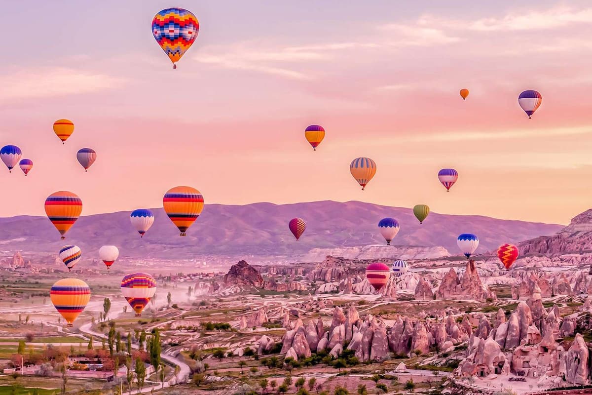
Where to stay in Cappadocia comes down to three things: how close the valleys and the rock churches lie, whether the room looks over the morning balloons, and how the town buses and roads reach the rest of the region. The home page lists the tours in Greece, and the turkey package tours page sets the Turkey plans side by side.
This page walks the region town by town, from Goreme, Uchisar and Ortahisar to Urgup, Mustafapasa, Avanos, Nevsehir, Kayseri and the south. The istanbul and cappadocia tour spends its middle days here, and the where to stay in istanbul page covers the city at either end.
What decides where to stay in Cappadocia?
Where to stay in Cappadocia starts with one point: the name covers a region of Central Anatolia, not a village. Its towns lie at different distances from the valleys, the balloon fields and the roads. A base is a choice between them.
The historical region lies largely in six provinces: Nevsehir, Kayseri, Aksaray, Kirsehir, Sivas and Nigde. Today the touristic Cappadocia region lies in Nevsehir province. So a plan for where to stay in Cappadocia stays inside a single province. It is a much smaller map than the old name covers.
Wikivoyage separates two meanings of the name. In antiquity it belonged to a kingdom, which later became a province of Rome. The Cappadocia that visitors know is a smaller area near Nevsehir. This page on where to stay in Cappadocia uses the second meaning only. In Turkish the name is Kapadokya.
Wikivoyage lists seven towns for the region: Ortahisar, Nevsehir, Goreme, Uchisar, Urgup, Avanos and Guzelyurt. It calls Goreme the main tourist base and Nevsehir the regional transport hub. The sections below take the towns one by one.
Millions of years of wind and water cut the soft volcanic tuff under every base into fairy chimneys. For where to stay in Cappadocia, the rock is a constant. The real differences are walking distances, views and roads.
Three tests narrow where to stay in Cappadocia. The first is walking distance to the valleys. The second is a view of the balloons, which launch at sunrise. The third is the road links and the feel of the evening streets. Each test points to a different town.
Walking distance is about the valley edge. A base next to a trail saves a morning ride. A base in a village centre saves a long walk home. Decide which of the two you want before you compare towns.
For where to stay in Cappadocia, links and evenings are the other two tests. Links decide how easily you reach the airport, a bus or a day trip. Evenings decide whether the street outside is quiet or lively. A traveller who sleeps early and one who wants late streets need different towns.
The rest of this page sorts where to stay in Cappadocia into these base groups:
- Goreme
- Uchisar and Ortahisar
- Urgup and Mustafapasa
- Avanos and Cavusin
- Nevsehir
- Kayseri
- The south: Derinkuyu, Ihlara and Guzelyurt
How do the towns spread out for where to stay in Cappadocia?
For where to stay in Cappadocia, the towns lie close together on one high plateau. Wikipedia places Uchisar 12 km west of Urgup and 10 km south of Avanos. These short gaps keep neighbouring towns within a brief drive of each other.
Nearly 100 square kilometres of Nevsehir Province fall inside the Goreme Historical National Park. It lies in the volcanic area of Mount Hasan and Mount Erciyes. Urgup, Cavusin and Goreme lie in its vicinity. So the park is a useful map anchor for where to stay in Cappadocia.
In nineteen eighty-five, UNESCO added the park and the rock sites around it to its World Heritage list. Goreme village sits inside it, while Uchisar stands on its edge. That gives you a first sorting rule: inside the park or at its edge.
Height is part of every choice of where to stay in Cappadocia. The plateau under the towns rises above 1,000 metres, and the town of Uchisar stands at 1,270 metres. Near Kayseri, the peak of Mount Erciyes reaches 3,916 metres, the tallest of the volcanic peaks.
One road shows the spread well. It runs between Avanos in the north and Goreme. The village of Cavusin lies on it, about five kilometres north of Goreme. Towns on one road are easy to combine in a single day.
The spread has one clear outlier. Wikivoyage treats Guzelyurt as an outlier in the southwest. There the tuff rises out of the plateau again. An outlier lies apart from the main group, so the other six towns of its list sit closer together. Guzelyurt gets its own section later on this page.
A base in the middle of the cluster saves time. Gaps of 10 or 12 km let you spend a morning in one town and an afternoon in another. A base far out to the southwest adds road time to every plan. It suits a stay built around that one area.
How do the two airports shape where to stay in Cappadocia?
For where to stay in Cappadocia, the arrival airport sets the first night. Wikivoyage has Kayseri Erkilet Airport 70 km east of Goreme. The Nevsehir airport, Kapadokya, stands 30 km from Nevsehir town, to the north. Each one points a traveller toward a different side of the region.
Flights from Istanbul land at Nevsehir Kapadokya Airport, and Wikivoyage gives the flight time as 90 minutes. The bulk of arrivals head for Goreme, at the heart of the fairy chimney landscape. Package tours from Istanbul arrive this way and go on by bus. For where to stay in Cappadocia, this airport suits a first night near Goreme.
Wikivoyage advises a taxi or a transfer to reach Nevsehir town from the airport. The airport has car hire. Wikivoyage warns that the rental fleets at regional airports such as Nevsehir are small, so a traveller books ahead. A car collected at the arrival airport takes care of the onward trip.
Kayseri Erkilet Airport sits 5 km to the north of the centre of Kayseri. Wikivoyage calls it the main landing point for tours of Cappadocia, with direct transfers. Flights from Istanbul take 80 minutes. For where to stay in Cappadocia, a landing here puts the road west to the valley towns first.
A traveller who comes from the east via Kayseri changes at Avanos, says Wikivoyage, onto a minibus called a dolmus. The bus from Kayseri to Nevsehir runs hourly, takes 90 minutes and goes via Avanos. For where to stay in Cappadocia, Avanos is therefore the first town on the road in.
Wikivoyage tells travellers from other cities to change in Istanbul for the Nevsehir airport. The long way is the bus. Buses from Istanbul run round the clock and take 10 hours. They end at the Nevsehir bus station, where a dolmus carries on to Goreme. That extra change is worth planning around.
The first night is the one the airport changes. A late landing and a short transfer favour a village near the arrival road. From the second day, where to stay in Cappadocia follows the valleys, the balloon views and the evenings. Each one gets its own look in the lines below.
How do the seasons change where to stay in Cappadocia?
For where to stay in Cappadocia, the season matters because the region lies inland on a high plateau. Wikipedia credits the inland site and high altitude for a markedly continental climate. Summer brings heat and dry air, while winter brings cold and snow. Each season changes what a base has to offer.
Wikivoyage describes summer days as hot and dry, with chilly nights. Wikipedia lists a highest recorded temperature of 39.5 degrees Celsius for Nevsehir. In summer, where to stay in Cappadocia means planning for heat by day and a warm layer at night.
For where to stay in Cappadocia in autumn, Wikivoyage calls the season mild and dry. It picks out September as the time to visit. Mild, dry days leave every base open for walks and for evenings outdoors.
Wikivoyage ties spring to the Kirkikindi thunderstorms, the heavy downpours of inland Anatolia. Its Nevsehir page dates the thunderstorms from April to mid-June. For where to stay in Cappadocia in spring, a base with indoor space helps on wet afternoons.
Winters are cold and snowy, and Wikipedia adds that Nevsehir sees heavy snow. The season sets opening hours too. As Wikivoyage lists them, Kaymakli and Derinkuyu open from eight to five between November and March. From April to October the closing time is seven.
At sunrise the winds are lightest, so Wikivoyage places the balloon launches then. Where the balloons fly on a given day varies with conditions. For where to stay in Cappadocia, a terrace view depends on the day as well as on the base.
Holidays shape where to stay in Cappadocia through the calendar. Wikivoyage Turkey says holidays can bring delays in travel, traffic congestion, booked-up accommodation and crowded venues. Ramazan Bayrami, a three-day holiday, follows the fasting month, and the page calls travel heavy then. At the four-day Kurban Bayrami, travel is intense.
Both holidays fall 10 to 11 days sooner each year, because they follow the lunar calendar. A traveller checks the calendar first. Wikivoyage says to plan ahead, and that holds for a holiday week.
Wikivoyage says Ramadan itself does not close businesses, banks or official places. Parts of Turkey, the interior and the east among them, treat snacks and drinks in public as bad taste. A traveller follows local habits. A restaurant owner can also close for the full month.
Why does Goreme come up first in where to stay in Cappadocia?
For where to stay in Cappadocia, Goreme comes first because Wikivoyage names it the region’s main tourist base. The town lies in Nevsehir Province in Central Anatolia. Fairy chimneys and rock churches surround it, and a web of valleys spreads out from it.
Where to stay in Cappadocia leads first to a village with four older names. Wikipedia lists them as Korama, Matiana, Macan and Avcilar. In Byzantine times the site held two neighbouring villages. Today’s village stands where Matiana, also written Macan, once lay. The Open Air Museum stands on the land of the older Korama.
Goreme drew little tourism until the nineteen-seventies. Before that it was a small farming settlement. It lay away from the main roads that linked Kayseri to Konya and the coast to Aksaray. For where to stay in Cappadocia, that history explains why the village grew around its visitors only in recent decades.
Two travellers left early records of the village. The French archaeologist Charles Texier passed through in the eighteen-thirties. He left the first account and drawing of Goreme by a Western writer. Sir William Hamilton wrote a book on his travels of the same decade. In it he named the chapel of St Hieron and the so-called Roman Castle.
The town counts 2,034 residents, and almost all of them now work in tourism. Former residents moved to Nevsehir, Avanos, Uchisar and Urgup after selling their houses for conversion into hotels. Readers who ask where to stay in Cappadocia meet a village that lives on its visitors.
In the middle of the village lies the bus station, ringed by ticket offices and cafes. Long-distance buses reach Goreme from all over Turkey. Wikivoyage adds that the other Cappadocia towns lie within a 30-minute dolmus ride. With the station in the middle of town, where to stay in Cappadocia is easier to plan without a car.
Wikivoyage describes Goreme as very touristy, which fits a traveller who likes services and other visitors near at hand. Without a vehicle, tours are the obvious way to reach the outlying sights, as the same page puts it. Those still weighing where to stay in Cappadocia can compare the other villages in the next sections.
Which streets and slopes of Goreme matter for where to stay in Cappadocia?
For where to stay in Cappadocia, Wikivoyage advises walking in Goreme, because the town is small. The Open Air Museum is within a 30-minute walk. Outlying places such as Rose Valley call for a taxi ride or a tour.
The Roman Castle is a rock outcrop 100 metres south of the bus station. It holds a rock-cut Roman tomb, and only the upper part of its temple front survives. The village also holds pillared tombs believed to date from Roman times. A base near the centre keeps where to stay in Cappadocia close to such old stone.
The Central Mosque stands 200 metres south of the bus station, on Eminbey Street. The Kasabasi Mosque sits on the parallel Isali Street. The Open Air Museum has its address on Muze Street, 1 km east of the town. For where to stay in Cappadocia, these streets give a simple map of the centre.
In the eighteenth century a mansion, the Mehmet Pasa Mansion, was built in the village. The true name of its first owner is unknown. Murals cover the walls of its men’s room and its women’s room. The men’s room shows mosques and landscapes of Constantinople, while the women’s room shows more domestic scenes.
Pigeon Valley ascends southwest of the town, and Wikivoyage describes it as riddled with pigeon coops carved from soft rock. The doors of such coops are less than 10 cm high. The droppings were collected for fertiliser and whitewash. For where to stay in Cappadocia, the village edge matters, because Rose Valley is entered 2 km north of town.
Lovers’ Hill (Asiklar Tepesi) is a viewpoint to the southeast, 200 metres from the centre. More than one trail climbs it. At sunrise and sunset the slanting light colours the rock and casts deep shadows, Wikivoyage notes. Overcast skies dull the formations. For where to stay in Cappadocia, a base near this viewpoint suits travellers who plan for early light.
For where to stay in Cappadocia, daily needs matter too. Wikivoyage counts over a dozen supermarkets around the town centre, so shopping sits close to a base here. The valleys and the balloon views get their own sections below.
What does Uchisar add to where to stay in Cappadocia?
For where to stay in Cappadocia, Uchisar suits a traveller who wants a small base on foot. Wikivoyage states that all the sights of the town lie within walking distance. The town stands on the road between Nevsehir and Goreme, so the shared minibuses pass through it.
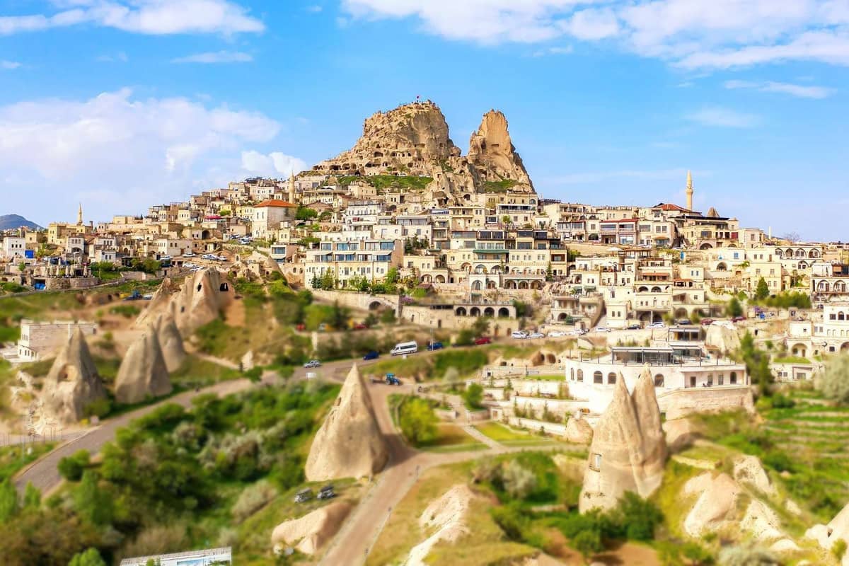
Wikipedia describes the town in two parts. The old village gathers at the foot of the rock cone, with old stone houses and carved facades among them. A newer part lies closer to the road from Nevsehir to Goreme. See which quarter holds the room as you decide where to stay in Cappadocia.
A tunnel of about 100 metres runs beneath houses in the centre. It was cut from tuff, a type of rock. Wikipedia suggests it joined the castle to the land outside and guarded the water source. The passages inside the castle rock are now mostly blocked. Wikivoyage adds that two lesser pinnacles also stand within the town.
Wikivoyage places the town off the D302 road on the way to Goreme. Uchisar has no bus station, and the minibuses make multiple stops through the town. Anyone choosing where to stay in Cappadocia by minibus can take whichever of those stops lies closest.
The trail into Pigeon Valley starts at the coach parking area on the south edge of town, as Wikivoyage states. A room at that end of Uchisar sits close to the trailhead. Check a room against that edge of the town when you ask where to stay in Cappadocia.
Wikipedia dates a Byzantine buffer zone in the area to the seventh century AD. The Seljuks later set up small centres with caravanserais across the region. Wikipedia also credits French incomers and Turks back from France with a large part in turning old houses into hotels.
Wikivoyage lists small cafes near the castle entrance and notes that the town has no free-standing bar. That points to calm evenings. Uchisar suits a traveller who plans where to stay in Cappadocia for quiet nights.
How does Ortahisar fit where to stay in Cappadocia?
For where to stay in Cappadocia, Ortahisar is the town of the Middle Castle, as its Turkish name states. It lies in the Urgup District, about 20 km east of Nevsehir. Wikipedia adds that its earlier Byzantine name was Potamia.
A rock castle, 90 metres tall, rises in the town centre. The people of the town call it Sivrikaya. Wikipedia calls it an example of rock-cut building. It says the castle is believed to have been a refuge in Byzantine times. For where to stay in Cappadocia, it gives Ortahisar a clear landmark.
Wikipedia says the upper floors of the old houses are built of tuff blocks, mostly without mortar. The houses are generally one or two storeys high. An outside staircase of tuff slabs leads to the upper floor. Boutique hotels have been made from such houses. A traveller who asks where to stay in Cappadocia can sleep in that old stone.
Wikipedia calls Ortahisar a centre for fruit storage. The caves in the local tuff hold a constant ten degrees Celsius in summer and winter. Citrus fruits, potatoes, apples and onions rest there for up to nine months. The produce then travels on to other parts of Turkey, Europe and Russia.
For where to stay in Cappadocia, a base in Ortahisar has the rock-cut Hallac Monastery to its north-east. Per Wikipedia, walls close the courtyard on three sides, leaving the south open. Rubble has raised the ground by one and a half metres, so the rooms have low entrances. Locals later walled up the entrances and used the rooms as pigeonhouses.
The Cambazli Church, called the Church of Acrobats, also stands in the town. It is a cross-in-square church with wall paintings of the thirteenth century, as Wikipedia states. The building now serves as a storehouse. Wikipedia files it under the castle and churches of the town.
Wikivoyage lists Ortahisar among the towns that the dolmus minibuses connect with Goreme and Urgup. It calls the town historically central, with traditional neighbourhoods and an authentic atmosphere. It also places the town among the less-visited ones nearby. That suits a traveller who plans where to stay in Cappadocia for old streets.
How does Urgup answer where to stay in Cappadocia?
For where to stay in Cappadocia, Urgup is a town of 24,647 people at an average height of 1,044 metres. Wikipedia rates the town a handy base for rock-cut churches and underground cities. It adds that the town holds more amenities than other Cappadocian towns.
Before you decide where to stay in Cappadocia, note that Urgup has carried three older names. The Byzantines called it Osiana, the Greek townspeople called it Prokopi, and an Ottoman Turkish name was Burgut Kalesi. Prokopi honoured the Church of Saint Procopius. Wikivoyage adds that the Seljuks made it a trading centre in the eleventh century.
Anyone weighing where to stay in Cappadocia finds a plain centre here. Temenni Hill, also called Wish Hill, rises among the old stone houses. A symbolic tomb on top honours the Seljuk leader Ruknettin Kilicarslan IV. Cumhuriyet Square, the main square, lies just south of the hill.
The grand houses around the hill date to the late Ottoman period, when Turks and Christians shared the town. Non-religious frescoes survive in houses built for minority families. The Dutlu Mosque on the square is a 250-year-old mansion. Its minaret was added after the Greek townspeople left in the exchange of populations.
Town life also counts when you look at where to stay in Cappadocia. The town has a thriving wine-growing industry, and Wikivoyage calls the whole region a major wine-producing area. A small local museum stands inside the park in the middle of town. The Saturday market runs on Ahmet Asim Yolac Street, 500 metres south of the centre.
For where to stay in Cappadocia, the road links matter. The bus station is central, and Wikivoyage says dolmus minibuses connect all the small towns of the region. The Three Beauties fairy chimneys stand two kilometres west, along the road to Nevsehir. Urgup suits a traveller who wants a real town with a market, a park and an old quarter.
What does Mustafapasa add to where to stay in Cappadocia?
For where to stay in Cappadocia, Mustafapasa is a small town of 1,295 people. It lies in Nevsehir Province, five kilometres from Urgup. Its older Greek name is Sinasos. Its grand stone mansions were built with money that traders sent home from Constantinople.
To judge where to stay in Cappadocia, it helps to know why the town looks as it does. In the nineteenth century, Sinasos was a mainly Cappadocian Greek settlement. Earning a living in Anatolia was hard, so its people moved to Constantinople and traded in seafood, especially caviar. Early in the twentieth century it held 3,000 Greeks and 1,000 Turks.
Under the Treaty of Lausanne, the Greek population left for Greece in the exchange of populations. Their new home was Nea Sinasos, a village in the north of Euboea. Macedonian Muslims from Kastoria came in their place. Wikipedia says the town then lost much of its earlier prosperity and is well on the way to recovery.
A base in the town centre keeps you near the Church of Saint Helena and Constantine. It is a large church of the nineteenth century, with a grapevine carved around its entrance. It is occasionally used for concerts. Buildings of Cappadocia University also stand in the centre, one of them in a medrese of the nineteenth century.
For where to stay in Cappadocia on foot, the valley that runs out from Mustafapasa is easy to reach. Rock-cut churches stand in it, among them the Church of Saint Stephen and the Monastery of Saint Nicholas. The town’s Church of Saint Basil was still in use in the nineteenth century. It was then recut and repainted.
Walkers weighing where to stay in Cappadocia also have the Gomeda Valley close by. Wikivoyage reaches it by a hiking trail southwest of the town. It describes a tangle of rock outcrops cut into dwellings, with Alakara Church the first a walker reaches. The Church of the Holy Apostles there dates to the early tenth century.
For where to stay in Cappadocia, The town stands at a height of 1,163 metres. The town of Nevsehir lies 27 kilometres away. Mustafapasa suits a traveller who prefers a village base to a busy centre. Grape-growing and farming gave the old living, and tourism now counts for more each year.
How does Avanos fit where to stay in Cappadocia?
For where to stay in Cappadocia, Avanos is the town on the banks of the Kizilirmak, Turkey’s longest river. Nevsehir lies 18 km to its south. Wikivoyage calls its old town on the north bank walkable, while the newer town spreads along the south bank.
The Kizilirmak is also called the Red River, and its red silt gives the town its pottery clay. Pottery is the main industry, and Wikipedia records that the craft probably goes back to Hittite times. Where to stay in Cappadocia then depends on taste: Avanos offers a craft town instead of a castle rock.
For where to stay in Cappadocia on foot, the north bank is compact. The bus station is fairly central, an open square along Kapadokya Street. A narrow metal footbridge links the two banks, and the New Central Mosque stands at its north end. An ethnography museum occupies a former mansion in the town.
North of the centre the ground rises. For where to stay in Cappadocia with a view, Wikivoyage lists rooms on those slopes. The stone houses of the old north bank, Wikipedia says, were built in the nineteenth century or the early twentieth. The south bank was landscaped for recreation in later years.
The Ozkonak underground city lies 14 km northeast of Avanos. A local farmer found it in the early nineteen seventies while tracing where the water in his field vanished. Ten floors have been counted, dropping 40 metres below ground. Anyone sorting out where to stay in Cappadocia gains one more northern stop here.
Goreme lies 18 km south of Avanos, and Wikivoyage puts the start of the hoodoo landscape about 15 km south. The new town sprawls, so Zelve and the fairy chimneys need a vehicle or a taxi. Minibuses from Nevsehir reach Avanos, which lies just off Highway D300.
For where to stay in Cappadocia, Avanos suits a traveller who likes a river town and a walkable old centre. A bus or taxi reaches the rocks.
What do Cavusin and the Zelve side add to where to stay in Cappadocia?
For where to stay in Cappadocia, Cavusin is a village five kilometres north of Goreme on the Avanos road. Wikipedia lists 421 residents. Its old part lies on and around a large rock ridge that is visible for miles around. The newer homes stand along the main road.
Tourism more or less ignored Cavusin until recently, although Goreme lies so close. Then lodgings opened, especially in the older part of the village. Modern homes stand nearer the main road, where villagers were rehoused in the early nineteen sixties. A traveller asking where to stay in Cappadocia therefore meets two Cavusins: the ridge and the road.
Both of the rock-cut churches in Cavusin carry the name of St John the Baptist. The first stands beside the main road. A fallen part of its facade leaves two large frescoed angels in the open air. Wikipedia also lists it as the Nicephorus Phocas Church and the Great Pigeon House.
The emperor Nicephorus Phocas, a Cappadocian on his mother’s side, visited the region in the mid-tenth century. The first church holds frescoes of him and his wife. Whoever weighs where to stay in Cappadocia by its churches finds both inside this village.
The second church lies in the old part of the village. It is a large basilica of the early sixth century. Its carved decoration draws more interest than its barely visible frescoes. From the ridge, a visitor looks down on fairy chimneys that show how wind and rain shaped the rock.
The church of St Agathangelus stands on the far left side of the Gulludere valley, about 2 km from Cavusin. It dates to the sixth or seventh century, and Wikivoyage also calls the valley Rose Valley. A walker weighing where to stay in Cappadocia can start from the village.
Pasabag, the Monks Valley, lies 1 km from Zelve, and Wikivoyage places it off the road to Cavusin. Zelve spreads over three valleys and became an open-air museum in the late nineteen sixties. On the road from Urgup to Avanos, 2 km out of Urgup, lies Devrent Valley.
For where to stay in Cappadocia, Cavusin suits a traveller who wants a small village near these valleys.
How do the valleys near Goreme shape where to stay in Cappadocia?
For where to stay in Cappadocia, the valleys decide how far you walk before the rocks begin. Goreme lies in a network of valleys, as Wikipedia puts it. Wikivoyage places Rose Valley 2 km north of the town. It says Pigeon Valley ascends south-west of the town, so each edge of Goreme opens a different trail.
Wikipedia pictures the park as flat uplands and tall hills, split by streams into steep valleys. Little grows there except along the river corridors. Wikivoyage calls Rose Valley scenic and green. Where to stay in Cappadocia then depends on which valley you want at the end of the street.
Rose Valley holds rock-carved churches. Wikivoyage names the Cross Church, the Columned Church and the Grape Church. Red Valley lies further south, a vista of fairy chimneys. Meskendir Valley drains north to meet it, and its church has geometric frescoes. For where to stay in Cappadocia, a bed on the north edge of Goreme shortens the walk to Rose Valley.
Wikivoyage joins Rose, Red and Meskendir valleys into one hike of 5 hours. It advises starting at dawn, to avoid the afternoon sun and the dust of tour jeeps. From Meskendir Valley the path climbs north to the main road. A ride back to town needs arranging there. Weigh that walk back as you settle where to stay in Cappadocia.
Love Valley is the valley of the rock towers. Wikipedia links the valley with fairy chimneys; Wikivoyage writes of great rock towers on its sides. A vehicle enters from the north along a dirt road that suits a two-wheel-drive car in the dry. On foot, a couple of shorter routes lead in.
Pigeon Valley joins Uchisar to Goreme, and Wikipedia times the walk between the two at around two hours. Wikivoyage says trails range from easy strolls, as in a sculpture park, to long treks through canyons. A base at either end of the walk answers where to stay in Cappadocia for a day on foot.
Evening light matters in every valley. Wikivoyage names sunrise and sunset as the hours when the rock formations take colour. A late walk from the edge of your village catches that hour. Choose where to stay in Cappadocia with the path home in mind. The valleys then suit an evening stroll as well.
Where to stay in Cappadocia for a view of the morning balloons?
Where to stay in Cappadocia for balloon views depends on the wind as much as the address. Balloons rise at sunrise, Wikivoyage notes, when winds are lightest. It adds that where they fly on a given day varies with conditions. A base gives you a chance of a view, never a promise.
Wikivoyage describes the flight day from start to end. Passengers are collected pre-dawn and taken to the launch site. After the flight come breakfast and a ride back to the hotel. So for where to stay in Cappadocia, the room frames the whole morning, from first look to return.
Watching from the ground works too. Wikivoyage advises being in position early. It reads the crowd as a sign: cars drawing up and camera tripods going up mark a good spot. Its tip for a distinctive photo is balloons and fairy chimneys in one frame. That tip suits a base among the rocks for where to stay in Cappadocia.
Photographs on Wikipedia place balloons over Cavusin and beside the rock castle of Ortahisar. The same site ties the tourism of Goreme to its hot air balloon rides. The 60-metre rock of Uchisar is visible over a wide distance. These four head the list as you choose where to stay in Cappadocia.
Height and direction matter more than the name of the town. A base on a slope sees further than one in a hollow. When you compare rooms for where to stay in Cappadocia, ask which way the windows and the roof terrace face. A terrace over open valley holds more sky than one facing a street wall.
A flight needs light wind, so a windy dawn can pass without a launch. The route also changes from day to day. One night in a base gives one chance, and more nights give more chances. Where to stay in Cappadocia for balloons is a choice for more than one morning.
How does Nevsehir fit where to stay in Cappadocia?
For where to stay in Cappadocia, Nevsehir is the seat of its province. Wikipedia counts 128,290 people there. The city lies 290 km from Ankara, at a height of 1,224 metres. Wikipedia adds that the modern town is not itself a tourist centre.
Asking where to stay in Cappadocia leads to a city with a layered name. Wikipedia places the Hittite settlement of Nissa on Mount Kahveci, in what is now Nar. The Ottomans later renamed the place Muskara. Nevsehir means “New City” in Persian and Ottoman Turkish.
Before the grand vizier Damat Ibrahim Pasha took an interest, Muskara was a village of only 18 houses. Wikipedia lists the mosques, fountains, schools, soup kitchens, inns and bath houses he built. For where to stay in Cappadocia, the Kursunlu Mosque is the centrepiece of that complex. Wikivoyage adds a library and a hammam.
Wikipedia dates the castle on the hill in the middle of town to the Byzantine period. Wikivoyage calls it a curtain wall around a courtyard, with good views. A huge underground city came to light beneath the centre after demolition work on the hillside. Anyone weighing where to stay in Cappadocia finds it inside the town.
Wikivoyage calls the underground city Kayasehir. It puts the bulk of it on the east slope, reached by boardwalks from Kaya Mosque. Wikivoyage dates the earliest remains to the sixth century AD and says people lived there into modern times. The site is listed as open to visitors; confirm the current rules before a visit.
Wikivoyage puts the coach station out of the centre, 5 km to the south-west. A dolmus from it reaches Saatci Hoca Street, the stop for dolmuses from nearby towns. A university here carries the name of Haci Bektas Veli, a point for where to stay in Cappadocia. Wikivoyage puts that Sufi saint’s shrine at Hacibektas, 45 km north.
Wikivoyage notes that Nevsehir has no fairy chimneys of its own but a remarkable set of underground cities. Kaymakli and Derinkuyu lie south of it. The city sprawls, though its sights can be explored on foot. One answer to where to stay in Cappadocia is a base in a working city, and this is it.
How does Kayseri fit where to stay in Cappadocia?
For where to stay in Cappadocia, Kayseri is the large city east of the valley towns. Wikipedia calls it the historical capital of Cappadocia. Mount Erciyes, a dormant volcano, rises above the city. At the last count, 1,210,983 people lived in its four urban districts.
Wikivoyage says Kayseri takes its name from Caesar Augustus, and that the older name was Mazaka. Basil of Caesarea founded a large complex of charitable houses, a monastery and churches there in the fourth century. Wikipedia states that nothing of it remains. For where to stay in Cappadocia, the past here sits in later monuments.
Wikivoyage says the Seljuks left the greatest legacy, in the citadel and the mosque and school complexes. The clock tower stands at the main crossroads, at the north foot of the castle. Wikivoyage first dates the castle to about AD 240. The Archaeology Museum inside it focuses on Neolithic and Hittite objects.
Wikivoyage places the Great Mosque, Ulu Camii, by the bazaar 200 m south-west of the castle. Wikipedia adds that a Danishmend emir started it and the Seljuks finished it. The Covered Bazaar, Kapali Carsi, fills the south-west side of the castle. A room near the castle keeps all of these close, for where to stay in Cappadocia.
Its summit stands over 1,500 metres above the city’s average height. Wikivoyage places it 15 km south of town, with the resort 10 km further and skiing in winter. Wikipedia puts the ski resort half an hour from the centre, a winter point for where to stay in Cappadocia. It calls the ski resort one of the largest in Turkey.
Wikivoyage lists three tram lines, T1, T2 and T3. The T1 line runs along Sivas Boulevard, and T3 serves the bus terminal. That terminal lies 6 km north-west of the centre, with a tram stop beside it. From the airport, buses run downtown every 30 minutes. Tickets for trams and buses must be bought beforehand from kiosks.
The road does the linking. By road, Ankara is about three hours from Kayseri and the Cappadocia valleys about 45 minutes, says Wikipedia. For where to stay in Cappadocia, Kayseri suits a traveller who wants a big city, trams and a ski mountain. Wikivoyage adds that visitors pass through the city but do not linger.
What do the underground cities add to where to stay in Cappadocia?
For where to stay in Cappadocia, the underground cities add a base in the south. Wikivoyage calls Kaymakli and Derinkuyu substantial villages on the D765 road to Nigde. Kaymakli lies 20 km south of Nevsehir, and Derinkuyu lies 15 km beyond Kaymakli. Both belong to Nevsehir Province.
Derinkuyu is a town of its own, not only a site. It is the seat of Derinkuyu District and has 10,912 people. The underground city lies near it and, as Wikipedia states, is the largest excavated one in Turkey. So where to stay in Cappadocia can be answered with one address: the town beside the city.
Kaymakli answers with a workshop floor. Its third level holds kitchens, storage places and wine or oil presses. It also holds a block of andesite with fifty-seven holes, each about 10 centimetres wide. The article reports that the block served for cold-forming copper. For where to stay in Cappadocia, a night in Kaymakli keeps that floor close.
Both towns carried Greek names until the exchange of populations in nineteen twenty-three: Anaku for Kaymakli and Malakopi for Derinkuyu. A linguist’s note quoted on Wikipedia describes sizable churches and elegant houses that bear traces of that past. The houses carry initials and dates. Where to stay in Cappadocia can include a slow walk through these streets.
For where to stay in Cappadocia, the Soganli Valley widens the map to the south-east. Wikipedia places it in Yesilhisar district of Kayseri Province, in the south-eastern part of the region. The valley was known as Soandos in the past. Between the ninth and the thirteenth centuries, Byzantine monks made their home there and left behind around a hundred churches.
The larger part of these buildings is now buried, ruined or used as stables. At the valley’s south-eastern end stands the lower village, Asagi Soganli. The valley splits into two branches at Yukari Soganli, the upper village. Dovecotes in the cliffs have their entry holes marked with white paint. The inhabitants use the guano as fertiliser.
Tokali Church stands high in a cliff before the lower village, up a stair of over 50 steps. A Wikipedia line dated to the nineteen-nineties notes no dolmus link to the valley. The valley lies at a distance from the centre of Cappadocia. For where to stay in Cappadocia, a southern base suits a traveller planning around the cities.
How do the Ihlara Valley and Guzelyurt fit where to stay in Cappadocia?
For where to stay in Cappadocia, Guzelyurt is the town beside the Ihlara Valley. Wikipedia places it in Aksaray Province, 45 km from the city of Aksaray, at 1,485 metres. It has 2,570 people and was called Gelveri before. On Wikivoyage’s map, the village sits at the western edge of Cappadocia.
The Ihlara Valley lies inside the municipality of Guzelyurt. The valley article gives 15 km of length, up to 150 m of depth and around 50 rock-hewn churches. Ihlara village marks the south-east end and Selime the north-west end. Where to stay in Cappadocia then comes down to which end of that line you want to start from.
Where to stay in Cappadocia can follow the churches, and the article names two of them. The Church under the Tree honours Daniel the Stylite and is cut from the cliff. The Ascension in its cupola pre-dates Iconoclasm. The Pine Needle Terrace church has four halls cut into the rock and frescoes of the Holy Apostles.
At the canyon’s north-western end stands Selime. Wikipedia’s Guzelyurt page counts the Selime rock monastery among the largest religious buildings of the region. The same article lists the tomb of Selime Sultan in the village. For where to stay in Cappadocia, Selime is a village at the far end of the walk.
The church of St Gregory stands on Cevizli Street, as Wikivoyage places it. It became a mosque, with the bell tower made a minaret and the iconostasis a mihrab. Steps in the garden lead down to a cave with a holy well. Wikipedia adds that Gregory of Nazianzus lived in the area.
Monastery Valley lies at the south edge of the town, Wikivoyage states. It has over 50 ancient churches cut into the hillside, but you can enter only a couple of them. The Red Church near Sivrihisar dates from the sixth century and stands free on its hill.
For where to stay in Cappadocia, Mount Hasan is a landmark over the plateau, a volcano with two summits. Its silhouette and that of Mount Erciyes dominate the landscape, the article states. The city of Aksaray lies 30 to 40 km north-west of the volcano. Local buses from Aksaray reach Guzelyurt every two hours, in about 45 minutes.
Where to stay in Cappadocia for a first visit of two or three days?
For where to stay in Cappadocia, a first stay of two or three days needs one base. Goreme, Uchisar and Urgup each work for all the nights. Wikivoyage gives the loop at the Goreme Open Air Museum two to three hours. That leaves the rest of day one free for the village.
A first day at the Goreme Open Air Museum anchors any plan on where to stay in Cappadocia. Wikivoyage adds that 50 metres beyond the main compound lies the Tokali Church. The church has a tenth-century part and an eleventh-century part, and both are richly frescoed. A room in Goreme keeps that walk short.
Uchisar adds a climb to the second day. The way up the castle rock is 275 steep stairs by Wikivoyage’s count, with great views at the top. Uchisar lies 7 km east of Nevsehir, as its article states. For where to stay in Cappadocia, the town keeps the castle on foot and the city a short ride away.
Zelve fills a morning on the Urgup side. The article on Zelve places the site between Urgup and Avanos. Wikivoyage describes a village carved out of the rocks near Pasabag valley. The big expansion of its dwellings came in the Byzantine era. So both of those towns work as a base for this trip.
Urgup suits the traveller who wants a town for all three nights. Wikivoyage says its sights spread over a broad area, with a majority near main roads that have frequent dolmus minibuses. For a bus-based plan of where to stay in Cappadocia, the town’s layout is simple to follow.
Days two and three can turn south by road. Kaymakli and Derinkuyu lie south of Nevsehir, as Wikivoyage places them. Wikipedia puts Ihlara Valley in Aksaray Province, in the southwest of the region. Those trips start from your base. Check the road links as you weigh where to stay in Cappadocia.
The last test is simple. Goreme has the services around its bus station. Uchisar has a short walk to the castle. Urgup has a town centre with a Saturday market. Before you fix where to stay in Cappadocia, weigh what lies right outside the door.
Where to stay in Cappadocia with children?
For where to stay in Cappadocia with children, Urgup puts Devrent Valley 2 km north, on the Avanos road. Wikivoyage says its fairy chimney rocks have not been carved into dwellings. It adds that one of them is shaped like a camel. A short outing with a clear target gives young travellers something to look for.
Horses give a child a second hook. An older reading of the name Cappadocia is “Land of good horses”, though the article says the sound fits poorly. Wikivoyage lists horse riding on its Avanos page, mainly south of the town around Cavusin. Cavusin is one more base to weigh for where to stay in Cappadocia.
Avanos adds a craft with a hands-on task. Wikivoyage describes a pottery in the town where visitors can have a go at making their own mug. Wikivoyage says the Kizilirmak behind the craft loops across Anatolia to reach the Black Sea near Samsun. A family asking where to stay in Cappadocia gets a river town with a craft.
The underground cities need slow steps. Compared with Derinkuyu, the Kaymakli tunnels run lower and narrower, and they slope more steeply, Wikipedia notes. Wikivoyage lists four floors open to visitors there. Small children move slowly on such slopes. Plan the visit as one outing of its own as you decide where to stay in Cappadocia.
Evenings and floors need a little planning too. The plateau turns cool at night, even after a hot day, so pack a warm layer for every child. Cave rooms and rock paths have uneven floors, so shoes with a good grip help. A family weighing where to stay in Cappadocia can ask the host about both.
Families who want calm evenings can weigh where to stay in Cappadocia among Ortahisar, Mustafapasa and Urgup. Urgup adds a house museum on Temenni Hill. Wikivoyage describes a restored Ottoman mansion with cave rooms that shows how people lived there in the nineteen-twenties. A child can walk through a real cave home before choosing a bed.
Where to stay in Cappadocia for walking and hiking?
For where to stay in Cappadocia on foot, pick the village at the start of your route. Wikivoyage describes the Pigeon Valley hike as one-way, 4 km, from Uchisar down to Goreme. The two ends of that walk make natural bases for walkers.
Direction matters on that trail. Wikivoyage says the walk is easier downhill, and that you go with the flow of other hikers. The side canyons join the main one instead of splitting away, so there is less chance of a dead end. Where to stay in Cappadocia then comes down to the end you want to wake up in.
Four bases suit walkers, and each opens a different route. Uchisar and Goreme hold the two ends of Pigeon Valley. Cavusin lies on the road north of Goreme. Ihlara lies far to the southwest. Each one answers where to stay in Cappadocia for a different kind of day on foot.
For where to stay in Cappadocia with short walks, Uchisar adds two outings. Tiraz Castle is a carved pinnacle east across the valley from Uchisar Castle. Wikivoyage describes a good walking trail around it and a view back at Uchisar Castle. It draws a smaller crowd. Wikivoyage lists Kekligin Castle as a third carved pinnacle of Uchisar.
The south asks for a different plan. Wikipedia places a stairway of almost 400 steps at the north end of Ihlara village. It drops over 100 metres into the canyon that the Melendiz River formed. Staying in the village keeps the top of the stairway close. That is where to stay in Cappadocia for a long canyon day.
Mountain walkers look east. Wikivoyage says that in summer the lifts of the Erciyes mountain resort give access to mountain trails. The same page reserves the approach to the summit for experienced mountaineers. For where to stay in Cappadocia on a mountain day, Kayseri sits at the foot of the peak.
A walker who has not settled where to stay in Cappadocia can book a hiking tour for the outlying valleys. Wikivoyage says the jeep takes the rough track, and the tour guide knows the easiest trails. Plan the day around the heat and the light. Carry water in summer, when the days are hot and dry.
Where to stay in Cappadocia for food, crafts and evenings?
For where to stay in Cappadocia and food, start with the clay pot. Wikivoyage describes testi kebap as meat and vegetables cooked in a clay pot sealed with bread dough. The pot is broken when it is served. Wikivoyage names it as the town specialty of Goreme.
For where to stay in Cappadocia and a second dish, try manti. Wikivoyage describes small dumplings stuffed with minced meat and served with yoghurt and garlic sauce. Kayseri has its own form, mantisi, with minced meat wrapped in strips of dough and boiled. Wikivoyage calls it traditional Kayseri home food that restaurants seldom serve.
Pastirma comes from the same city. Wikivoyage describes dried, salted beef covered with cemen, a caraway paste. It is served as a spicy starter, in main dishes or as stuffing for borek. Wikipedia lists sucuk, pastirma and manti as the dishes Kayseri is known for. White beans with spiced meat, called pastirmali kuru fasulye, join the regional list.
Each town keeps its eating places in one spot, so where to stay in Cappadocia can follow the food. In Avanos, Wikivoyage puts the main strip just north of the footbridge. In Urgup, eateries and patisseries line Ataturk Boulevard near the bus station. In Nevsehir, small places line Ataturk Boulevard near Lale Street.
Carpets, kilims and pottery turn up in every town, as Wikivoyage states. It adds that Goreme sells traditional carpets made locally. Urgup keeps its carpet and kilim stores along the main street. For where to stay in Cappadocia near the craft shops, a town centre is the place to look.
Pottery is a different matter. Wikivoyage advises buying it in Avanos, 18 km north of Goreme, where it is a major industry. It asks you to think about the bumpy journey home. Kayseri’s handwoven carpets are the major touristic merchandise there. For where to stay in Cappadocia as a pottery buyer, Avanos is the town where the craft is made.
For where to stay in Cappadocia and evenings, start with tea. Wikivoyage calls it the staple drink of Anatolia, and carpet and souvenir shops can invite visitors in for a cup. Wikivoyage lists a Turkish bath just south of Temenni Hill in Urgup, open until half past eleven. The local wine is mostly red.
How do buses, transfers and cars shape where to stay in Cappadocia?
For where to stay in Cappadocia, the dolmus minibus network is the first test of a base. Wikivoyage says the villages are all linked by dolmus, and the runs are frequent enough to use for sightseeing. A room near a stop keeps every town in reach without a car.
The Goreme page of Wikivoyage names seven towns on the dolmus lines: Nevsehir, Goreme, Uchisar, Avanos, Cavusin, Urgup and Ortahisar. It gives a gap of half an hour to an hour between runs, and rides of under half an hour. The closest stop counts as much as the town itself when you weigh where to stay in Cappadocia.
Nevsehir is the hinge of the system. Wikivoyage names Saatci Hoca Street as the stop where the dolmus from the bus terminal arrives. Local buses and dolmuses from Aksaray, Avanos, Goreme, Kaymakli, Derinkuyu, Urgup and Nigde also pick up and drop off there. Put that stop on the list for where to stay in Cappadocia.
The south asks for more planning. Wikivoyage says you need wheels to reach the outlying underground cities. Kaymakli and Derinkuyu stand on the D765 road to Nigde, and it expects a dolmus every fifteen minutes there. For Ihlara Valley, it names Aksaray as the hub. A base on the Nevsehir side shortens the road south.
Drivers get a simple map. Wikivoyage calls the highways of the region straight and fast. Its drive from Ankara takes the O-21, then the D300 east to Nevsehir and the D302 on to Goreme. If you drive, ask the host about parking at the door before you decide where to stay in Cappadocia.
The Urgup page of Wikivoyage lists two direct buses a day from Ankara. They take almost four hours and call at Nevsehir, Goreme and Avanos. Taxis wait in front of the Nevsehir bus terminal. City buses 1 and 2 run from the centre back to it. Such links widen where to stay in Cappadocia.
Which kinds of lodging answer where to stay in Cappadocia?
Rooms in caves, Wikivoyage writes, are the specialty of the region. So where to stay in Cappadocia starts with a choice of room type. The three types are rooms cut into the rock, stone mansions and standard modern hotels. Each type belongs to particular towns, and the town sections above show which.
Cave rooms are old homes of the rock made ready for guests. Wikivoyage says caves have found modern use as hotels. It adds that the hardest part can be finding the way from lobby to room across the rock. Wikipedia dates cave homes around Goreme to at least the third century. That history shapes where to stay in Cappadocia.
Stone mansions are the second type. Wikivoyage says Ottoman mansions were built above ground in local stone and frequently extended back into the hillside. It places the old Greek cave mansions mainly in Mustafapasa. Their cave and stone rooms are spacious and high-ceilinged, in buildings of the nineteenth century. Where to stay in Cappadocia can mean a mansion room.
Urgup shows both types in one town. Wikivoyage puts its cave hotels mainly in the Esbelli district in the northwest. Among them are mansions extended into the hillside, with masonry and cave rooms side by side. Conventional modern hotels stand on the east side of town. Urgup gives a clear answer to where to stay in Cappadocia by style.
Other kinds of rooms appear in the listings of Wikivoyage. It says the Nar quarter of Nevsehir holds over a dozen small places called cave hotels, built in old cellars. It lists restored cave houses for self-catering in Uchisar, and self-catering cave rooms in Urgup. It points travellers with limited mobility to standard modern hotels.
Ask the host how a rock room is warmed in winter and cooled in summer. Ask about the number of steps to the door too. The answers shape where to stay in Cappadocia as much as the town does.
The Ministry of Culture and Tourism links two lists on its own site. One holds facilities with a Tourism Operation or Tourism Investment Certificate. The other holds facilities registered by local municipalities. A second official page searches the Ministry register by name, certificate type, province and district. Check these lists before you book.
Which other questions do travellers ask about where to stay in Cappadocia?
How long a stay does the region need?
Wikivoyage states that the Cappadocia museum pass is valid for three days from the first museum visit. That gives a stay a natural first block, and the central towns and valleys fill it. Each extra day lets a plan for where to stay in Cappadocia reach a little further out.
Where to stay in Cappadocia can also serve longer stays. Wikivoyage lists Pancarlik Valley 2 km south of Urgup, entered by the turnoff for Ortahisar on the road towards Mustafapasa. It holds rock-carved dwellings and a frescoed church of the eleventh century. The same source places Sobesos, a Roman city of the fourth century AD, near Sahinefendi.
Wikivoyage puts Hacibektas 45 km north of Nevsehir. It has the shrine of Haci Bektas Veli, a Sufi saint of the thirteenth century. A commemoration falls in August. Aksaray is a laid-back city and a hub for the Ihlara Valley and Tuz Golu, the salt lake. For where to stay in Cappadocia, one day trip suits a longer visit.
How does the region link on to Konya, Pamukkale and Istanbul by road?
For where to stay in Cappadocia, the bus links to other cities run through Nevsehir. Wikivoyage times the bus at three and a half hours from Konya and 10 from Pamukkale. From Istanbul they take 10 hours via Bolu. The Nevsehir bus station stands 5 km southwest of town on the D300 towards Aksaray and Konya.
For where to stay in Cappadocia, Konya lies closest by bus of these three places. Wikivoyage presents Konya as home of Rumi, the Sufi poet, and praises its Seljuk buildings. Wikipedia lists the Mevlana Museum in Konya as the house of the mausoleum of Rumi. It started life as the lodge of the Mevlevi dervishes.
By car from Ankara, Wikivoyage says to take the O-21 south and leave at Alayhan. A caravanserai there recalls the tribulations of long-ago journeys. The D300 then runs east to Nevsehir, and the D302 leads into Goreme. The Nevsehir page reckons 290 km and 3 hours. Plan the first night of where to stay in Cappadocia around that drive.
Which everyday needs does a base cover, such as shops and a phone signal?
The towns all have small stores for basics, as Wikivoyage states. In Avanos, little supermarkets stand mostly on the road towards the bus station. In Urgup, the stores cluster south of Castle Hill. Uchisar’s main store opens each day from eight in the morning until midnight. For daily shopping, any of them answers where to stay in Cappadocia.
Cash is the other practical point. Wikivoyage places an ATM across the street from the Goreme bus station and says the Nevsehir bus station has none. Nevsehir’s downtown supermarkets, it adds, keep their doors open between nine in the morning and nine at night. The route of arrival can shape where to stay in Cappadocia.
Wikivoyage lists 4G from all Turkish carriers in Urgup, Avanos and Nevsehir, and on their approach roads. A traveller who works online checks the signal at a base before booking. That is one more point to settle when choosing where to stay in Cappadocia.
What do the old names say about the towns?
Names carry meanings, and they add a layer to where to stay in Cappadocia. Wikivoyage reads Uchisar as the outermost fort, the fortified main pinnacle of the town. A book cited in Wikipedia says Christians sheltering in the valleys named the place gor emi. The words mean you cannot see this place. It became Korama and then Goreme.
Avanos was once Venessa, says Wikivoyage, though little of its Roman and Byzantine town remains above ground. Wikipedia gives Kodessane as a possible early Christian name of Cavusin. For where to stay in Cappadocia, these older names show that each base has a long record of settlement.
The south and east carry old names too. The Ihlara Valley takes its name from the Greek Peristrema, meaning winding round. That was the old name of the village of Belisarma, halfway along the canyon. Mount Erciyes, near Kayseri, was ancient Argaeus, as Wikipedia lists. A traveller reading maps for where to stay in Cappadocia meets both layers.