
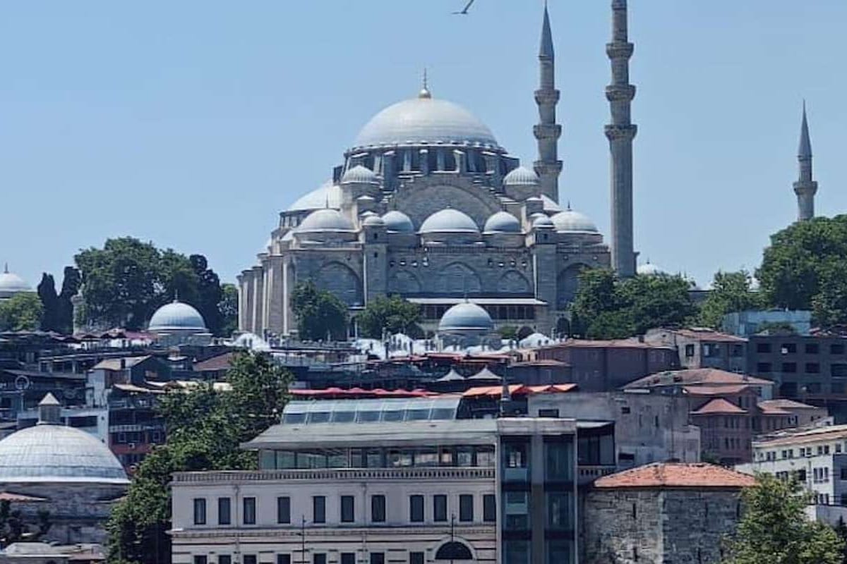
Where to stay in Istanbul comes down to three things: how far the sights lie on foot, which tram, metro or ferry stop sits near the door, and the feel of the streets after dark. The home page lists the tours in Greece, and the turkey package tours page sets the Turkey plans side by side.
This page walks the city district by district, from the old city and the Golden Horn to Beyoglu, the Bosphorus villages, the Asian shore and the islands. The istanbul and cappadocia tour starts and ends here, and the turkey map page shows where the city lies.
What decides where to stay in Istanbul?
Distance decides where to stay in Istanbul. The city holds more than 15 million people across 5,461 square kilometres, so no single walk covers all of it. Three tests set a base: the sights on foot, the nearest stop, and the feel of the streets.
The city and Istanbul Province share one boundary. The province counts 25 districts in Europe and 14 in Asia. These counts show why a plan for where to stay in Istanbul starts with a district, not with a street. The old city district of Fatih alone covers 15 square kilometres.
Wikivoyage splits the city into three parts. From north to south runs the Bosphorus. In Europe, the Golden Horn splits the land, and the Sea of Marmara closes it off to the south. Picking a shore comes first in deciding where to stay in Istanbul. Each part has its own streets and its own links.
The first test is the walk. Wikivoyage places the bulk of the old monuments around Sultanahmet Square. A base beside the square turns the first days into short walks. A base far from the old city swaps that walk for a ride. Both choices work for where to stay in Istanbul.
The second test is the stop. A base near a tram, metro or ferry stop reaches other districts without a taxi. The later parts of this page name the stop for each choice of where to stay in Istanbul. A traveller can then match the stop to the plan of the days.
The third test is the feel of the streets. Narrow lanes, wide avenues, shore roads and steep hills give a quiet morning in one quarter. They give a busy night in another. This feel shapes where to stay in Istanbul as much as the map does. The district parts below describe each quarter in turn.
The page sorts the city into seven groups of districts:
- The old city
- The Golden Horn
- Beyoglu
- The European Bosphorus
- The Asian side
- The islands
- The airport side
How do the European and Asian shores split where to stay in Istanbul?
The Bosphorus splits where to stay in Istanbul into a European shore and an Asian shore. Wikipedia puts roughly two in three residents on the European shore, with the remaining third in Asia. Bridges, a rail tunnel and ferries link the two shores. A base on either side reaches the other.
The Bosphorus is the line between the two continents. Europe starts on the western bank of the strait; Asia starts on the eastern one. Passenger ferries, fishing boats and cargo ships share the water every day. A traveller on one bank always looks across at the other.
The Golden Horn is the second line. This estuary separates the historic centre from the rest of the city. North of the Horn sit Galata, Beyoglu and Taksim, described by Wikivoyage as the centre of the modern city. For where to stay in Istanbul, the Horn marks the step from the old city to Beyoglu.
Four bridges cross the Golden Horn. The Galata Bridge links Karakoy on the north shore with Eminonu on the south shore. The Ataturk Bridge joins Kasimpasa and Unkapani, and the Halic Bridge joins Sutluce and Defterdar. The fourth, the Golden Horn Metro Bridge, carries a metro line.
Three bridges link the shores for anyone who chooses where to stay in Istanbul. The 15 July Martyrs Bridge was the first. The Fatih Sultan Mehmet Bridge stands about five kilometres north of it. The Yavuz Sultan Selim Bridge lies near the northern end. No standard gauge railway joined Europe and Asia before the Marmaray tunnel.
Wikivoyage gives about 20 minutes for a ferry crossing between the shores. It also reports weekday traffic jams that can last an hour on the highways to the bridges. A base on one shore, close to a ferry pier, is a sound plan for where to stay in Istanbul. The traveller crosses by water.
The name Bogazici covers the parts of the city with a view of the Bosphorus. On the European bank, these run from Besiktas to Sariyer. On the Asian bank, they run from Uskudar to Beykoz. Bebek and Emirgan lie on the European bank, and Cengelkoy and Kanlica lie on the Asian bank.
On the Asian side, which Wikivoyage finds comparatively less visited, Kadikoy is the main district. For where to stay in Istanbul, that suits a traveller who prefers streets with fewer visitors. A ferry ride links that side to the old city.
How do the seasons change where to stay in Istanbul?
The seasons change where to stay in Istanbul because rain and humidity swing through the year. Wikipedia states that winter months get at least twice the precipitation of summer months. It also calls mid-summer moderately uncomfortable because of humidity. A base beside a tram or metro stop suits both seasons.
For where to stay in Istanbul in July and August, Wikivoyage gives a day average of 26 degrees Celsius. The night average is 17 degrees. Humid Black Sea air arrives on a north-easterly wind that blows almost all the time, the same page notes. That air makes the city feel muggy.
Spring brings the tulips into a plan for where to stay in Istanbul. Wikivoyage states that they bloom from late March, and it picks April for the views. A large carpet of them blooms in Sultanahmet in late April. The page names Sultanahmet Park, Gulhane Park, Emirgan Park and Camlica Hill for the larger patches.
Winter is the damp part of the year. From December through March, Wikivoyage lists days of about 8 degrees Celsius and nights near 2. Rain falls on almost three weeks of an average month. A spell can last a week or more. For where to stay in Istanbul, a short walk to a stop matters then.
Snow belongs to the season too. Wikipedia states that snowfall is sporadic but accumulates virtually every winter. Sea-effect snowstorms of more than 30 centimetres happen almost annually. When it falls, it is highly disruptive to city infrastructure. A plan for where to stay in Istanbul in that season keeps a spare day for travel.
Ramadan changes the crowds, not the weather. According to Wikipedia, Eyup on the Golden Horn is full of visitors from all over the city throughout Ramadan. Large tents by its mosque serve the evening meal that ends the fast. Wikivoyage adds that large urban centres hardly notice Ramadan, and that businesses and banks stay open.
Both Bayrams are public holidays, and Wikivoyage says travel is heavy then. Wikipedia lists three days for the Ramadan Feast and four for the Sacrifice Feast. Each has a half day before it. Those dates shift each year, so a traveller checks them before choosing where to stay in Istanbul.
How do the two airports shape where to stay in Istanbul?
The two airports shape where to stay in Istanbul because one serves each shore. Istanbul Airport belongs to Arnavutkoy district, out to the north-west on the European shore. Sabiha Gokcen Airport lies in the Pendik district on the Asian side. Each landing therefore needs a ride across the city.
Of the pair, Istanbul Airport is the bigger one. A ceremony opened it on the twenty-ninth of October, twenty eighteen. All scheduled passenger flights moved there from Ataturk Airport on the sixth of April, twenty nineteen. Wikivoyage treats it as the city’s chief airport and the main gateway into Turkey.
Wikivoyage gives about 50 kilometres and about 50 minutes by taxi from Istanbul Airport to Sultanahmet. It adds that neither airport bus service runs straight to Sultanahmet. A coach to the Aksaray hub takes about 90 minutes, depending on traffic. That ride is the first fact to weigh when choosing where to stay in Istanbul.
For where to stay in Istanbul, the M11 metro line is the rail link. It runs between Gayrettepe and Halkali via the airport. The line gives quick access to Levent, the main commercial centre, and meets the Marmaray, the M1 and the M2. A line change and a short walk on foot can come after that, Wikivoyage adds.
Sabiha Gokcen Airport opened on the eighth of January, two thousand and one. It was built because Ataturk Airport was not large enough for the demand. Wikivoyage lists 50 kilometres and 60 to 90 minutes by airport coach from Sabiha Gokcen to Taksim. That coach ride matters when a traveller weighs where to stay in Istanbul after a late landing.
The M4 metro line runs from the airport to Kadikoy in about an hour. Wikivoyage adds that the line is not well connected to the rest of the metro network. A traveller continues by ferry or changes to the Marmaray at Ayrilik Cesmesi. That line ends at Kadikoy, a point worth noting for where to stay in Istanbul.
Wikivoyage states that no airline at Sabiha Gokcen has announced a move to Istanbul Airport. It calls Istanbul Airport not convenient for the Asian side. A first night on the shore of the landing is one plain answer to where to stay in Istanbul. The move to the other shore can follow a day later.
Why does Sultanahmet suit a first look at where to stay in Istanbul?
Sultanahmet suits a first look at where to stay in Istanbul. It sits in Fatih, the district of the old peninsula, and the T1 tram stops under its name. Fatih fills the peninsula between the Sea of Marmara on its south side and the Golden Horn on its north.
Fatih covers 15 square kilometres and holds 57 neighbourhoods, and Sultan Ahmet, written Sultanahmet, is one of them. The Theodosian wall closes the district on the west, and the Bosphorus closes it on the east. For where to stay in Istanbul, that places Sultanahmet near the eastern tip.
UNESCO lists the quarter as the Sultanahmet Urban Archaeological Component Area of the Historic Areas of Istanbul. The whole listed property covers 765.5 hectares in Fatih. A traveller weighing where to stay in Istanbul by history gets a base inside a World Heritage component area.
The T1 tram calls at Sultanahmet between Cemberlitas and Gulhane, the stop for the park. The line goes on to Sirkeci and Eminonu, then across the bridge to the Galata district and Kabatas. For where to stay in Istanbul, a base here sits one tram ride from the Eminonu piers.
Wikivoyage measures walks from the Sultanahmet stop. The Basilica Cistern lies 260 metres away and Little Hagia Sophia 850 metres. This strip takes in Hagia Sophia, the palace of Topkapi and the Blue Mosque. That short distance explains why the quarter fits a first stay when a traveller asks where to stay in Istanbul.
Sogukcesme Street, whose name means Cold Fountain Street, is a car-free cobbled lane. It descends beside Hagia Sophia, on its north side, and ends at the Gulhane Park gate. Wikivoyage lists wooden Ottoman houses along it, a part of them reproductions. The lane shows the kind of short walk that a Sultanahmet base opens.
The Blue Mosque is a working mosque, so Wikivoyage asks visitors to dress with care and avoid prayer times. A first day can bend around those hours, since the sights and the tram stop lie close together. That is the case for Sultanahmet when a traveller first asks where to stay in Istanbul.
Which streets around the Hippodrome matter for where to stay in Istanbul?
At Meydani, the old Hippodrome, is a long public square just west of the Blue Mosque. Its streets matter for where to stay in Istanbul because they lead to the tram, the bazaar and the sea. Wikivoyage says the U-shaped racetrack can still be traced there.
Two ends fixed the old plan of the square. The starting gates, called carceres, stood at the northern end. The curved tribune, the sphendone, stood at the southern end, and its lower part survives. A visitor choosing where to stay in Istanbul near the square can trace this plan on foot.
Today the monuments of the middle barrier stand in pits inside a landscaped garden. The German Fountain, an octagonal fountain in neo-Byzantine style, marks the northern entrance in front of the Blue Mosque. The article on the Hippodrome says it is possible that more remains lie beneath the parkland of Sultanahmet.
Divan Yolu leaves the square westward. Its name means Road to the Divan, because dignitaries walked it to meetings in Topkapi Palace. Wikipedia explains that it follows the Mese, the main street of Byzantine Constantinople. From the Milion near Hagia Sophia, that street ran about 600 metres to the Forum of Constantine. Ottoman mosques, libraries and sultans’ tombs line it.
Wikivoyage says the road changes name at Cemberlitas, where it becomes Yeniceriler Street as far as Beyazit. Ordu Street then runs to Laleli and Aksaray. The stretch from Sultanahmet is closed to vehicles, and the T1 tram runs along all of it. For where to stay in Istanbul, that gives a walking spine served by one tram line.
The Arasta Bazaar is a market street built with the mosque complex in the seventeenth century. It lies south-east of the mosque and has space for around 200 shops. Fire destroyed it in the early twentieth century, and restoration in the nineteen-eighties reopened it. For where to stay in Istanbul, it puts a market at the mosque’s door.
South of the square, side streets lead to the Sea of Marmara. Kucuk Ayasofya Street passes Little Hagia Sophia, a sixth-century church that became a mosque. Kennedy Avenue, the coast road, is more of a barrier than a way of getting around, says Wikivoyage. For where to stay in Istanbul, that road lies between the walls and the sea.
How do Sirkeci and Eminonu answer where to stay in Istanbul?
For where to stay in Istanbul, Sirkeci and Eminonu sit at the old city’s tip, where three waters meet. Nearby, the Golden Horn and the Bosphorus run into the Sea of Marmara. Rail, tram and ferry all stop here, so the pair works as a transport base first.
On a map of where to stay in Istanbul, Sirkeci is a neighbourhood inside the Eminonu quarter of Fatih. The Golden Horn mouth lies to its north and the Topkapi Palace area to its east. Bahcekapi lies to its west and Cagaloglu to its south. A Byzantine chain across the Golden Horn once ended at the Tower of Eugenius here.
In the nineteenth century a railway reached the quarter along the Marmara shore. The sultan chose a route beside the walls of the Topkapi Palace lower garden. August Jasmund, a Prussian architect, designed the terminal, first named Musir Ahmet Pasha Station. Its address lies in the Hoca Pasa neighbourhood.
Service on the old line stopped for the Marmaray works, and the T6 line now calls here again. Marmaray trains cross the Bosphorus from an underground platform. Wikipedia calls Sirkeci a hotel neighbourhood of the historical peninsula. It belongs in any plan for where to stay in Istanbul. Small shops, workshop buildings, offices and bookshops share its streets.
Eminonu is a commercial waterfront area, joined to Karakoy by the Galata Bridge. Wikivoyage measures the bridge at 490 metres. For where to stay in Istanbul by ferry, terminals line the shore, and a car ferry crosses to Harem. The T1 tram has a stop. The busy main square is overlooked by the New Mosque and the Spice Bazaar.
The New Mosque has 66 domes and semi-domes and two minarets. It sits by the Galata Bridge, at its southern end, facing Beyoglu across the water. Early in the Republic, tollbooths at the bridge end were cleared to open the large square before it.
Daily, about two million people work in Eminonu or cross it, yet only 30,000 live there. The buildings are mainly offices, shops and workshops, and at night it is quiet. For where to stay in Istanbul, the pair suits a traveller with an early train, tram or boat. A traveller who wants late streets looks across the Golden Horn.
What do Cankurtaran and Kumkapi add to where to stay in Istanbul?
For where to stay in Istanbul, Cankurtaran and Kumkapi give the old city its Marmara shore. Cankurtaran is a narrow coastal strip southeast of Sultanahmet. Kumkapi is an old fishermen’s quarter on the same coast. The T6 tram line calls at a stop in both quarters.
The Cankurtaran railway station stands on Sadirvan Street, one block north of Kennedy Avenue and the shore. Hagia Sophia and the Imperial Gate of Topkapi Palace are a short walk away. The station lies 2.1 kilometres from Sirkeci Terminal. For where to stay in Istanbul by tram, the T6 line gives Cankurtaran its own stop.
Kennedy Avenue is 13 kilometres long and follows the line of the old sea walls. By Wikivoyage’s account, it went up on land reclaimed from the water in the mid-twentieth century. With the tramway, it impedes access to the shore. Walkers plan ahead which footbridge to cross on.
The wall along the Marmara shore ran almost 8,460 metres, with thirteen gates and 188 towers. Parts were damaged when the coast road was built. The Ahirkapi Lighthouse, still in use, stands on that road in Cankurtaran, in walking distance of the tram stop. It is a landmark for where to stay in Istanbul on this shore.
Kumkapi means Sand Gate, the modern name of a gate in the sea wall. In Byzantine times the gate opened onto the harbour of Kontoskalion, meant to replace the silted Harbour of the Sophiae. Wikivoyage calls Kumkapi an old fishermen’s quarter, with seafood taverns called meyhanes along its streets.
Kumkapi has long been a centre of the city’s Armenian community. The seat of the Armenian Patriarchate of Constantinople is here. The Greek Orthodox church of Panayia Elpida stands in the quarter too. Fish restaurants draw visitors all year. That mix of churches and fish streets is what Kumkapi adds to where to stay in Istanbul.
The old suburban station of Kumkapi closed for the Marmaray project, and the T6 line now serves the stop. The T6 line links it with Cankurtaran and Sirkeci. For where to stay in Istanbul, Cankurtaran suits a traveller who wants a shore strip beside the old sights. Kumkapi suits one who wants seafood streets and a tram home.
Where do Beyazit and the Grand Bazaar fit into where to stay in Istanbul?
Beyazit Square fits where to stay in Istanbul as a base beside the Grand Bazaar. Wikipedia gives its official name as Freedom Square, though the square is better known by the name of its mosque. The T1 tram reaches the square and the covered bazaar next to it.
The square stands where the Forum of Theodosius once lay. Constantine I built it as the Forum Tauri, the Forum of the Bull. It took the name of Theodosius I in the late fourth century. A base here for where to stay in Istanbul sits on very old public ground.
The Bayezid II Mosque gives the square its everyday name. It dates to the early sixteenth century. Wikipedia calls it the oldest imperial complex in the city kept in nearly its first form. Older accounts named it the Pigeon Mosque, after the birds that gathered nearby.
The main gate of Istanbul University opens onto the square through a grand Neo-Renaissance arch. In its grounds stands the Beyazit Tower, an 85-metre fire-watch tower. Its lights show the weather: red for snow, blue for clear skies, green for rain, yellow for fog. The tower is in view from the square.
The Beyazit State Library fills the old soup kitchen of the mosque complex. Builders found the remains of a Byzantine church below the site during its renovation. The old bathhouse of the complex is now the Museum of Turkish Hamam Culture. For where to stay in Istanbul, all three stand by the square.
The redesigned square gives walkers more room. The article describes wider pedestrian space, new resting and viewing terraces, and old trees kept in place. For where to stay in Istanbul, that makes the square a place to pause between walks.
The Grand Bazaar stretches from west to east between the Beyazit and Nuruosmaniye mosques, so Beyazit is its western end. Its old core, the Bedesten, has a north gate called Sahaflar Kapisi, the Second-hand Book Sellers’ Gate. The book market, Sahaflar Carsisi, moved to the mosque side after a late nineteenth-century earthquake.
This base suits a traveller who plans long days at the bazaar and in the old city. That is the case for Beyazit when weighing where to stay in Istanbul.
How do Laleli and Aksaray fit where to stay in Istanbul?
Laleli and Aksaray fit where to stay in Istanbul as two linked neighbourhoods west of Beyazit. Wikipedia places Laleli between Beyazit and Aksaray and ties it to the wholesale textile trade. Aksaray lies beyond it, around a busy square, and the T1 tram calls at both.
Laleli means “with tulips” in Turkish. It is a Fatih neighbourhood known for its large textile wholesaling business. The literature and science faculties of Istanbul University stand here, and Wikivoyage names the tram stop on Ordu Street Laleli-Universite. For where to stay in Istanbul, the quarter offers a campus and a trade district around one tram line.
The Laleli Mosque is an eighteenth-century imperial mosque ordered by Sultan Mustafa III. A writer of the time gave its official name as Nur Mustafa, the Light of Mustafa. Everyday speech chose the district name instead. Clothes shops now fill the large basement beneath it, and the tomb of Mustafa III faces Ordu Street.
The back streets are older than the main road. The Bodrum Mosque began as a tenth-century Byzantine church of the Myreiaion Palace, with an underground cistern beside it. Both stand on the site of a lost fifth-century rotunda. A traveller choosing where to stay in Istanbul here can reach these corners on a short walk.
Aksaray means “White Palace”. Mehmet II brought settlers from Aksaray in central Turkey to repopulate the city in the fifteenth century. They founded the neighbourhood, which is mainly modern today. Restaurants there serve the dishes of Sanliurfa, Diyarbakir and Hatay.
The Pertevniyal Valide Sultan Mosque stands by the junction near the Aksaray tram stop. The smaller Murad Pasha Mosque, of the fifteenth century, lies between Aksaray and Yusufpasa. Vatan Caddesi runs northwest toward the city walls along the route of the lost Lycos river. For where to stay in Istanbul, Aksaray adds old stones to a busy junction.
Aksaray works as a junction. A stop of the M1 metro serves it. Wikivoyage puts the Yusufpasa tram stop 250 metres from the metro station. A tunnel of 0.6 kilometres joins the M1 to the Yenikapi transfer centre. For where to stay in Istanbul, the junction gives rail links to the western suburbs and the old city.
Yenikapi lies south of Aksaray on the Marmara shore. Its transfer centre joins the M1, the M2 and the Marmaray. Excavations there uncovered the Harbour of Theodosius, in use from the fifth to the tenth century, and 34 sunken ships. For where to stay in Istanbul, the pair suits a traveller who puts rail links first and sights second.
What do Fener and Balat offer for where to stay in Istanbul?
Fener and Balat lie side by side on the western shore of the Golden Horn, in the Fatih district. Each has a T5 tram stop and a ferry pier. For where to stay in Istanbul, that gives a base with two ways out, the tram and the boat.
The name Fener comes from the Greek word phanarion, which means lantern. The Patriarchate of Constantinople moved to this quarter and remains here today. Wikipedia names the walled compound around the Church of St. George as the chief attraction of Fener. That compound matters when you weigh where to stay in Istanbul on this shore.
A red-brick school, the Phanar Greek Orthodox College, rises beside the church called St. Mary of the Mongols. Locals call it the Red Castle. Wikivoyage uses its red brick and dome as a mark of the southern bank of the Golden Horn. It names the Suleymaniye Mosque and the Eyup Mosque as the other marks of that bank.
The Bulgarian St. Stephen Church stands on the shore where Fener runs into Balat. Its iron parts were made in Vienna and shipped down the Danube. It is one of the prefabricated cast iron churches that still stand in the world. For where to stay in Istanbul, the church marks the meeting point of both quarters.
Historically, Balat was the main Jewish quarter of Istanbul. Of the 26 synagogues in the city, the Ahrida Synagogue is the oldest, completed in the early fifteenth century. The reading platform is shaped like the prow of a ship. A base in Balat, for where to stay in Istanbul, keeps this building in the same neighbourhood.
Two and three storey stone houses stand in rows along the back streets of both quarters. The houses of Fener carry bay windows called cumbas, and the houses of Balat have been repainted in bright colours. Behind Fener the ground climbs steeply toward Fatih. For where to stay in Istanbul, these lanes are made for walking.
The T5 tram stops in both quarters and runs on to Eminonu. The Golden Horn ferry also stops at both, with links to Karakoy, Uskudar, Haskoy, Sutluce and Eyup. Parks line both shores of the Golden Horn. A tram stop and a pier give where to stay in Istanbul on this shore two daily routes.
How do Eyup and the upper Golden Horn fit where to stay in Istanbul?
Eyup sits where the Kagithane and Alibey streams join, at the head of the Golden Horn. The quarter is named after Abu Ayyub al-Ansari, a companion of the Prophet Muhammad, whose tomb lies beside the mosque. For where to stay in Istanbul, Eyup is the upper Golden Horn base.
Sultan Mehmed II had the mosque complex built five years after the conquest of the city. An Ottoman sultan was girded here with the Sword of Osman when his reign began. Pilgrims come from all over the country throughout the year, which matters when you weigh where to stay in Istanbul.
Eyup Cemetery climbs the slope behind the mosque to a lookout over the Golden Horn. Its gravestones belong to people who chose to rest near the mosque. The area has long served as a burial ground, largely because it lay outside the city. For where to stay in Istanbul, the slope adds a respectful walk.
A cable car links downtown Eyup with Pierre Loti Hill, which overlooks the Golden Horn. Wikivoyage gives the ride as three minutes. The hill is named after Pierre Loti, a French writer of the nineteenth century. For where to stay in Istanbul, the hill adds a panoramic view of the estuary.
On the waterfront east of downtown Eyup stands the Feshane, a former factory that made fezzes for the Ottoman armies. The Istanbul Metropolitan Municipality now owns it, and it hosts exhibitions. Wikivoyage names Eyup Sahil Park, Silahtaraga Park and Nilufer Park among the parks along the Golden Horn.
An hourly Golden Horn ferry service links Uskudar and Karakoy with the suburbs on the estuary. Ferries run as far west as Eyup. The Rahmi M. Koc Museum at Haskoy, on the northern shore, is devoted to transport, industry and communications. The Eyup pier ties where to stay in Istanbul to the water.
Wikivoyage states that the Golden Horn has not much accommodation and that visitors walk here from Sultanahmet or Galata. A base here suits a traveller who wants the mosque, the slope and the shore parks close by. For where to stay in Istanbul, Eyup works as a base and as a place to reach from another base.
Why does Karakoy come up in where to stay in Istanbul?
For where to stay in Istanbul, Karakoy is the old port quarter beside the Golden Horn mouth. Beyoglu district holds it, on the European shore of the strait. Streets run out from Karakoy Square to the bridge, the hill and the quarters around it.
Karakoy was historically known as Galata. Wikipedia counts it among the city’s oldest quarters. It has been a port area since Byzantine times. Then the north shore of the Golden Horn was a settlement of its own. The quay still matters for where to stay in Istanbul.
The source names the routes out of the square. Each sets a walk for where to stay in Istanbul:
- The Galata Bridge leads southwest to Eminonu.
- Tersane Street leads west to Azapkapi.
- Voyvoda Street, or Bankalar Caddesi, leads northwest to Sishane.
- The steep Yuksek Kaldirim Street climbs north to Pera.
- Kemeralti Street and Necatibey Street lead northeast to Tophane.
Voyvoda Street was the financial centre of the late Ottoman Empire, and the Ottoman Bank set up its headquarters here. Grand bank buildings still line the street. The source says they are being converted into hotels, restaurants and cultural centres. That is a clue for where to stay in Istanbul.
The T1 tram stop at Karakoy lies close to the start of the street. The Tunel funicular climbs from Karakoy to the start of Istiklal Avenue. Ferries leave the Karakoy quay for Kadikoy and Uskudar. Galataport, with its cruise terminal, lies just northeast of that quay. These links shape where to stay in Istanbul.
Karakoy stays an active business centre. Tersane Street holds Persembe Pazari, the Thursday Market, with tools, plumbing items and spare parts for sale. An underpass below Karakoy Square holds more shops. Expect working streets beside the waterfront.
Churches of the Latin Catholic, Greek Orthodox, Armenian and Bulgarian rites stand here, with a couple of synagogues. Karakoy suits a traveller who wants the waterfront and the bridge. The streets north of the square climb steeply, so a base here swaps climbing for the water. Weigh that swap for where to stay in Istanbul.
What does Galata add to where to stay in Istanbul?
For where to stay in Istanbul, Galata is the hill quarter above the Karakoy quay. Between the thirteenth and fifteenth centuries, the Genoese held a walled colony on this spot. The tower, the stairs and the steep lanes below it all rise uphill from the water.
Wikivoyage describes Galata as a trade colony of the Genoese that rose in the fourteenth century. The Genoese held a walled citadel on the slope. That slope is the part of Galata to know for where to stay in Istanbul. Only a small part of the walls still stands, close to the tower.
The Galata Tower stands on a hill at an elevation of 35 metres. It rises 62.59 metres to the tip of its roof. Wikivoyage lists it 400 metres uphill from Karakoy and 400 metres from Tunel Square. For where to stay in Istanbul, those figures describe a short walk that is steep.
The Kamondo Stairs, a curved staircase in Neo-Baroque and early Art Nouveau style, join Bankalar Caddesi with Kart Cinar Sokak. The banker Abraham Salomon Camondo built them in the later nineteenth century. He lived on Kart Cinar Sokak and worked on Bankalar Caddesi. They mark the climb from quay to hill for where to stay in Istanbul.
Serdar-i Ekrem Street runs near the tower. The Crimea Memorial Church stands on it. Sultan Abdulmecid gave the land, and the church was built in memory of British soldiers of the Crimean War. Galip Dede Street runs parallel to the Tunel line, from Beyoglu down to Karakoy. These lanes shape where to stay in Istanbul here.
The Arap Mosque began as a church built by Dominican friars in the fourteenth century. Its bell tower became the minaret. Sultan Bayezid II gave it to Muslims who had fled Spain, hence the name Arab Mosque. Wikivoyage calls it the largest mosque on the Galata side of the Golden Horn. The Zulfaris Synagogue houses the Jewish Museum of Turkey.
Galata suits a traveller who likes steep lanes of old stone. The walks are short, but the slopes are real, and luggage makes them harder. Weigh that climb for where to stay in Istanbul.
How does Beyoglu answer where to stay in Istanbul?
For where to stay in Istanbul, Beyoglu is the district across the Golden Horn from the old city. It covers 9 square kilometres and holds 225,920 people, as Wikipedia states. Galata, Cihangir, Tophane, Kasimpasa and Taksim lie inside it. The M2 metro, the T1 tram and two funiculars serve it.
On a map of where to stay in Istanbul, Beyoglu is a municipality on the European side. The Golden Horn separates it from Fatih, the old city district. The district was long called Pera, a Greek word meaning across. Wikipedia counts 45 neighbourhoods inside it, at 25,000 people per square kilometre.
The article places Galata on a hilltop that goes down to the sea. It offers the Italian word calata, a downward slope, as one source of the name. The Tunel funicular runs uphill from near where the Golden Horn meets the Bosphorus. For where to stay in Istanbul, that slope means a climb or a ride.
The lead collage of the article shows the Galata Tower and the Republic Monument in Taksim. It also shows the Church of Sant’Antonio di Padova, Galataport with the Nusretiye Mosque, the Municipal Hall and Istiklal Avenue. That list runs from the shore to Taksim. It marks the span of the district for where to stay in Istanbul.
The M2 metro runs through the district and calls at Sishane and Taksim. The metro article gives 1.65 kilometres and two minutes between those two stops. The T1 tram runs in the district between its Kabatas and Karakoy stops. For where to stay in Istanbul, these lines give a base a stop without a taxi.
Tarlabasi Caddesi runs parallel to the avenue. This wide two-way boulevard was built in the nineteen eighties and takes the main road traffic of the area. For where to stay in Istanbul, the avenue beside it is a walking street. Historic buildings and churches stand on the streets on either side of the boulevard.
Beyoglu suits a traveller who wants rail links, a walking street and evenings out. The article lists present-day Beyoglu among the main centres of culture, leisure and entertainment in Istanbul. It adds a night life. A traveller who wants an early night reads the quieter districts below for where to stay in Istanbul.
What does Istiklal Avenue mean for where to stay in Istanbul?
For where to stay in Istanbul, Istiklal Avenue is a 1.4 kilometre walking street in Beyoglu. It runs from Tunel Square in the south to Taksim Square in the north. A nostalgic tram rides along it. Wikipedia gives up to 3 million people a day for the avenue.
The name Istiklal means independence. The avenue took it after the Republic was declared on the twenty-ninth of October, to mark Turkey’s War of Independence. Before that it was Cadde-i Kebir in Ottoman Turkish and the Grande Rue de Pera in French. Both names mean the Grand Avenue of Pera.
The street is lined with late Ottoman buildings dating from the nineteenth century into the early twentieth. They follow Neo-Classical, Neo-Gothic, Beaux-Arts and Art Nouveau styles. Buildings that were once apartment blocks now hold cinemas, theatres, libraries and galleries. The article also lists pubs and nightclubs with live music. For where to stay in Istanbul, the avenue keeps evening hours.
Galatasaray Square marks the middle of the avenue. The oldest secondary school in Turkey, Galatasaray High School, stands there. For where to stay in Istanbul, the side streets matter: they run off the avenue like ribs from a spine. Yesilcam Street recalls the film industry of the nineteen fifties to seventies in the streets near Emek Passage.
The Flower Passage, Cicek Pasaji, took the place of the Naum Theatre during the nineteenth century. The Balik Pazari, the Fish Market, lies beside the Armenian Uc Horan church. Both sit on or immediately beside the avenue, so a base there has them close by.
Armenian, Roman Catholic and Greek Orthodox churches stand on or beside the street. Sant’Antonio di Padova is the largest Catholic church in Turkey. Hagia Triada stands where the avenue meets Taksim Square. The consulates of France, Greece, the Netherlands, Russia, Spain and Sweden also stand on or beside it. They were embassies until the capital moved to Ankara.
The T2 nostalgic tram runs between Tunel Square and Taksim Square. A revival of the late nineteen eighties and early nineties pedestrianised the street, and the tram returned in nineteen ninety. For where to stay in Istanbul, the avenue suits a traveller who wants a tram and late evenings. A traveller who wants silence picks another district.
Why does Taksim come up in where to stay in Istanbul?
Taksim comes up in plans for where to stay in Istanbul because it is the main transport hub of Beyoglu. The metro, a funicular and the city bus network meet at one square. A traveller who wants rail and buses close at hand starts the search here.
The name explains why Taksim matters for where to stay in Istanbul. In Arabic, taksim means “division” or “distribution”. Water lines from the north of Istanbul were collected here and branched off to other parts of the city. Sultan Mahmud I established this use. A stone reservoir along one side of the square gave the place its name.
For where to stay in Istanbul, the layout is easy to read. Taksim Square lies in Beyoglu on the European side. The Ataturk Cultural Center stands on its east, Gezi Park on its north and the Taksim Mosque on its west. Five roads meet on it: Gumussuyu, Cumhuriyet, Tarlabasi, Istiklal and Siraselviler.
The Republic Monument is the landmark of the square. Pietro Canonica, an Italian sculptor, made it, and it was inaugurated in nineteen twenty-eight. It marks the fifth anniversary of the Republic. A monument gives a traveller a clear meeting point on any map of where to stay in Istanbul.
The Ataturk Cultural Center, a concert hall and theatre, runs along the east side. Its rebuilt form reopened on the twenty-ninth of October after a gap of thirteen years. Gezi Park lies to the north. It covers about four hectares and is one of the last green spaces in Beyoglu.
A nineteenth-century artillery barracks filled the site, and in nineteen twenty-one its courtyard became the Taksim Stadium. Turkey’s national football team played its first official international match there and drew two-all with Romania. Plans by the French planner Henri Prost led to the barracks being pulled down. The park was completed in nineteen forty-three.
Taksim is the main transfer point of the city bus system. The M2 metro began here, with its first section running to Fourth Levent. The F1 funicular links the Kabatas tram stop to the Taksim metro station, and the ride up takes 110 seconds. For where to stay in Istanbul, the hub suits a traveller who ranks rail links first.
What do Cihangir and Tophane add to where to stay in Istanbul?
Cihangir and Tophane add a hill and a shore to where to stay in Istanbul. Cihangir climbs the slope between Taksim Square and Kabatas, with narrow streets and two parks. Tophane runs downhill from Galata to the Bosphorus and holds a cannon foundry and a mosque complex by Mimar Sinan.
Cihangir is a neighbourhood of Beyoglu between Taksim Square and Kabatas. Taksim, with its metro station, marks one end of the slope. Kabatas, with its tram stop, marks the other. Both ends have rail, which matters for where to stay in Istanbul. Wikipedia states that it has narrow streets, two parks and street cafes, mainly around Akarsu Yokusu Sokagi.
Prince Cihangir gave the quarter its name, which means “conqueror” in Turkish. He was a son of Suleiman the Magnificent. After the prince died, the sultan had Mimar Sinan build a mosque above the Bosphorus. A nineteenth-century rebuild replaced the sixteenth-century original. The mosque offers views across the water to Sarayburnu.
Byzantine times probably left the hill unsettled. Under Suleiman it was a forested hunting ground. In the later nineteenth century, Europeans bought land here and built homes. The quarter is known today for artists, writers, actors, expatriates and street cats. For where to stay in Istanbul, it suits a traveller who likes cafes on a slope.
Tophane means “armoury”. The quarter runs downhill from Galata to the Bosphorus, between Karakoy to the southwest and Findikli to the northeast. In the Ottoman era it was the first industrial zone of the city. The Tophane-i Amire foundry made cannons and cannonballs. Part of it survives with tiny carved cannons on its front and now shows temporary art exhibitions.
The Kilic Ali Pasha complex was designed by Mimar Sinan, who was in his nineties at the time. The mosque once stood right beside the Bosphorus. The water in front was later filled in, and it now faces the Galataport cruise terminal. For where to stay in Istanbul, the complex is a clear marker on the shore.
The baroque Nusretiye Mosque was built for Sultan Mahmud II. The Tophane Fountain of the eighteenth century stands between it and the Kilic Ali Pasha Mosque. The Istanbul Modern museum fills the water side of the same square. For where to stay in Istanbul, Tophane suits a traveller who wants old buildings and the sea beside them.
What does the old Pera quarter add to where to stay in Istanbul?
For where to stay in Istanbul, the old Pera quarter is the hillside across the Golden Horn. European merchants and diplomats lived there in the nineteenth century. Wikivoyage calls Beyoglu the diplomatic district of that age. Consulates, a museum and a dervish lodge still mark its slopes.
Europeans knew the district by its Greek name, Pera, which Wikivoyage translates as the other side. In the Byzantine era, Greek speakers called the orchard hillside Peran en Sykais, meaning fig field across the water. The name puts Pera opposite the old city, a first test for where to stay in Istanbul.
Wikipedia names Pera among the first parts of the city with telephone lines, electricity, trams and a municipal government. Embassies stood on its slopes until the capital moved to Ankara, and the buildings now serve as consulates. The Palace of Venice, built in the early sixteenth century for the Venetian Bailo, holds the Italian Consulate today.
Tepebasi is a quarter of Beyoglu beside the avenue. The Pera Museum stands on Mesrutiyet Avenue there, in a former hotel building. It shows Orientalist paintings among its collections. Wikivoyage puts it 400 metres from Sishane. Odakule, a high rise of the nineteen seventies, stands next to it, a marker for where to stay in Istanbul.
Asmalimescit is a subdistrict of Beyoglu, and its street of the same name lies near the Tunel Passage. Turkish restaurants and grill houses stand in rows along the street. Suriye Pasaji, a six-storey neoclassical arcade, stands on the avenue there. Its upper floors are mainly homes. For where to stay in Istanbul, the subdistrict mixes restaurants, arcades and residents.
Two places of worship lie close to Sishane, as Wikivoyage lists them. A neo-gothic Anglican church of the late nineteenth century stands on Kumbaracibasi Yokusu, 220 metres away. The Neve Shalom Synagogue, the largest in Turkey, lies 260 metres away. Both are landmarks for where to stay in Istanbul on this slope.
The Galata Mevlevi Lodge stands on the downhill street below the avenue’s lower end, 90 metres from Tunel Square. It dates to the late fifteenth century, and no other Mevlevi lodge in the city is older. It has a quiet garden and an upper hall for the whirling ceremony. For where to stay in Istanbul, it marks the calm corner.
How do the Tunel and the Sishane slopes shape where to stay in Istanbul?
For where to stay in Istanbul, the Tunel is a funicular with two stations. It lifts a traveller from Karakoy to Tunel Square, 61.55 metres higher. Sishane, a stop on the M2 metro, lies close by. The pair links the shore, the avenue and the metro.
Pera stood on a steep hill, with embassies and markets above and the banks and ports of Galata below. Wikipedia gives an average of 40,000 people a day on the street between them. A French engineer, Gavand, saw the struggle as a tourist and drew up a funicular plan. The climb explains the Tunel for where to stay in Istanbul.
Its first trains ran on a seventeenth of January, late in the nineteenth century. Only the London Underground is older among the underground city railways of the world. The first trains were wooden and steam-driven, and one car carried goods, animals and carts. Electrified steel cars replaced them in the early nineteen seventies.
The lower station, Karakoy, stands at the east end of Tersane Avenue. The upper station sits in the Metrohan building on Tunel Square, built in the early twentieth century. A ride takes about a minute and a half. Wikivoyage lists a train every five minutes until half past ten at night.
Sishane is an underground station of the M2 metro, built under Mesrutiyet Street. One entrance opens onto Istiklal Avenue, and others lead toward Kasimpasa. An out-of-station interchange links it with the Tunel and the T2 nostalgic tram. For where to stay in Istanbul, the stop gives the slope a metro link toward Halic and Taksim.
Beyond Sishane, the M2 crosses the Golden Horn on a cable-stayed bridge, 936 metres long. It runs between Azapkapi on the Beyoglu bank and Unkapani on the Fatih bank. Its two towers, 65 metres high, are shaped like horns. The line runs on to the Yenikapi hub in Fatih, a link that counts for where to stay in Istanbul.
The walk down from the avenue to the shore runs downhill, and the climb back is steep. The Tunel and the Sishane stop remove that climb. The F1 funicular joins Taksim Square with Kabatas on the shore. For where to stay in Istanbul, Tunel and Sishane suit a traveller who wants rail, museums and a walking avenue.
How does Besiktas answer where to stay in Istanbul?
Besiktas gives where to stay in Istanbul a working district on the strait’s European shore. It faces Uskudar across the strait, and its pier sends ferries to the Asian side. The quarter has market streets, a museum and a boat landing.
Besiktas lies on the European shore, with Beyoglu to the south and Sisli and Sariyer to the north. Its shore runs from Dolmabahce Palace in the south to the Bebek area in the north. For where to stay in Istanbul, this section means the old quarter at the pier.
The name joins besik, a cradle, and tas, a stone. One reading of the name gives bes tas, five stones, after mooring pillars that Barbarossa Hayreddin Pasha raised. The Byzantines called the place Diplokionion, Greek for double pillar, after twin columns that marked an entry from the water.
The old centre is the Besiktas quarter and Carsi, a word that means marketplace. Carsi adjoins the small Abbasaga Park, and Wikipedia places Barbaros Square and the Naval Museum there. When you weigh where to stay in Istanbul, Carsi is the walking centre of this quarter.
Wikivoyage places the sculpture of Barbarossa Hayreddin Pasha in the square opposite the Naval Museum. The museum stands on Hayrettin Iskelesi Street, near the pier for the Kadikoy line. It holds about 20,000 pieces, among them the Ottoman galley Tarihi Kadirga. Wikipedia states that no other original galley survives anywhere.
Wikipedia gives its daily hours as nine until five. It closes on Mondays, New Year’s Day and the first day of religious holidays. Hours change, so check the current notice. A pier-side museum is one reason to weigh Besiktas in where to stay in Istanbul.
Uphill, Yildiz Park lies between the Yildiz and Ciragan palaces. Its outer section is open to everyone, and Wikipedia ranks the park among the city’s biggest. Yildiz Palace, the Star Palace, housed the sultan and his court in the late nineteenth century. Both add a green side to where to stay in Istanbul.
What does the Dolmabahce shore add to where to stay in Istanbul?
For where to stay in Istanbul, the Dolmabahce shore adds the stretch between Kabatas and Besiktas. A palace, a mosque and a clock tower face the water here. Kabatas holds the end of the T1 tram, the funicular to Taksim and the ferry piers.
Wikipedia describes Kabatas as a busy waterside area of Beyoglu, between Karakoy and Besiktas. It is a major transport interchange. The T1 tram runs from here to Bagcilar, and a funicular climbs to Taksim Square. That makes Kabatas a hinge for where to stay in Istanbul, linking the old city and the north.
Ferries sail from Kabatas to Uskudar and Kadikoy on the Asian shore and to the Princes’ Islands. Wikivoyage adds that bus line 25E runs along the waterfront from Kabatas to Sariyer. These links help a traveller who is still choosing where to stay in Istanbul.
Wikivoyage lists the Kabatas stop 650 metres from Dolmabahce Palace. Wikipedia says the Dolmabahce quarter lies north of Kabatas and takes its name from the palace. For where to stay in Istanbul, the palace gives this shore its name and its landmark.
The Dolmabahce Mosque stands by the water in Kabatas, close to the palace. Queen Mother Bezmialem Valide Sultan commissioned it, and the architect Garabet Balyan designed it. Her son, Sultan Abdulmecid, saw the work through. It has twin minarets and huge stone arches cut with large windows that let light flood the hall.
The Dolmabahce Clock Tower stands next to the mosque, on a waterfront square before the palace’s Treasury Gate. Sultan Abdulhamid II ordered it, and Sarkis Balyan designed it in the neo-baroque style. It has four storeys and rises 27 metres. For where to stay in Istanbul, it marks the square between mosque and gate.
Akaretler Street, officially Suleyman Seba Avenue, lies south of central Besiktas, near the palace. Wikivoyage says late Ottoman-era row houses line it, built for the state elite. North of Besiktas, a former Ottoman palace at Ciragan joins Yildiz Palace by a marble bridge.
For where to stay in Istanbul, this shore suits a traveller who wants tram, funicular and ferries together. The T1 tram reaches Eminonu from here, and Taksim waits at the top of the funicular.
Why does Nisantasi come up in where to stay in Istanbul?
For where to stay in Istanbul, Nisantasi is a residential quarter in the Sisli district, on the European side. It has four neighbourhoods: Tesvikiye, Macka, Osmanbey and Pangalti. Tesvikiye forms the centre. Apartment blocks built between the nineteenth century and the early twentieth fill its streets; a wooded park lies south.
For where to stay in Istanbul, the name Nisantasi comes from nisan tasi, which means target stone. Such stones, small obelisks or columns, recorded the shots of Ottoman archers, sultans among them. Each inscription names the archer, the time of the shot and the distance flown.
The quarter dates from the mid-nineteenth century, when Sultan Abdulmecid I founded it. He raised a pair of small obelisks to mark its limits. The Neo-Baroque Tesvikiye Mosque was part of his plan to draw settlers. For where to stay in Istanbul, the name Tesvikiye fits: it means encouragement.
Vali Konagi Avenue and Rumeli Avenue divide Tesvikiye from Osmanbey to the west. Halaskargazi Avenue divides Osmanbey from Pangalti. Macka lies just south of Tesvikiye. Anit Tas, a small obelisk, is a target stone at the corner of Tesvikiye Avenue and Vali Konagi Avenue.
For where to stay in Istanbul, Wikivoyage points to the Art Nouveau apartment buildings here. Their ground floors hold shops, cafes and restaurants. On Vali Konagi Avenue stands the house the architect Vedat Tek designed and built for himself. Its facade shows the First National Architecture style. Ihlamur Pavilion, a former Ottoman summer palace, stands in Tesvikiye too.
Macka Park, large and wooded, lies directly south of the quarter. It began as part of the Dolmabahce Palace gardens and became parkland midway through the nineteenth century. Paths serve joggers and walkers, and the park has children’s areas, benches and decorative pools. Wikivoyage adds a four-person gondola lift over the valley, a shortcut between Besiktas and Taksim Square.
For where to stay in Istanbul, the nearest metro stop to the centre is Osmanbey on the M2 line. Buses run along Halaskargazi Avenue to Taksim and Mecidiyekoy. Wikipedia adds that the ferries on the Besiktas shore are an easy walk. Nisantasi suits a traveller who wants a residential base with a park.
How do Sisli and the Levent towers fit where to stay in Istanbul?
For where to stay in Istanbul, Sisli is a European-side district with Beyoglu to the south. Its avenues hold the largest part of the Istanbul Central Business District. Levent and Maslak continue the business district north along Buyukdere Avenue, and the M2 metro line serves all three.
Until the nineteenth century, Sisli was open country used for hunting, farming and leisure. It grew as a middle-class residential district in the late Ottoman and early republican years. Wide avenues gained stone buildings with Art Nouveau iron balconies. For where to stay in Istanbul, the district was among the first areas supplied with tramlines, electricity and natural gas.
For where to stay in Istanbul, the large buildings on the grand avenues now hold offices, banks and big shops. Halaskargazi Avenue is the main road through the middle of the district. The back streets stay residential, with cafes, pubs and shops. Parking in the narrow side streets is a problem, the article notes.
Mecidiyekoy means Mecid’s Village, a name it gained when settlement began under Sultan Abdulmecid I. The M2 and M7 metro lines both serve Sisli-Mecidiyekoy station, and the Metrobus stops there too. For where to stay in Istanbul, Wikivoyage adds that the Metrobus runs between the western suburbs and the Asian Side.
For where to stay in Istanbul, Levent is a neighbourhood of Besiktas on the western Bosphorus shore. Its name comes from levend, a soldier of the Ottoman navy. In the late eighteenth century a fleet admiral received farmland here. The modern neighbourhood began in the twentieth century as a planned estate of villas with gardens.
Istanbul Sapphire is the tallest tower in Levent, with 54 floors above ground. Its roof stands 238 metres high, and 261 metres with the spire. The stations Levent and 4. Levent on the M2 line serve the business district. For where to stay in Istanbul, the article puts this skyline at quite a distance from the historical peninsula.
Maslak lies further north, in the Sariyer district. Its tallest tower, the Spine Tower, has 47 floors and stands 202 metres high. The ITU-Ayazaga and Ataturk Oto Sanayi stations of the M2 line serve it. Istanbul Technical University runs its Ayazaga campus here.
Wikivoyage calls the business district not very suitable for walking tours, with motorways crossing much of it. For where to stay in Istanbul, a base here suits a work trip. The M2 covers the 8.5 kilometres from Taksim to 4. Levent in twelve minutes. South of Taksim the same line crosses the Golden Horn to Yenikapi.
What does Ortakoy add to where to stay in Istanbul?
Ortakoy adds a pier square to where to stay in Istanbul. Part of Besiktas district on the European shore, the neighbourhood has 9,121 residents. Its mosque stands at the water, close to the Bosphorus Bridge. A base here suits a traveller who wants the strait outside the door.
Wikivoyage puts the walk from Besiktas at around twenty-five minutes, along an avenue shaded by plane trees. Buses that hug the waterfront leave from Kabatas, Taksim Square and Besiktas. Ortakoy Pier is a stop of the Bosphorus Line. For where to stay in Istanbul here, note that the M2 metro keeps inland, away from the shore sights.
Builders completed the Ortakoy Mosque, formally the Buyuk Mecidiye Camii, in the mid-nineteenth century. Sultan Abdulmecid I commissioned it. The Armenian father and son Garabet Balyan and Nikogos Balyan designed it, as they did the nearby Dolmabahce Palace. A single dome covers the prayer hall, with two slim minarets beside it.
For where to stay in Istanbul, the mosque is a landmark with a long repair history. Its first minarets were fluted; after a late nineteenth-century earthquake, plain masonry ones took their place. The brick dome later cracked and was rebuilt in concrete. Inside, the dome carries trompe-l’oeil frescoes, and the calligraphy panels are the sultan’s own work.
Other places of worship stand close by. The Etz Ahayim Synagogue is on Icadiye Street, near the right leg of the Bosphorus Bridge, and serves Ashkenazi Jews. A fire destroyed it in nineteen forty-one, and it was rebuilt. Wikipedia lists two active Armenian churches in Ortakoy. For where to stay in Istanbul, the article calls the quarter historically multicultural.
Ortakoy means Middle Village in Turkish. By the bridge is the Esma Sultan Mansion, a yali Sultan Abdulaziz gave his daughter on her marriage. A fire damaged it in the twentieth century, and it was renovated as an event venue. In the nineteenth century the writer Emilia Hornby rented a house in Ortakoy.
The square is the home of kumpir, a baked potato with fillings, which Wikivoyage calls a speciality of Ortakoy. Seafood restaurants line the shore here, as the Culture of Istanbul article states. For where to stay in Istanbul, Ortakoy suits a traveller who wants water, a square and a mosque.
How do Arnavutkoy and Bebek answer where to stay in Istanbul?
Arnavutkoy and Bebek answer where to stay in Istanbul with two shore neighbourhoods of Besiktas. Arnavutkoy lies between Ortakoy and Bebek on the European shoreline. Bebek sits on a small bay a little further north. Wooden houses line the first, and a mosque, a pier and a campus mark the second.
The name Arnavutkoy means Albanian village. Albanians came to the city in the fifteenth century, brought by Sultan Mehmed the Conqueror to lay pavements. He settled them here. The neighbourhood has 3,574 residents, fewer than Bebek. For where to stay in Istanbul, that makes Arnavutkoy the smaller of the two bases.
Wikivoyage describes the yali of Arnavutkoy as multiple-storey wooden mansions along the waterfront, each with artwork on its facade. At the eastern end the coast juts out to form Akintiburnu, the Cape of the Current. The current off that point was once strong enough that small boats needed a tow to get round.
Regular buses serve the busy coast road, as Wikipedia describes it. Ferry calls at the terminal on the main square are infrequent. On the Arnavutkoy side stands the high school of Robert College, the oldest American school beyond the United States. For where to stay in Istanbul, the coast road and the pier decide the day.
For where to stay in Istanbul, Bebek offers Bebek Bay, once a resort with a sultan’s palace. It is a small bay on the European shore, and 5,464 people live in the neighbourhood. The name means baby. The article gives three readings. They are the pupil of the Bosphorus, a nickname of Mustafa Celebi, and pretty as a baby.
Bebek Mosque stands in a courtyard on Cevdet Pasa Avenue. Its architect was Mimar Kemaleddin, early in the twentieth century. A waterfront mansion built for the mother of Abbas Hilmi, the last Khedive of Egypt, now houses the Egyptian Consulate. The Kavafyan Mansion, from the eighteenth century, is one of the oldest wooden buildings in Istanbul.
Bogazici University has campuses in Bebek, in the former college section of Robert College. Asiyan lies between Bebek and Rumeli Fortress, and the F4 funicular ends there at an underground station. Wikivoyage places the fortress 1.7 kilometres from Bebek, on the waterfront avenue. For where to stay in Istanbul, Bebek pairs a bay with a walk north.
What do Rumelihisari and Emirgan add to where to stay in Istanbul?
For where to stay in Istanbul, Rumelihisari and Emirgan give the green stretch of the European shore. A medieval fortress, a hillside park and an art museum share this shore. Buses run along the shore road, and Emirgan also has a ferry pier.
The village of Rumelihisari takes its name from the fortress above it. The fortress spreads over hills on the European bank, Wikipedia notes, while the village belongs to Sariyer district. Wikivoyage adds that it stands on the waterfront avenue. For where to stay in Istanbul, that gives the village a hillside setting above the shore road.
These days the walls hold a museum and host open-air concerts and art festivals in season. The South Campus of Bogazici University, named for the Bosphorus, stands on the ridge near Rumelihisari. It is the oldest of the university’s seven campuses. For where to stay in Istanbul, the village pairs a museum with a campus.
Emirgan lies on the western shore, north of the Fatih Sultan Mehmet Bridge. Wikipedia lists bus lines 22, 22RE, 25E, 40T and 42T at the village. It calls the ferries from the pier infrequent. For where to stay in Istanbul, a base here means planning around a bus or a boat.
Emirgan takes its name from Emir Gune Han, who handed Yerevan to Sultan Murad IV in the seventeenth century. The sultan gave him woodland, now Emirgan Park. A plane tree shades the main square. The Hamid Evvel Mosque, built by the water in the nineteenth century, stands beside the square.
Emirgan Park covers the hillside above the village. Its size puts it among the city’s biggest public parks. Two decorative ponds and plants of more than 120 species fill it. In Byzantine times the area was called Kyparades, the Cypress Forest. A tulip garden was set up here in the nineteen sixties, and the tulip festival now runs every April.
The Sakip Sabanci Museum fills a mansion known as Atli Kosk, the Equestrian Villa, and shows calligraphy and Ottoman-era paintings. The Baltalimani Japanese Garden, built with support from Shimonoseki, a sister city, holds ponds, waterfalls and a cherry lane. For where to stay in Istanbul, this stretch of shore suits a traveller who wants parks and museums.
How do Sariyer and the upper Bosphorus fit where to stay in Istanbul?
For where to stay in Istanbul, Sariyer is the far north of the European shore. The district covers 177 square kilometres and reaches the Black Sea coast. Fishing harbours, forest and old villages fill that space, and the old city lies a long ride to the south.
Sariyer lies on the north-eastern part of the European side. It borders Eyupsultan to the north-west, Besiktas to the south and Kagithane to the west. The district also runs the Black Sea coast west of the Bosphorus mouth, including Kilyos. For where to stay in Istanbul, that makes Sariyer a wide district rather than a single village.
Beneath the district lies the site of Phinopolis, an ancient Greek city that grew from a Thracian settlement. Its Bosphorus villages were fishing communities backed by steep hills. In the eighteenth century, people close to the sultan built waterside mansions here. The villages were holiday towns for Istanbul people in the nineteen fifties and sixties.
Yenikoy keeps tightly packed old houses near the sea, and its Orthodox churches show a longstanding Greek community. Tarabya was once the Greek Therapia, from the word for therapy, a place of retreat for the sick. For where to stay in Istanbul, each village has its own past.
Buyukdere was once the Greek Vathys Kolpos, meaning the deep gulf. The Sadberk Hanim Museum there fills two wooden villas of the nineteenth century on the shore. At the Black Sea entrance, Rumelifeneri is a fishermen’s village with a lighthouse. The 30-metre tower is the tallest in Turkey, as Wikipedia states.
The Belgrad Forest holds nine nature parks and is shared between Sariyer and Eyupsultan. For where to stay in Istanbul, the Sariyer side adds forest to the shore.
Buyukdere Avenue is the main road from Besiktas to Maslak and beyond. A high-speed ferry serves commuters. The M2 metro runs via Maslak to Haciosman, about three kilometres from the coast. Wikivoyage adds bus 25E from Kabatas to Sariyer. For where to stay in Istanbul, the metro ends inland, so shore trips use a bus or a boat.
Sariyer Pier is the ninth of the ten European piers that Wikivoyage lists, counting from Besiktas. A ferry also crosses from Sariyer to Anadolu Kavagi on the Asian coast. For where to stay in Istanbul, Sariyer suits a traveller who wants a harbour, villages and forest. That traveller accepts a long ride to the old city.
How does Kadikoy answer where to stay in Istanbul?
For where to stay in Istanbul, Kadikoy is the Asian-side district nearest the old city, two kilometres across the water. Wikivoyage states that distance. Its ferry quay, bus terminal and market streets stand side by side, so a base here starts at the water.
Kadikoy was once Chalcedon, a colony of Greek settlers from Megara, founded before Byzantium. The Ottoman name means village of the judge, after the first judge of the city. In Wikivoyage’s words, the place has always served as a port and a ferry stop. The old name also lives on in chalcedony, a semi-precious stone.
The centre of Kadikoy is the hub for people who commute between the two sides of the city. A bus and minibus terminal stands next to the ferry quay. Wikivoyage says the crossing sails from Eminonu, Karakoy and Besiktas on the European side. For where to stay in Istanbul, the pier is the first point to check.
The M4 metro starts at Kadikoy and was the first rapid transit line on the Asian side. It runs underground and shows as deep pink on the maps. At Ayrilik Cesmesi it meets the Marmaray, as Wikivoyage states. That gives a second way out besides the ferry.
Haydarpasa station stands on an embankment over the water, slightly north of the centre of Kadikoy. Two German architects, Otto Ritter and Helmut Conu, gave it a neo-classical design. Wikivoyage calls the style Teutonic-castle, built to impress travellers from Asia entering Europe. For where to stay in Istanbul, it is a landmark north of the ferry quay.
For where to stay in Istanbul, the market streets begin beside the Osman Aga Mosque. A bronze bull statue marks the Altiyol junction. Bahariye Avenue, a pedestrian mall, runs south from the bull past the Sureyya Opera House. The house opened in the nineteen twenties, served as a cinema, and now hosts ballet and opera.
Residents walk the seaside or sit in the grass facing the European side across the water. Wikivoyage finds the district worth lingering in for bazaars, street art, independent bookstores, bars and cafes. For where to stay in Istanbul, Kadikoy suits a traveller who likes lived-in streets and accepts a ferry ride.
What does Moda add to where to stay in Istanbul?
For where to stay in Istanbul, Moda is the quarter on the peninsula between central Kadikoy and the Kurbagalidere creek. Wikipedia states that it became a residential area when wealthy non-Muslim families built mansions there in the late nineteenth century. Mansions, churches and a tram loop shape it today.
The neighbourhood of Caferaga, which includes Moda, lies between Kadikoy Bay in the north and Kalamis Bay in the south. Wikipedia lists the ferry piers of Kadikoy in that same neighbourhood. For where to stay in Istanbul, that puts Moda close to the water crossing.
Moda’s own pier, restored in recent times, first went up early in the twentieth century. A ferry line from Bostanci calls at Moda, Kadikoy and Kabatas, as the city line list shows. For where to stay in Istanbul, that gives the quarter a sea link to the European shore.
The T3 nostalgia tram runs a clockwise loop of 2.6 kilometres, with ten stops, from Kadikoy to Moda and back. The cars are second-hand trams from Germany. Wikivoyage calls the ride more a nostalgia trip than practical transport. For where to stay in Istanbul, the loop runs along Bahariye Avenue and around the Moda peninsula.
Wikivoyage describes Moda Avenue as a street of three parts. Its north end is a modern cafe strip. The tram crosses midway on Cem Street. The south end has a sprinkling of neo-classical mansions. To weigh where to stay in Istanbul, read the avenue as a walk from cafes to old houses.
The Whittall Mansion of Moda, from about the turn of the twentieth century, is a historic house museum today. Wikivoyage says rock star Baris Manco lived there and the museum covers his life and work. Wikivoyage names Moda as the neighbourhood around that museum.
Wikipedia calls Moda an old, quiet, cosmopolitan settlement. Its church buildings are Armenian, Greek and Anglican. Apartment blocks have replaced part of the older housing, the article adds. For where to stay in Istanbul, Moda suits a traveller who wants calm streets and a ferry pier close by.
How does Uskudar answer where to stay in Istanbul?
Uskudar answers where to stay in Istanbul as a ferry and rail town on the Asian shore. Wikipedia calls it a major transport hub, with ferries to Eminonu, Karakoy, Kabatas and Besiktas. The district covers 35 square kilometres and lies directly opposite Eminonu.
Greek settlers from Megara founded the town in the seventh century BC. Byzantium was founded on the opposite shore only decades later. They named it Chrysopolis, which means Golden City. In the twelfth century the name changed to Skoutarion. Scutari is another old name for the town.
The central square holds the ferry docks and a Marmaray station. For where to stay in Istanbul, that gives a ferry to Eminonu and a train under the strait to Sirkeci. The M5 metro starts here and runs on to Cekmekoy. Buses follow the shore north as far as Anadolu Kavagi.
Two mosques by Mimar Sinan stand near the ferry dock. A traveller who picks this shore for where to stay in Istanbul sees them on arrival. The larger one, the Mihrimah Sultan Mosque, is also called the Jetty Mosque. Before the coast road was built, it stood right beside the water.
The smaller Semsi Pasha Mosque stands at the water’s edge. Windows in its seawall frame the strait like pictures in a gallery. It is one of the smallest works of Mimar Sinan in the city. The district holds over 180 mosques in all.
A long promenade runs south from the centre toward Harem. For where to stay in Istanbul, it adds a shore walk. The view crosses to Topkapi Palace and Hagia Sophia. Just 200 metres off this coast, the Maiden’s Tower rises from a small islet. On fine days people gather on the shore to fish or drink tea.
Behind the coast, the streets of Imrahor still hold classic Ottoman wooden houses. Harem, at the southern end, has a major intercity bus terminal. Residents of the city also picnic on Camlica Hill. For where to stay in Istanbul, Uskudar suits a traveller who wants a residential town and an old-city ferry.
What do Kuzguncuk and Cengelkoy add to where to stay in Istanbul?
Kuzguncuk and Cengelkoy add two Bosphorus villages to where to stay in Istanbul. Both are neighbourhoods of the Uskudar district on the Asian shore. Kuzguncuk has 4,151 residents in a valley that opens to the strait, and Cengelkoy has 13,801.
Kuzguncuk lies between Uskudar and Beylerbeyi, with Besiktas straight across the water. The article calls it somewhat isolated from the main city, with nature preserves, cemeteries and a military site around it. For where to stay in Istanbul, that makes a quiet village base with streets of antique Ottoman wooden houses.
The name means little raven in Turkish. One story ties it to Kuzgun Baba, a holy man of the time of Sultan Mehmet the Second. Another story traces the name to an older one, Kozinitza.
Places of worship include two synagogues, Armenian and Greek Orthodox churches, and two mosques. The first mosque in the village centre dates from the middle of the twentieth century. Its site was the courtyard of the Armenian church, and the congregation’s gifts helped fund it.
A traveller who maps where to stay in Istanbul finds a ferry dock and a little park by the water. Wikivoyage lists a ferry line that links Cengelkoy, Kuzguncuk and Kabatas. Cobbled streets, plane trees and vegetable gardens make the village a natural film set. The article adds that filming can disturb residents by day and night.
Cengelkoy lies on the Asian shore between Beylerbeyi and Kuleli. The article calls it mainly a residential district, with mansions from the Ottoman period. An 800-year-old sycamore tree stands on one of its two main terraced squares. For where to stay in Istanbul, that adds a historic fishing village.
In the sixth century the port was called Sophianai. The name came from a palace that Justin the Second built for his consort Sophia. Today’s name means hook village, though its origin is uncertain. The Uskudar article links cengel to hooks or anchors, and apparently to metalworkers there in Ottoman times.
The village is known for its small cucumbers, once grown in its hillside gardens and now grown in Kandira. Wikivoyage names buses 15 and 15F from Uskudar, with Cengelkoy further along the route than Beylerbeyi. It calls the shore road narrow.
For where to stay in Istanbul, both villages suit a traveller who wants a village pace and a ferry dock. The ferry line to Kabatas links both villages to the European shore, as Wikivoyage lists it.
What does the Asian Bosphorus shore add to where to stay in Istanbul?
The Asian Bosphorus shore adds a row of ferry villages to where to stay in Istanbul. In Wikivoyage’s terms, this is the strait’s Asian bank, from the Marmara end up to the Black Sea. Beylerbeyi, Kandilli, Anadoluhisari and Kanlica each have their own pier.
Wikipedia puts Beylerbeyi on the Asian shore, north of the Bosphorus Bridge, with Ortakoy directly across the water. Cengelkoy borders it on the northeast and Kuzguncuk on the southwest. For where to stay in Istanbul, Wikipedia gives the neighbourhood a population of 5,168.
In Beylerbeyi, the palace is the landmark for where to stay in Istanbul. Wikipedia notes that it works today as a museum open to the public. Near it stand two small seaside pavilions, the imperial stables and a sunken pavilion. The Hamid-i Evvel Mosque, also called the Beylerbeyi Mosque, dates from the eighteenth century.
Kandilli lies on the Asian side, and Wikipedia describes it as home to urban forests of Istanbul. The Kandilli Observatory, a facility of Bogazici University, deals with earthquake science. Wikivoyage lists Kandilli Pier among the Asian Bosphorus piers. For where to stay in Istanbul, the village has a boat link.
Anadoluhisari is a village named after its fortress, beside the mouth of the Goksu creek. According to Wikipedia, the site once held what was left of a Roman temple to Uranus. The fortress later served as a customs house and military prison. Wikivoyage adds that ferries call here, so a base for where to stay in Istanbul has a pier.
The Kucuksu Pavilion stands just south of the fortress, in the Kucuksu neighbourhood of Beykoz. Wikivoyage says early European travellers called the place where the Goksu River meets the Bosphorus the Sweet Waters of Asia. Cast-iron railings ring the pavilion garden, with a gate on all four sides; the building now serves as a museum.
Wikipedia notes that Kanlica is known for a yoghurt sprinkled with caster sugar. City ferries link Kanlica Pier with Arnavutkoy, Bebek, Emirgan and Istinye. Wikivoyage calls the boat always quicker than the congested bridges. It adds that traffic can be intense on the narrow shore road. For where to stay in Istanbul on this bank, the pier decides the trip.
How do Bagdat Avenue and Fenerbahce fit where to stay in Istanbul?
Bagdat Avenue and Fenerbahce give where to stay in Istanbul a Marmara coast choice on the Asian side. The avenue runs about 14 kilometres from Maltepe to Kadikoy. Fenerbahce is the lighthouse neighbourhood in Kadikoy, on the Marmara shore.
Wikipedia describes Bagdat Avenue as a high street of the Anatolian side that almost parallels the Marmara coast. A six-kilometre stretch from Bostanci to Kiziltoprak lies inside Kadikoy. Wikivoyage places the road about 500 metres inland, with the Marmaray stations of Feneryolu, Suadiye and Bostanci along it. For where to stay in Istanbul, that gives the avenue a rail link.
The road began as a link between Constantinople and Anatolia in Byzantine and Ottoman times. The Ottomans built fountains along it for travellers, and Selamicesme and Catalcesme keep the word cesme, meaning fountain. For where to stay in Istanbul, the avenue’s name records Sultan Murad IV recapturing Baghdad in the seventeenth century.
Wikipedia compares the avenue with Istiklal Avenue on the European side and notes that almost all its architecture is modern. It is a one-way street lined with old plane trees. For where to stay in Istanbul, the avenue gives a long tree-lined walk rather than a row of old landmarks.
Ozgurluk Park in Selamicesme and Goztepe Park lie just off the avenue. Goztepe Park shows tulips in April and roses in June. Between the avenue and the water runs the Sahilyolu, a coastal road that faces the Princes’ Islands. In the back streets of Goztepe, lampposts shaped like giraffes mark a toy museum.
Fenerbahce is bordered by Feneryolu, Goztepe, Caddebostan and Zuhtupasa, and its name means lighthouse garden. The lighthouse stands in a public park about one and a half kilometres south of Kadikoy. Wikipedia notes that the site is open while the tower is closed. Sultan Suleiman ordered a light on this cape in the sixteenth century.
Kalamis lies beside it, with a large marina and a park. Wikivoyage names Fener Kalamis Street as the main street from the Fenerbahce Mosque south past the marina to the park. The Marmaray line serves the same coast. For where to stay in Istanbul, this shore suits a traveller who wants a long walk and a rail link.
How do the Princes’ Islands answer where to stay in Istanbul?
For where to stay in Istanbul, the Princes’ Islands offer a night on the water. The group counts nine islands, about 5 kilometres out from the Asian shore in the Sea of Marmara. They form part of the city. Wikivoyage notes that no bridge, tunnel or airstrip reaches them, so every guest arrives by ferry.
On a map of where to stay in Istanbul, the islands form the district of Adalar. It is by far the least populous district of the city, with 16,690 permanent residents. Its land area is 11 square kilometres. Byzantine princes and other royalty were exiled here. Members of the sultans’ family followed, which gave the group its name.
The district rests on four main islands. Kinaliada lies nearest the mainland, and Buyukada is the largest. For where to stay in Istanbul, size matters: Buyukada covers 5.46 square kilometres, Heybeliada 2.4, Burgazada 1.5 and Kinaliada 1.3. A ferry on the main run calls at the three smaller islands in turn and ends at Buyukada.
Each main island has its own point for where to stay in Istanbul. Heybeliada holds the Halki seminary on Hope Hill, where a Byzantine monastery once stood. Burgazada keeps the house of the short-story writer Sait Faik Abasiyanik as a museum. Kinaliada takes its name, meaning Henna Island, from earth that is red with iron and copper.
Heybeliada has about 3,000 residents in winter, and the number grows to 10,000 when the owners of summer houses return. For where to stay in Istanbul by sea, Wikivoyage names June to August as the crowded months. It recommends April, late spring, September and October, with mild air and quiet islands.
Wikipedia adds that storms and high waves sometimes cancel the ferries, and that the islands almost empty in winter. A traveller with an early flight or train on the mainland checks the weather first. The islands work as a second base for where to stay in Istanbul, after nights in the old city.
What does Buyukada add to where to stay in Istanbul?
Buyukada adds to where to stay in Istanbul the island with the greatest number of visitor facilities, as Wikivoyage states. It is the largest of the group, 4.3 kilometres long and 1.3 kilometres wide. Two neighbourhoods, Maden and Nizam, make up the island.
The ferry terminal was designed in eighteen ninety-nine and began service in nineteen fifteen. A clock tower from nineteen twenty-three, the year the Turkish Republic was founded, stands not far inland. Clocktower Square lies a block from the pier. For where to stay in Istanbul on this island, that square is the fixed point.
Roads fan out from the square and meet again at Birlik Meydani, between two hills. Only service vehicles run on the islands, so Buyukada suits where to stay in Istanbul without a car. Electric minibuses and taxis serve the island, and bicycles are for hire near the pier. The Grand Tour, Buyuk Tur, is a 15-kilometre circuit of the island.
Two peaks dominate the middle. The Hill of Jesus, 164 metres high, is the one nearest the ferry landing. The Great Hill, Yucetepe, reaches 202 metres and carries the Monastery of St George Koudonas. The walk up from Birlik Meydani is steep and takes thirty minutes. From the yard, the view takes in the other islands and the sea.
On the twenty-third of April, St George’s Day, a pilgrimage climbs to the monastery. Christians and Muslims both take part, winding thread along the path. The date matches a public holiday in Turkey, and Wikipedia says the crowds can be enormous. For where to stay in Istanbul, that date is worth knowing early.
For where to stay in Istanbul, the island keeps nineteenth-century mansions, above all along Cankaya Caddesi. The Mizzi Mansion at number seventeen is a brick house in the Italianate style. The first ferry service, in eighteen forty-six, made the island a summer retreat for wealthier city residents. Leon Trotsky lived here from nineteen twenty-nine to nineteen thirty-three.
The Museum of the Princes’ Islands opened in twenty ten at Aya Nikola bay. Viranbag, near the south point, looks over Heybeliada and Istanbul at sunset. Building is concentrated on the northern side, while the south is still largely wooded. Small strips of sand and pebble beach edge the shore.
The ferry takes about 90 minutes from the European piers and about 45 minutes from the Asian side, Wikivoyage states. The last boats leave around eleven at night. For where to stay in Istanbul, the island suits a quiet evening with no early start in the city.
How do Bakirkoy and Yesilkoy fit where to stay in Istanbul?
Bakirkoy and Yesilkoy fit where to stay in Istanbul as the Marmara shore base west of the old city. Wikipedia places Bakirkoy between the D.100 highway and the Sea of Marmara. It puts Yesilkoy about 11 kilometres west of the historic centre. Both districts lie on the European side.
Bakirkoy covers 29 square kilometres and holds fifteen neighbourhoods. Its coast is 13 kilometres long, with small cliffs at Yesilkoy and Yesilyurt and a sandy beach at Florya. For where to stay in Istanbul, the district is therefore a long strip of shore, not one compact square.
In the Byzantine period Bakirkoy was a seaside retreat called Hebdomon, “the Seventh”. The name counts seven Roman miles from the Milion marker of Constantinople. The Atakoy marina now lies where Emperor Valens built a palace. A cistern and a seventeenth-century powder house are the older remains the article lists.
The article lists a ferry from Bakirkoy to Kadikoy, Bostanci and the Adalar islands. It adds that the light railway between the old airport and Aksaray runs through the district. A station on the suburban line between Sirkeci and Halkali also serves the quarter. Check the rail stop and the pier first when weighing where to stay in Istanbul here.
Yesilkoy means Green Village. It was called San Stefano until nineteen twenty-six. Wikipedia names Art Nouveau wooden houses here. Three townhouses stand on Istasyon Caddesi. The Treaty of San Stefano was signed in a family house on Istanbul Caddesi. Both streets are worth a look when weighing where to stay in Istanbul on this shore.
Yesilkoy has a station on the Marmaray commuter railway between Gebze and Halkali. The first station here, on the suburban line to Sirkeci, was built in eighteen seventy-one. Florya, next along the shore, has two Marmaray stations, Florya and Florya Akvaryum. The Istanbul Aquarium stands in Florya, near the motorway and railway.
The old Ataturk Airport lies in Yesilkoy. It closed to scheduled passenger flights and now serves general aviation. Part of the grounds became the Ataturk Airport National Garden. More than 132,500 trees are planned there in place of asphalt. For where to stay in Istanbul, that new park sits on and around an old runway.
Where to stay in Istanbul for a short layover near the airport?
A short layover narrows where to stay in Istanbul to the terminal itself or the nearest district. Wikivoyage lists a hotel inside each airport. It names Kurtkoy and Pendik near Sabiha Gokcen Airport. A lake district lies 30 to 40 minutes by taxi from Istanbul Airport.
Wikivoyage gives the distance to Istanbul Airport as 35 kilometres, to the north on the European shore. The M11 station stands about 300 metres from the main terminal. Footbridges and moving walkways join the two. For where to stay in Istanbul on a layover, that short walk to the train is the first fact.
The M11 reaches Gayrettepe in 30 minutes. From there the airport page asks for two changes to reach Sultanahmet. The M2 runs south to Vezneciler. The T1 tram stop at Laleli-Universite is 300 metres away, and three stops east end at Sultanahmet. A layover plan for where to stay in Istanbul counts those changes, not only the distance.
Wikivoyage names one on-site hotel at Istanbul Airport, with rooms airside and landside. At Sabiha Gokcen Airport, Wikipedia reports an hourly hotel and lounge on the airside, in international departures. A hotel in the terminal removes the city ride from a layover. It is one plain answer to where to stay in Istanbul for a stop of hours.
Sabiha Gokcen Airport sits about 30 kilometres east of the centre, by Wikivoyage’s count. It calls the ground-side procedures laborious, and arriving two hours before a flight cuts it very close. A security check comes just to enter the terminal. A layover traveller on the Asian side keeps that wait in mind when choosing where to stay in Istanbul.
Wikivoyage counts about half a dozen hotels at Kurtkoy, 2 kilometres north of Sabiha Gokcen Airport. It adds about a dozen at Pendik town, 6 kilometres south on the Marmara coast, near the high-speed rail station. These are the two districts it names around the airport for where to stay in Istanbul.
Wikivoyage finds nowhere in particular worth seeking out near Istanbul Airport. For layovers of eight hours or more, it points to the Bahcesehir lake district. A taxi takes 30 to 40 minutes in normal traffic, and the district has walking paths and playgrounds. For where to stay in Istanbul on a long wait, it is the named alternative.
Where to stay in Istanbul for a first visit of three days?
Where to stay in Istanbul for a first visit of three days is answered by one tram line. T1 calls at Sultanahmet, Gulhane, Sirkeci and Eminonu before it crosses the Golden Horn to the Galata district. Wikivoyage adds that the trams are frequent and the journeys short.
For where to stay in Istanbul, day one keeps to the old city, with Gulhane Park as a green start. Wikivoyage says the park stretches for a kilometre east of Topkapi and Hagia Sophia. Its south gate stands on Alemdar Avenue near the Blue Mosque, so a Sultanahmet base reaches it on foot.
The park also hides a cistern. Wikivoyage says the Gulhane Park Cistern came to light during the makeover of nineteen twelve. It once held an aquarium and is now an art space. The same page adds plane trees for summer shade and parakeets of unknown origin.
The Istanbul Archaeology Museums stand 350 metres from the Gulhane stop, as Wikivoyage measures it. The main collection fills a neoclassical building of the late nineteenth century. It shows Sumerian tablets, pieces of the wall of Babylon and Roman statues, with explanations in Turkish and English. For where to stay in Istanbul, a tram-side base keeps the walk short.
The Basilica Cistern closes the first day. Wikipedia gives its chamber as 138 metres by 65 metres, walled in firebrick 4 metres thick. Water reached it from the Belgrad Forest, 19 kilometres to the north, through the Valens Aqueduct. At day’s end, where to stay in Istanbul is a question about the tram home.
Day two crosses the Golden Horn on that line. On the far shore T1 runs on to Kabatas, where a funicular climbs to Taksim. The Tunel funicular links Karakoy with Beyoglu, so a Karakoy base starts this day at the foot of that climb. Sultanahmet or Karakoy is the choice behind where to stay in Istanbul for these days.
Day three goes up the Bosphorus. The public ferry leaves the Eminonu terminal, east of the Galata Bridge, for Anadolu Kavagi at the strait’s northern entrance. It waits long enough for a walk to Yoros Castle, then returns to Eminonu in the late afternoon. A T1 base reaches the terminal by tram, a point for where to stay in Istanbul.
Where to stay in Istanbul with children?
Where to stay in Istanbul with children starts with the rides. Wikivoyage’s page on Istanbul with children singles out ferries, heritage trams and cable cars as rides for children. It puts road rush hours at roughly seven to ten in the morning and five to eight in the evening.
The Rahmi M. Koc Museum at Haskoy, on the northern shore of the Golden Horn, fills two historical buildings. Wikipedia says one building cast anchors and chains for the Ottoman navy. The other began as a dockyard. Wikivoyage adds that visitors are allowed to board a submarine, railway carriages and an out-of-service Bosphorus ferry.
Miniaturk stands on the north-eastern shore of the Golden Horn. Wikipedia counts 135 models at one twenty-fifth scale. Of these, 60 come from Istanbul, 63 from Anatolia and 13 from Ottoman lands now outside Turkey. The Temple of Artemis at Ephesus is among them. The pair stands on one northern shore, which helps where to stay in Istanbul with children.
Three parks give room to run. Gulhane Park covers 9.7 hectares, and its renovation removed the zoo and the fun fair, as Wikipedia states. Yildiz Park in Besiktas has two man-made lakes in its open outer section. Emirgan Park spreads over a hillside with jogging tracks and picnic tables. These parks anchor where to stay in Istanbul with children.
A ferry is itself an outing. Wikivoyage describes gulls that fly alongside the boats and take simit from the passengers. On the Princes’ Islands, it names walking as the default transport. The ferry between Buyukada and Heybeliada takes ten minutes. A base near a pier opens these outings for where to stay in Istanbul with children.
Wikivoyage calls the heritage trams of Beyoglu and Kadikoy-Moda amusing rides. They give two districts a draw for where to stay in Istanbul with children. Wikivoyage notes work to ease streets and pavements for impaired mobility, which also helps a pushchair. Building work and diversions still take time with a pushchair.
For where to stay in Istanbul with children, three bases keep something at the door. Moda has a ferry pier of its own. Besiktas borders Yildiz Park. In Sultanahmet, Sogukcesme Street is a car-free lane down to the Gulhane Park gate.
Where to stay in Istanbul for evenings out and live music?
For where to stay in Istanbul by night, Beyoglu and Kadikoy each keep a street of bars or taverns. Narrow Nevizade Street lies behind Istiklal Avenue in Beyoglu. Kadife Street in Kadikoy is known as the bars street. Wikivoyage names both streets.
Wikivoyage gives three bases a line each for the night. Beyoglu has cafes and bars with live music. Kadikoy has a compact scene of local pubs and wine houses. Karakoy has underground parties with sea views. A traveller who weighs where to stay in Istanbul after dark can start from these three.
Wikivoyage says a walker finds Nevizade Street by entering Cicek Pasaji, a passage of taverns. The street is known for meyhane-style restaurants. Kartal Street and Ara Guler Street are named as bar streets. For where to stay in Istanbul, a room near Istiklal Avenue keeps these streets on foot.
Taverns of this kind go back a long way in the city. Wikipedia dates the meyhane to Ottoman times. The city counted about 500 of them as the nineteenth century began. The article calls them places that housed all kinds of people. Wikivoyage ties the nightlife of Beyoglu to Russians who settled there in the nineteen twenties.
Caferaga is the part of Kadikoy between the fish bazaar and Bahariye Avenue, and Wikivoyage calls it crowded with pubs. Kadife Street, called Barlar Sokagi, lies there. The city page of Wikivoyage adds that the scene is easy-going and serves mostly locals. For where to stay in Istanbul, a room in Caferaga puts a traveller inside that scene.
The Ataturk Cultural Center on Taksim Square has a new building by Murat Tabanlioglu, whose father Hayati designed the first. Wikipedia describes its transparent facade. Wikivoyage says the Sureyya Opera House in Kadikoy was built without a stage and now hosts classical music. For where to stay in Istanbul, Taksim and Kadikoy each hold a hall.
A ferry line from Kadikoy through Karakoy to Besiktas runs only on Friday and Saturday nights, as Wikipedia lists it. Wikivoyage names night buses from Taksim Square to Rumelifeneri, and from Kadikoy to Beykoz. It adds that the Metrobus runs all night. Where to stay in Istanbul after a late night depends on these lines and their current timetable.
Where to stay in Istanbul for food markets and cafes?
For where to stay in Istanbul with food in mind, Kadikoy keeps its central market beside the ferry quay. Karakoy gathers fish restaurants around its fish market, and Eminonu is tied to balik ekmek, the fish sandwich. Fatih links its Carsamba quarter to a Wednesday market.
Wikipedia calls the market of Kadikoy the biggest food market in Turkey. It lists fresh fish, seafood and olive oil soap among the goods. Wikivoyage adds herbal produce and second-hand bookshops in the upper streets. For where to stay in Istanbul, a room near the quay keeps these stalls within reach.
Akmar Pasaji is an alley a block south of the fish bazaar, stuffed with second-hand books, as Wikivoyage states. Wikipedia adds that the area becomes a large second-hand book and music street market on Sundays. For where to stay in Istanbul, a Sunday in Kadikoy adds that market to the food stalls.
Two markets carry a weekday in their names. The Tuesday Bazaar of Kadikoy, Sali Pazari, lies on Uzuncayir Street in Hasanpasa. Wikivoyage says it is open daily and sells produce, clothes and housewares. Carsamba, Turkish for Wednesday, is a part of Fatih near the Fatih Mosque. One account of its name is a large weekly Wednesday market.
Karakoy is a place to eat seafood, with fish restaurants gathered around the local fish market. More fish restaurants line the underside of the Galata Bridge. Besiktas has a historic centre around its market, Carsi, that locals also call Koyici, the inner village. For where to stay in Istanbul, Karakoy puts fish near the Galata Bridge.
Balik ekmek is a fillet of fried or grilled fish in Turkish bread, with vegetables. The article on the dish names mackerel or a similar oily fish. Wikivoyage sends a walker to the lower level of the Galata Bridge, near the Eminonu ferry pier. The Spice Bazaar nearby is smaller than the Grand Bazaar.
Simit is a ring of bread covered with sesame seeds. Production in Istanbul dates to the sixteenth century, and Evliya Celebi counted 70 simit bakeries in the sixteen thirties. Paintings of the early nineteenth century show simit sellers in the streets. Street carts still sell it, so a snack does not decide where to stay in Istanbul.
Cafes have their own streets. Ali Suavi Street in Kadikoy is called Sanatkarlar Street, the artists’ street, and Wikivoyage describes an alley lined with cafes. Small streets south of Taksim Square also hold cafes, where locals play board games. For where to stay in Istanbul, these two bases keep a cafe street at hand.
Where to stay in Istanbul for a room near the water?
A room near the water in Istanbul has five shores to pick from. They are the Bosphorus villages, Kadikoy and Moda, Uskudar, the Marmara shore and the Princes’ Islands. Wikipedia notes one old fact for where to stay in Istanbul by the sea. Until the early twentieth century, boats served the larger part of the Bosphorus villages.
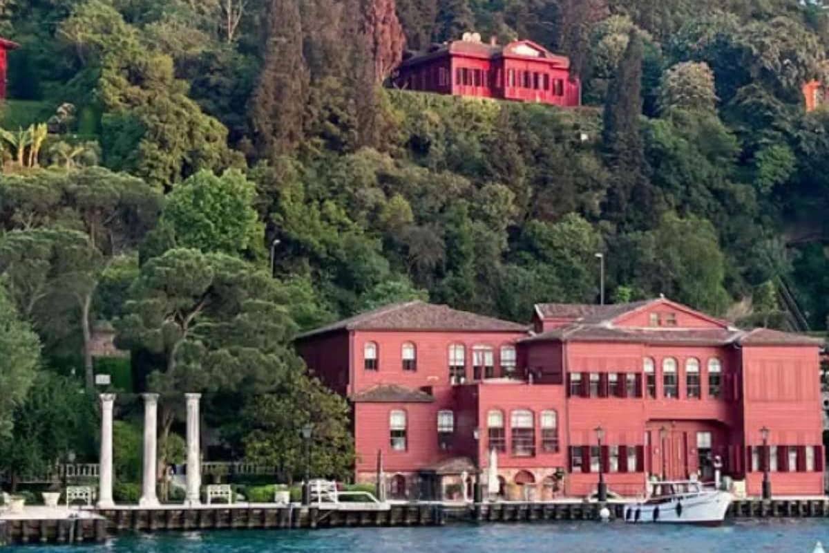
- Bosphorus villages: Bebek and Arnavutkoy on the European bank, Kandilli and Kanlica on the Asian bank.
- Kadikoy and Moda: the Asian shore, across the water from the old city.
- Uskudar: the shore town that looks back at the old city.
- The Marmara shore: the southern edge of the old peninsula, below the sea walls.
- The Princes’ Islands: nine islands in the Sea of Marmara, reached by ferry.
For where to stay in Istanbul by the strait, the yali houses set the scene. A yali is a house built at the shoreline. The word comes from a Greek term for seashore. A family spent time there as a second home, Wikipedia notes. The larger part first had private docks for caiques, the Bosphorus article adds.
One number from Wikipedia sets the scale of the water for where to stay in Istanbul on the Bosphorus. Between Kandilli Point and Asiyan, the currents reach 7 to 8 knots. Ships must change course by 45 degrees at that bend. Freighters and tankers also use the strait.
Caddebostan gives the Marmara coast a long walk for where to stay in Istanbul on the Asian side. Wikipedia calls its coast a waterfront promenade with a dedicated bicycle lane. The shore was filled in during the nineteen eighties, and the ferry pier there closed. The article places the quarter about 5 kilometres east of central Kadikoy.
Morning and evening bring the commuter boats. For where to stay in Istanbul on the Asian shore, note the commuters. Uskudar residents cross to the European side for work or school, the district article states. At rush hour, passengers hurry from the ferries to the buses. A base beside a pier suits a traveller whose days run on ferry rides.
Where to stay in Istanbul for a quiet stay away from the crowds?
A quiet base in Istanbul sits on a hillside, a village street or an island. For where to stay in Istanbul away from the crowds, five quarters fit: Cihangir, Kuzguncuk, Arnavutkoy, Heybeliada and Moda. Wikipedia places Fethi Pasha Grove, a large hillside park, between Kuzguncuk and Sultantepe.
- Cihangir: narrow streets and two parks above the Bosphorus shore.
- Kuzguncuk: a valley village on the Asian shore that Wikipedia calls quiet.
- Arnavutkoy: a small shore neighbourhood with wooden houses at the water.
- Heybeliada: the second-largest of the Princes’ Islands.
- Moda: a quarter of old mansions on a peninsula of Kadikoy.
Fethi Pasha Grove adds trees to where to stay in Istanbul on the Asian shore. The large park runs down a hillside to the Bosphorus shore. Fethi Ahmet Pasha, an Ottoman governor, ambassador and minister, gave it his name. After long neglect it was renovated and opened for recreation. The Bosphorus Bridge shows in the view.
Camlica Hill is the viewpoint for where to stay in Istanbul on the same shore. It rises 288 metres above the sea in Uskudar. Per Wikipedia, the view reaches over the lower Bosphorus to where the Golden Horn opens. A public park with monumental trees, flower gardens and fountains lies on the hill.
The evening call to prayer belongs to daily life, wherever a mosque stands. For where to stay in Istanbul, know what the adhan is. A muezzin recites it before each of the five daily prayers, as Wikipedia states. Muslims answer it with prayer. The call for the sunset prayer can be quicker, with fewer sung ornaments.
Heybeliada answers where to stay in Istanbul with an island of about 3 kilometres by 1, as Wikivoyage measures it. Wikipedia counts four hills: Hope Hill, Mill Hill, Village Hill and Woodcutter’s Son Hill. The name means “with a saddlebag” and is thought to refer to the valley between two hills.
A quiet base trades time for calm. The ferry or the bus stop sets that trade for where to stay in Istanbul away from the crowds. Wikipedia lists ferries to Heybeliada from Kabatas and Eminonu on the European side. Kadikoy and Bostanci on the Asian side do too. Cihangir and Moda keep a stop or a pier close.
Where to stay in Istanbul for a cruise call or a ferry departure?
For where to stay in Istanbul on a cruise call, Karakoy and Tophane sit beside the cruise terminal at Galataport. A ferry departure points to the city piers instead, from Eminonu on the old peninsula to Kadikoy and Uskudar. The right quay decides the base.
Galataport runs along 1.2 kilometres of shore in Karakoy, on the European side near the mouth of the Golden Horn. Its cruise terminal covers 29,000 square metres. Across the water lie the old peninsula, Topkapi Palace and the Ayasofya Mosque. That shore is the first fact for where to stay in Istanbul on a ship day.
Three large ships can berth there at the same time. Screens rise behind them, so nobody leaves a ship without passing customs and immigration. Those checks sit underground. For where to stay in Istanbul, Tophane reaches the shore at this point, so both quarters lie close.
Behind the quay lies a public square on an old military parade ground. Its centre holds the first free-standing clock tower in Istanbul. The sultan watched his troops from the Tophane Pavilion, a mid-nineteenth-century building on the spot. For where to stay in Istanbul, they are landmarks on arrival.
The T1 tram ties the terminal to the rest of a stay. The article puts its Karakoy stop very near the old passenger ship dock. Tophane, the next stop, lies near the Istanbul Modern museum. Both stops serve where to stay in Istanbul on a ship day.
A ferry day tests where to stay in Istanbul differently, because the city ferries call at piers on both banks:
- Eminonu: the main pier lies beside the Galata Bridge.
- Karakoy: the pier lies just north of the Galata Bridge.
- Kabatas: the pier sits beside the T1 tram stop and the funicular to Taksim.
- Besiktas: a pier on the European Bosphorus shore.
- Kadikoy and Uskudar: the two Asian-side hubs.
Yenikapi is the landing point for ferries across the Sea of Marmara, from Yalova, Bandirma and Armutlu. Haydarpasa, slightly north of Kadikoy, was the main terminal for trains from the Asian side until service stopped. For where to stay in Istanbul, a Marmara crossing starts at Yenikapi.
How do the tram and the funiculars shape where to stay in Istanbul?
For where to stay in Istanbul, the T1 tram ties the old city to the Bosphorus shore. It runs 19.3 kilometres from Kabatas to Bagcilar through the old city. Two funiculars then lift riders from the shore, one from Kabatas to Taksim and one from Karakoy to Tunel Square.
The T1 opened in nineteen ninety-two, on the alignment where trams last ran. Its track runs on reserved lanes for much of the route. Every stop has ticket counters and gates. For where to stay in Istanbul, this makes each stop a fixed point on the map.
Wikivoyage lists these T1 stops as links to other lines:
- Zeytinburnu: Marmaray and the M1 metro.
- Laleli-Universite: the M2 metro and the Grand Bazaar.
- Sirkeci: Marmaray and the T6 tram.
- Eminonu: Bosphorus ferries and the T5 tram.
- Kabatas: the funicular to Taksim.
The article lists a gap of two minutes at peak hours and up to fifteen at other times. Service runs from six in the morning to midnight. Wikivoyage adds that the line can be crowded, but journeys are short. A traveller checks the posted times for where to stay in Istanbul.
Two shorter lines serve the edges of the old city. The T5 follows the Golden Horn from Eminonu to Alibeykoy, the first line in the city without overhead wires. The T4 runs from Topkapi to Mescid-i Selam, with seven underground stops. Both widen where to stay in Istanbul.
Istanbul has three underground funiculars, as the transport article states. The F1 joins the Kabatas tram stop with the Taksim metro station along 594 metres of single track. The Tunel, the F2, has no stop between Karakoy and Tunel Square. The newest, the F4, links Bogazici University with Asiyan.
Two heritage trams add short rides. The T2 runs 1.6 kilometres between Taksim and Tunel, with five stops and a passing siding at Galatasaray Square. The T3 loops clockwise through Kadikoy and Moda in twenty minutes. The Istanbulkart, the city card, covers trams, funiculars, metro and ferries, a point for where to stay in Istanbul.
A base beside the T1, such as Sultanahmet, Sirkeci or Karakoy, suits a traveller who rides the line daily. A base at the top of a funicular suits one who wants Beyoglu at the door. That is the tram and funicular case for where to stay in Istanbul.
How do the metro and the Marmaray shape where to stay in Istanbul?
For where to stay in Istanbul, the rail map splits the city into two networks. Wikipedia counts eleven metro lines, eight on the European side and three on the Asian side. None crosses the strait. The Marmaray commuter line is the rail link that joins the two shores.
A traveller who plans where to stay in Istanbul reads the line letters first. M marks a metro line, T a tram, F a funicular and B a suburban line. The M1 opened first, on the third of September, nineteen eighty-nine. It splits at Otogar, the main coach station, toward the old Ataturk Airport and Kirazli.
For where to stay in Istanbul, the M2 links Yenikapi, Beyoglu and the business district. It crosses the Golden Horn, calls at Sishane, Taksim Square, Mecidiyekoy and Levent, and ends at Haciosman. The 20 kilometres from Sishane to Haciosman take 27 minutes. Taksim meets the F1 funicular, Levent the M6, Mecidiyekoy the M7 and Gayrettepe the M11.
The Asian side has three lines. The M4 runs from Kadikoy to Sabiha Gokcen Airport, and the M5 runs east from Uskudar through Umraniye and Cekmekoy. For where to stay in Istanbul on that shore, the M8 is the cross link. It joins the M4, the M5 and the Marmaray, and reaches the ferry jetty at Bostanci.
Because timetables change, check the current hours first, then settle where to stay in Istanbul. Wikipedia gives the metro hours as six in the morning until midnight, with a train every six to twelve minutes. Weekend night trains serve the M1A, M1B, M2, M4, M5, M6 and M7.
The Marmaray runs 77 kilometres from Halkali in Europe to Gebze in Asia, along the Marmara shore. A tunnel of 13.6 kilometres carries it under the Bosphorus. The tunnel stage opened on the Republic’s ninetieth anniversary. The full line opened in March, twenty nineteen. Trains run every eight minutes between Atakoy and Pendik, as Wikipedia states.
Wikivoyage names the main stops. West of the strait the line calls at Bakirkoy, Zeytinburnu and Sirkeci. East of it come Uskudar, Bostanci, Kartal, Pendik and Gebze. For where to stay in Istanbul, a base beside one of them has a rail route to the other shore.
Wikivoyage notes that a change between metro lines nearly always means leaving the gates and entering again. The Marmaray meets the metro at these stations:
- Yenikapi: the M1 and the M2.
- Ayrilik Cesmesi: the M4.
- Uskudar: the M5.
- Atakoy: the M9.
- Halkali: the M11.
How do the city ferries shape where to stay in Istanbul?
For where to stay in Istanbul, the ferry is one of the oldest means of transit, as Wikipedia describes it. The city has two parts split by the Bosphorus. The municipal fleet sails on 32 lines and calls at 53 piers along the Bosphorus and at the Princes’ Islands.
Three kinds of boat share the water, as Wikipedia lists them. The municipal fleet runs the traditional vapur ferries. A private fleet of 28 catamarans, the sea buses, serves 29 terminals. A second private fleet runs mainly urban services. The ferry service itself began in eighteen fifty-three with six paddle steamers.
Wikivoyage explains how the piers work. A liner from a given pier generally takes one route, and the signs name the destination. Eminonu alone has more than five piers. For where to stay in Istanbul, a traveller bound for Uskudar boards at the pier signed Uskudar Iskelesi.
For where to stay in Istanbul, the six liner routes in Wikivoyage show which quarters have a pier:
- Karakoy, Haydarpasa and Kadikoy.
- Uskudar, Karakoy, Eminonu and Eyupsultan: the Golden Horn route.
- Istinye to Cengelkoy along both shores: the whole Bosphorus route.
- Anadolu Kavagi, Rumeli Kavagi and Sariyer.
- Eminonu to Kavaklar: the special Bosphorus tour.
- Sirkeci, the Princes’ Islands, Yalova and Cinarcik: the islands route.
For where to stay in Istanbul, Eminonu has two ferry areas. The Golden Horn terminal is separate from the Bosphorus terminals, which lie east of the Galata Bridge. The ordinary vapur to Sariyer and Rumeli Kavagi follows the European coast. Its sign reads Bogaz Hatti, the Bosphorus line.
Wikivoyage names the main crossings of the strait: Kabatas to Uskudar, Eminonu to Uskudar and Eminonu to Kadikoy. The Kabatas and Eminonu piers lie close to the tram. At Kadikoy the M4, the nostalgic tram and the boats meet, as Wikipedia states. For where to stay in Istanbul, a pier beside a rail stop gives a base two routes.
Wikivoyage calls the sea bus from Kadikoy to Yenikapi a fast crossing, with rail routes to change to there. Wikipedia lists more sea bus ports at Bostanci, Kadikoy, Bakirkoy and Kabatas. For where to stay in Istanbul, a sea bus stop beside a rail stop adds a second route.
How do the hills, stairs and street noise change where to stay in Istanbul?
For where to stay in Istanbul, the old city stands on seven hills. A base on a ridge, a slope or a valley floor sets the climb. Wikipedia calls Istanbul the City on the Seven Hills. The name comes from Byzantine Constantinople, which followed the model of Rome.
All seven hills lie inside the old walls. The first, where Byzantium began, carries Topkapi Palace and the Sultan Ahmed Mosque. A fairly deep valley divides it from the second, which holds the Grand Bazaar and the Column of Constantine. For where to stay in Istanbul, Wikivoyage calls Sultanahmet the high point near the tip of the peninsula.
The third hill carries the main buildings of Istanbul University and the Suleymaniye Mosque. Its southern slopes run down to Kumkapi. The fourth slopes steeply to the Golden Horn and gently toward Aksaray. For where to stay in Istanbul, the slope sets the walk: uphill from the shore, easy toward Aksaray.
The valley to Balat splits the fifth hill from the sixth. The seventh, the dry hill of Byzantine times, reaches from Aksaray to the Theodosian walls. It has three summits, at Topkapi, Aksaray and Yedikule. For where to stay in Istanbul, Wikivoyage rates the walking as modest next to other Balkan and Mediterranean cities.
Wikivoyage calls Eminonu the low ground. It runs the shopping districts of Tahtakale, Mercan and Mahmutpasa uphill from Eminonu Square to the Beyazit II Mosque. In Karakoy, the curved Kamondo Stairs lead off Voyvoda Street. For where to stay in Istanbul, a wheeled bag rolls well on a flat road and slowly on steps.
Wikivoyage notes for wheelchair users that almost every metro station has lifts from street level to the platforms. Tram stops, it adds, sit low, with gentle ramps from the pavement. Its bus notes say old buses are being replaced by accessible ones. For where to stay in Istanbul, those lifts and ramps matter to a traveller with heavy bags.
Wikipedia describes speakers high on a mosque’s minarets that carry the call to prayer. A Wikivoyage caption on the old city reads: jump aside if you hear the tram bell. Wikipedia lists pubs and nightclubs with live music on Istiklal Avenue. For where to stay in Istanbul, a room on the courtyard side turns away from the street.
Which kinds of lodging answer where to stay in Istanbul?
For where to stay in Istanbul, Wikivoyage states that a traveller can find lodging in any part of the city. The kinds differ by building, not by district. They run from restored wooden houses and old trading inns to converted port and bank buildings, island guesthouses and apartments.
A konak, the wooden Ottoman house, is the first kind. Wikipedia describes a stone or brick ground floor under one or two timber storeys. Upper rooms can project over the street. Sogukcesme Street has restored houses of four to ten rooms, in concrete veneered with wood. For where to stay in Istanbul, a wooden front can hide a concrete frame.
A han is the second kind. Wikipedia defines a caravanserai as an inn for travellers, merchants and caravans, with rooms round a central courtyard. Early stone hans still stand in Tahtakale. The Sirkeci article pictures two han buildings that serve as hotels today. The courtyard plan decides which rooms face inward.
Karakoy shows the third kind, the converted port and bank building. Wikipedia lists rows of Ottoman-era bank buildings on Bankalar Caddesi. The old Ottoman Central Bank headquarters is now a museum. The same article says Istanbul’s old cruise ship terminal there now serves as a hotel. For where to stay in Istanbul, the old walls take new uses.
Wikivoyage places the lodging of Buyukada by the ferry pier, and its list there includes guesthouses called pansiyon. On Heybeliada, Wikipedia mentions a hotel that stays open all year. For where to stay in Istanbul, Wikivoyage adds apartments in Harbiye, hostels near Taksim and caravan parks at Ahirkapi.
Hotels are the last kind, and the Ministry of Culture and Tourism publishes the official lists. Its page lists facilities with a tourism operation or investment certificate. A second list holds facilities registered with local municipalities. For where to stay in Istanbul, a search page takes a name, a certificate type, a province and a district.
What more do travellers want to know about where to stay in Istanbul?
Which number of nights suits the old city when you plan where to stay in Istanbul?
No source read for this page names a number of nights, so the tasks set the count. Wikivoyage puts a visit to Hagia Sophia and Topkapi Palace at three to five hours at the least. For where to stay in Istanbul, that pair fills a half day of walking on its own.
The national museum pass is a second yardstick for where to stay in Istanbul. Wikivoyage gives it five days of validity, counted from the first entry. It gives one free entry to each listed museum, among them the Istanbul Archaeological Museums and the Galata Tower. A base in the old city or in Galata keeps those stops close.
The Theodosian walls add a long task for where to stay in Istanbul. Wikivoyage describes a seven-kilometre walk along the wall. It runs from the Golden Horn ferry stop at Ayvansaray to Yedikule Fortress. The article also names Monday and Wednesday as the main closing days of museums in the city. A closing day suits the move to another shore.
Does one base on each shore work for where to stay in Istanbul?
A split stay starts at the shore of arrival, which shapes where to stay in Istanbul. Wikivoyage says trains from Europe end at Halkali, 25 kilometres west of the centre. The Marmaray train runs on every 15 minutes. The article asks you to allow an hour to reach downtown. Trains from the east end at Sogutlucesme in Kadikoy.
Coaches arrive at Esenler, about ten kilometres northwest of Sultanahmet. The M1 metro runs to Aksaray, where a change to the tram reaches Sultanahmet in about thirty minutes. With heavy bags, Wikivoyage prefers a change at Zeytinburnu, where the two stations stand side by side. That way takes longer, which matters for where to stay in Istanbul.
Wikivoyage warns that evening ferries run less frequently. Confirm the last return before a night on the other shore. The article says a coach to Anatolia saves time when you get on or off on the Asian side. The saving runs from one hour fifteen minutes to one hour forty-five minutes. That detail matters for where to stay in Istanbul.
How does the Istanbulkart pay for the tram, metro and ferry?
The Istanbulkart is a contactless smart card for public transport, managed by the city municipality. The Istanbulkart article names buses, trams, funiculars, the metro, the Marmaray and ferries as the systems that accept it. One card therefore reaches every ride that shapes where to stay in Istanbul.
You hold the card near a reader, which reads it from up to eight centimetres. The screen then shows the balance left. The article states that up to five people can travel on one card, each taking a turn to tap. Wikivoyage adds that metro and tram exits need no tap, but the Metrobus line does.
Machines at metro entrances sell the card; Wikivoyage places top-up machines at tram stops and ferry piers. Metro stations have no staffed ticket booth. Wikivoyage notes that the phone version asks for a Turkish mobile number. For where to stay in Istanbul, a base near a stop keeps a machine close.
Which months bring a marathon or a festival for travellers who choose where to stay in Istanbul?
The Istanbul Marathon runs in November. Wikipedia calls it the only marathon whose course spans two continents. It starts on the Asian side, shortly before the First Bosphorus Bridge. It ends at the Inonu Stadium on the European side. Both shores meet the race, which matters for where to stay in Istanbul that month.
The race crosses three bridges, one over the Bosphorus and two over the Golden Horn. April brings the Istanbul Film Festival, held in the cinemas of the city. The marathon organiser also holds a half marathon that month. July brings the Istanbul Jazz Festival, which hosts rock, pop and blues too. A city arts foundation organises both festivals.
The Istanbul Biennial is a contemporary art exhibition from the same city arts foundation. Its article gives mid September to mid November, every two years. The entries read name no single district for these events. Check the venue of a programme before you fix where to stay in Istanbul for that season.