
Cephalonia island lies in the Ionian Sea off the west coast of the mainland, a limestone ridge cut by deep bays, white pebble beaches and old harbour towns. Boat days and outings from its ports add a western chapter to the tours in Greece.
The page covers the land and districts, the history from the first people to the union with Greece, Argostoli and the other towns, the north, the beaches, the caves, Mount Ainos, food and wine, getting there and around, and the seasons.
What is cephalonia island, and where does it lie?
Cephalonia island lies in western Greece and stands as the biggest island of the Ionian chain, as Wikipedia states. It is a regional unit with Argostoli as its seat. Wikipedia gives the Greek spelling of the name as Kefalonia.
Look at a map of Greece and cephalonia island lies out in open water to the west. Its group is called the Heptanese, a word that means Seven Islands. Wikipedia adds that the group also holds smaller islands besides the seven main ones.
Kythira is counted among the seven, yet it sits in the Attica Region. The region that contains Cephalonia island is the Ionian Islands, which Wikipedia describes as having eleven municipalities. On a clear day, Mount Ainos gives a view across to Zakynthos, Lefkada and Ithaca.
The name has more than one spelling, and cephalonia island carries all of them. Wikipedia gives Kefalonia or Cephalonia, and older forms such as Kefallinia and Kephallenia. Wikivoyage adds that islanders say “sefalonia”. The region joined with neighbouring Ithaca is called Kefallinia, which gives the airport its name.
Wikivoyage links the name to Cephalus, the son of Hermes in Greek myths. Wikipedia tells that Cephalus helped Amphitryon in a war and won the island of Same as his reward. After that, the story says, cephalonia island took his name.
Today the island is a regional unit with Argostoli as its seat. Wikipedia names Argostoli and Lixouri as the two largest towns. It also records an old Latin Catholic diocese, Kefalonia and Zakynthos. The name of that diocese joined two islands, and cephalonia island gave it the first half.
Even the sea has a story. The Greek word Ionios comes from a myth in which Io swam across the water. Wikipedia notes that the Ionian Sea is not related to Ionia in Anatolia. The whole Ionian Islands region covers 2,307 square kilometres, and this island is its largest part.
How big is cephalonia island, and what shapes its land?
Cephalonia island covers 773 square kilometres, as the Wikipedia infobox states. The peak of Mount Ainos stands 1,628 metres high. Four peninsulas and long bays give the land its shape, and dolomite and limestone form much of the rock below.
The figure of 773 square kilometres sits in the Wikipedia infobox. The same box gives a density of 46.7 people for each square kilometre. For your plan, that low number means room between the villages and quiet roads between the towns.
Wikivoyage says the island consists of four peninsulas and includes serious mountains. That mix of arms of land and high ground explains why cephalonia island feels like a set of small regions. A drive from one coast to another climbs, bends and drops again before it meets the sea.
One of the four peninsulas is Paliki in the west. Robert Bittlestone wrote the book Odysseus Unbound. He proposes that Paliki, now a peninsula, was an island in the late Bronze Age. Wikipedia reports that a project of three years tested the idea on cephalonia island.
The highest summit is Ainos, which Wikipedia gives as 1,628 metres. Its bedrock is dolomite and limestone of Cretaceous age, and Italian names for it are Monte Nero and Montagna Nera. A highway crosses the range, and between three and four thousand people live on its slopes.
Trees cover the mountains as well. Wikipedia lists the Greek fir and the black pine, and says pine woods grow at 700 to 1,200 metres. This green cover on cephalonia island rises over the dry coastal bays. It gives the centre of the island its dark colour.
Water has also shaped the land. Argostoli sits on a sheltered bay, and the Koutavos Lagoon lies at its end below the Castle of Saint George. Lixouri faces the capital across the same bay, about forty kilometres away. This long bay is the heart of the island.
Under the ground, sea water has its own route. At the Katavothres swallow holes near Argostoli, the sea disappears below the land. Wikipedia says it comes up in the Karavomylos area of Sami after about two weeks. In the north, the bay of Fiskardo is two kilometres long.
How is cephalonia island divided into towns and districts?
Cephalonia island has three municipalities, formed in a local government reform: Argostoli, Lixouri and Sami. Argostoli is the capital, and the census figure on Wikipedia gives the whole island 36,064 residents. Wikipedia lists the three as the municipalities of the island since that reform.
The Argostoli municipality is the largest, with 23,574 residents in the census Wikipedia cites. It covers 377.0 square kilometres. Wikipedia lists three municipal units inside it: Argostoli, Eleios-Pronnoi and Leivatho. The unit of Argostoli alone held 13,666 residents in that count on cephalonia island.
Argostoli has been the capital since the year seventeen fifty-seven, as Wikipedia states. The old capital was Agios Georgios, also called Kastro. Argostoli took over for the trade chances of its sheltered bay. The shift gave cephalonia island a harbour capital in place of a hill fortress.
On the Paliki peninsula, Lixouri is the leading town. Wikipedia counts it as the second largest town after Argostoli and before Sami. Its municipality covers 119.6 square kilometres and holds one municipal unit, Paliki. In the plan of cephalonia island, Lixouri is the centre of the west.
Wikipedia places Sami in the centre of the east coast. Its municipality covers 291.2 square kilometres and has 5,501 residents. The Sami unit alone covers 129.3 square kilometres and held 2,478 residents. Asos and Fiskardo belong to the unit of Erisos in the north of cephalonia island.
The map changed in steps. A reform in the late twentieth century grouped nearby communities. A second reform made one municipality for the whole island. A later one formed the three municipalities of today. Each step changed the borders on paper, though the island stayed one place.
Ports follow the towns. Argostoli has the main ferry port, linking the island to the mainland through Kyllini. In peak season the Lixouri ferry sails every hour or half-hour, as the Lixouri page states. Fiskardo is the northernmost port, 32 kilometres north of Argostoli. Poros has a ferry port beside its village.
What does the past of cephalonia island say about its first people?
Four city-states held cephalonia island by at least the sixth century BC: Pale, Cranii, Same and Pronnoi. As Wikipedia states, each one minted its own coins. Each also built temples and fortifications.
The oldest proof sits in the Archaeological Museum of Argostoli. Wikivoyage says its antiquities run from prehistoric times up to Roman times. It also shows a remarkable Mycenaean collection, so the story of cephalonia island starts before the cities. Finds from Melissani cave are on show there too.
Each city has a modern partner. Pale lies under modern Lixouri, Cranii under Argostoli, and Same under Sami. Pronnoi ruled its own district. Temples and walls rose both in the towns and in the countryside around them.
The cities joined wider Greek events. Two hundred hoplites from Pale fought at Plataea beside other Greeks. All four cities allied with Athens in the Peloponnesian War. The island lies close to the entry to the Bay of Corinth, which gave cephalonia island value to Athens.
The Corinthians attacked Krane in 431 BC and failed. Ten years later, Athens settled a group of Spartan deserters on the island. Soldiers from the island also joined the Sicilian Expedition under the Athenian general Demosthenes.
Culture reached far too. A man named Melampous won the lyre and song contest at the Pythian Games at Delphi in 582 BC. On Mount Ainos stood a sanctuary of Zeus Ainesios, according to Strabo. Later explorers found its remains.
Legend explains the name. Cephalus helped Amphitryon of Mycenae in a war and received the island of Same as his reward. That island then became known as Cephallenia. The page presents this as myth.
The page also notes a suggestion that the island is the Ithaca of Homer. Robert Bittlestone proposed that Paliki stood alone as an island in the late Bronze Age. A project of three years tested that idea.
In the fourth century BC, a new planned and fortified town at Same came to dominate Pronnoi. The cities sent troops and ships to Alexander the Great. The Macedonian king Philip V invaded cephalonia island in 218 BC.
How did Rome, Byzantium and Venice rule cephalonia island?
Rome conquered Same after a long siege in 189 BC. After that, cephalonia island lost its strategic weight. Byzantium later made it a base, and Venice held it from the start of the sixteenth century.
Under Rome, the old towns grew quiet. Lavish villas filled the coasts instead. The emperor Hadrian gave the island to Athens as a gift. These facts show how far cephalonia island had fallen from its days as a prize.
In the late Roman Empire, the island belonged to the province of Achaea. The four ancient cities survived into late antiquity, with Sami probably as the capital. Byzantine rule then changed the role of the island once more.
Muslim expansion in the western Mediterranean raised its worth. Byzantium used cephalonia island to block raids into the Adriatic and as a bridge for expeditions to Italy. From the eighth century, it formed the theme of Cephallenia.
The capital moved to the Castle of Saint George, a better protected site inland. Mardaites were resettled to serve as marines. The loss of Byzantine Italy later cut the importance of the island, and a civilian judge replaced the military strategos.
In the eleventh century, Italo-Normans besieged the main city. In the twelfth, Venetians plundered the island. After the Third Norman invasion, a county palatine formed under the Kingdom of Sicily. It ended when the last count, Leonardo III Tocco, lost to the Ottomans.
Turkish rule was short. A Spanish-Venetian army captured the island at the start of the sixteenth century, a rare Venetian success. Refugees came from the lost fortresses of Modon and Coron, and colonists came from Crete to cephalonia island.
From then on, the island stayed in the Stato da Mar until the republic ended. The governor Marcantonio Giustinian printed Hebrew books and sent them across the eastern Mediterranean. The island exported currants and had ships built at the Danzig shipyard.
Under Venice, the village of Assos became the administrative capital of the north. This happened in the last decade of the sixteenth century. Its castle was meant to shelter locals from Turks or pirates. With no natural springs, it never became a working fortress.
In the eighteenth century, the capital left the Kastro of Agios Georgios. Argostoli took its place. The people wanted the trading chances of its sheltered bay.
How did France and Britain rule cephalonia island before it joined Greece?
French forces took the Ionian Islands in June, in the closing years of the eighteenth century. Cephalonia island then became part of the French department of Ithaque, and the long rule of Venice was over.
The Treaty of Campoformio ended the Venetian Republic and awarded the Ionian Islands to France. A French force sailed on ships captured in Venice. This is the wider Ionian story in one clause, and the rest belongs to the island.
The French hold lasted one year. A combined Russian and Turkish fleet then took the islands. Next, cephalonia island belonged to the Septinsular Republic. The republic stood nominally under the Ottoman Empire but was protected by Russia.
The Treaty of Tilsit gave the islands back to France. Next, the British blockaded them. In September, they raised the Union Flag above the castle of Zakynthos. Cephalonia and Ithaca soon surrendered, and the British set up provisional governments.
The Treaty of Paris recognised the Ionian state as a British protectorate. A Swiss-born colonel named de Bosset governed provisionally. He is credited with achieving public works. The era changed the roads and bridges of cephalonia island.
The British also built the law courts in Argostoli, using stone from the ancient site at Krani. The Fanari lighthouse dates from the British years too. An earthquake destroyed it later, and builders rebuilt it from the original plans.
Greek nationalist groups formed in the following years. At first, they backed the Greeks in their revolution against the Ottomans. Then their energy turned towards the British. By the middle of the nineteenth century, calls for union with Greece, called enosis, were growing strong.
Rebellions broke out in Argostoli and Lixouri. They led to a relaxing of the laws and to freedom of the press. A new rebellion followed, and the governor suppressed it. Union stayed the declared aim of cephalonia island.
Greece received the Ionian Islands in the nineteenth century, and the British protectorate ended. Since then, cephalonia island has been part of the Greek state.
What did the great earthquakes change on cephalonia island?
The earthquakes of the middle of the twentieth century changed cephalonia island more than any other modern event. The strongest struck on the twelfth of August. It measured 6.8 and lifted the whole island by 60 cm, as Wikipedia states.
The shaking came in a series. Between Kefalonia and Zakynthos, more than 113 earthquakes were recorded in mid-August. The twelfth was the worst. For this reason the story of cephalonia island has two parts. One is the old stone towns before the quake. The other is the towns built after it.
In Argostoli, the capital, the damage was substantial. Its buildings were flattened. Buildings that German bombing in the war had spared were lost in the quake. The Argostoli page says the quake razed almost all of the island apart from the Fiskardo area. The capital of cephalonia island had to be built again.
Fiskardo is the clear exception on cephalonia island. As Wikipedia states, it escaped the destruction and kept its original architecture. Walking its harbour shows what a Cephalonian waterfront looked like before the quake. The poet and writer Nikos Kavvadias lived in Fiskardo, as the same page notes.
Other buildings carry the scars. The lighthouse at Agion Theodoron, on the road west of Argostoli, was destroyed. People also call it the Fanari lighthouse. The present one was rebuilt with Doric-style columns from the original plans. Parts of the De Bosset Bridge collapsed too, and the damage stays visible from the side today.
The effect on people was also large. Wikipedia reports that a great number of residents left the islands, and the economy suffered with them. The towns of cephalonia island that visitors see today belong to the era of rebuilding. Their plain modern look comes from that time, not from the Venetian past.
Older buildings still stand in towns that were struck. In Lixouri, the public library and museum in the Iakovateios building came through the quake. So did the first primary school. Such survivors are rare, so each one tells travellers how cephalonia island looked before the rebuilding began.
What does Argostoli offer on cephalonia island?
Argostoli is the capital and main town of cephalonia island, and a sheltered bay is its heart. Wikipedia states it has been the administrative centre since the eighteenth century. People moved down from the old Kastro to use the trade of the bay.
The town has two population counts. The latest census recorded 13,666 people in the municipal unit. The larger municipality, formed after the local reform, counted 23,574. Since the local reform, Argostoli is one of three municipalities on the island. Its trade shaped the town you see on cephalonia island today.
The De Bosset Bridge, the long landmark of the town, crosses the bay of Argostoli, a sight of cephalonia island. Wikipedia gives its length as 689.9 metres and says it rests on 16 low stone arches. On a small man-made island along the way stands an obelisk raised under British rule.
The bridge, once called the Drapano Bridge, now carries walkers only. It was closed to cars and renovated, then reopened as a footbridge. It also separates the Koutavos Lagoon from the open bay.
Beneath the Castle of St. George, where the bay ends, sits the Koutavos Lagoon. Loggerhead turtles feed there, and today it is a nature reserve. It was once an almost impassable swamp where mosquitoes and malaria were rife. A walk along the bridge shows a quiet corner of cephalonia island.
Opposite the Archaeological Museum stand the law courts. The British built them with stone from the ancient site at nearby Krani.
Two museums sit in the centre. The Archaeological Museum holds finds from prehistoric to Roman times, with a remarkable Mycenaean collection, as Wikivoyage states. The Corgialenios Library is also a folk museum, with ceramics, sculptures, textiles, silver utensils and rare books. Both give the history of cephalonia island in objects.
Lithostroto is the old stone street of Argostoli. A little way along it stands the Bell Tower, rebuilt to house the original clock mechanism. Short walks here show how the town rose again. The bus station stands between the lagoon and the bridge, and it links Argostoli with Athens and Patras.
West of the centre, the coastal road was called the Piccolo Gyro in Venetian times. At Katavothres, sea water vanishes into the ground. Wikipedia adds that the water travels under the island and passes the Melissani lake. In the nineteenth century its power turned a water mill. It is a puzzle of cephalonia island.
What does Lixouri add to cephalonia island?
Lixouri is the second largest town on cephalonia island, after Argostoli and before Sami. It leads the Paliki peninsula, west of Argostoli across the bay. It also has its own long cultural story.
The town began on cephalonia island when citizens of the ancient town of Pale found a new place to live.
The Cephalonia page lists Pale as the ancient city of today’s Lixouri. Wikipedia states the new town took its name from Paleas, a son of the mythical king Kefalos. The old city was abandoned by the sixteenth century, though ancient ruins can still be seen north of Lixouri.
Lixouri was a cultural centre of cephalonia island long before it was a resort. Wikipedia notes that it had a Catholic bishopric. In the nineteenth century it was a popular place to visit, and the composer Richard Strauss came. The poet Andreas Laskaratos was born here, and he wrote about life in his home town.
Today the town has a library and a museum in the Iakovateios building. A theatre opened in the early years of this century. The Ionian University also has a campus in Lixouri, where the department of Ethnomusicology works. Together these places give cephalonia island a lively second centre of learning and music.
The ferry across the bay joins Lixouri to Argostoli. In peak season it sails hourly or twice an hour, Wikipedia states, and it takes vehicles under 5 tons. The Argostoli page gives hourly sailings in winter and double that number in summer. The Lixouri port also has a summer link with Patras and Killini.
The peninsula holds the beaches of the west. Wikipedia notes that the area is renowned for beaches such as Xi, Fteri and Petani, praised for clear water. A bus service runs twice daily to the villages of the peninsula. The municipal unit of Paliki holds villages such as Mantzavinata, Kaminarata and Monopolata on cephalonia island.
The rivalry between Argostoli and Lixouri is now primarily cultural and sporting, Wikipedia explains. It gives the distance between the two towns as approximately 40 kilometres, both on one bay. Argostoli has long been the administrative and economic hub, while Lixouri kept its cultural role. Visiting both gives a fuller picture of cephalonia island.
All the same, the two towns share one island story.
What do Sami and Poros show on the east coast of cephalonia island?
Sami and Poros are two harbour towns on the east coast of cephalonia island. Sami sits in the middle of the eastern shore and is the seat of its own municipality. Poros lies in the south-east, 28 km from Sami, and links the island to Kyllini on the mainland.
Sami has a long past, because the ancient city-state of Same stood on this spot. Today the town is the seat of one of three municipalities on cephalonia island. Its municipal unit holds 2,478 people, so the town is small and calm.
Sami also took a role in cinema. The portside of this old-fashioned port was turned into a kind of set. The film was Captain Corelli’s Mandolin, as Wikivoyage notes. The caves of Melissani and Drogarati lie 2 km and 3 km from the town.
Antisamos beach lies near Sami, on the same coast of cephalonia island. The beach appeared in the Corelli film too. Wikivoyage adds that a permanent traffic jam builds up around it, so the roads nearby fill with cars.
Poros is split into three parts. The port links the island with Kyllini on the Peloponnese by a regular year-round ferry, as Wikipedia states. In summer a ferry can link Poros with Zakynthos, and small caiques offer cruises to Ithaca. Timetables differ, so check the current one.
The Greek word poros stands for a crossing. The mouth of the Vohinas river is the only natural crossing point. The river gave the town its name. Behind the town runs the Poros gorge, a ravine 80 metres deep.
The Poros area is old. Finds from the Drakaina cave in the gorge confirm that people lived there since 5,700 BC. A Mycenaean tomb at Tzanata points to an important town nearby. A rough track from the gorge leads to Atros monastery, the oldest on cephalonia island.
The town has a Blue Flag beach called Aragia, which lies apart from the centre. The Vohinas river separates the two. The harbour is also home to the local fishing boats, which supply fresh fish to the area around Poros.
What do Fiskardo and Assos show in the north of cephalonia island?
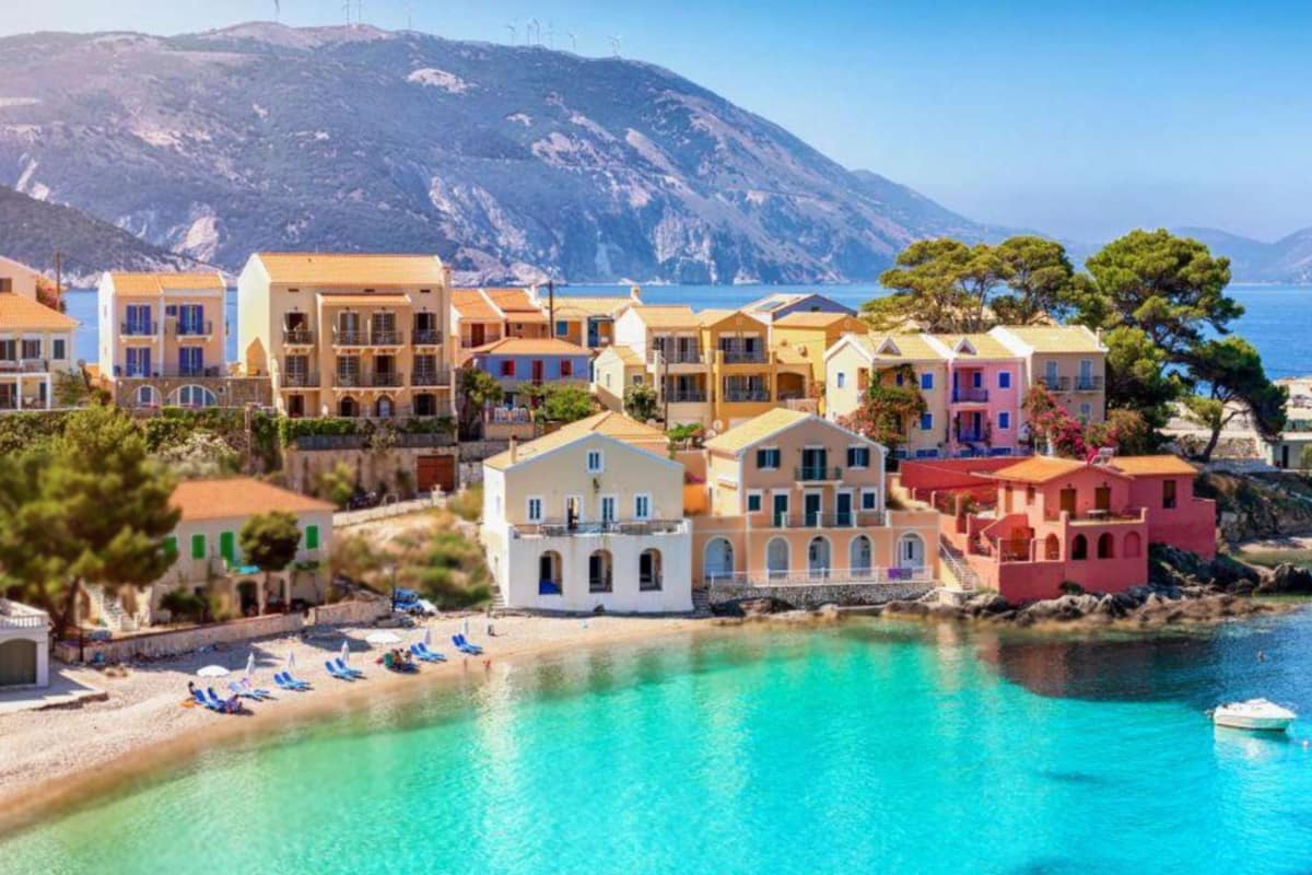
Fiskardo is the northernmost port of cephalonia island and kept its original architecture through the great earthquake. Assos, to the south-west of it, holds a Venetian castle built in the sixteenth century. Together the two places show the older, calmer north of the island.
Fiskardo lies 32 km north of Argostoli and 24 km north of Sami. The name also belongs to a bay two kilometres long, where the port sits. The fishing fleet is small and shrinking, and the coast nearby is rocky, with coves of pebbles.
Lefkada and the Ithacan port of Frikes both have ferry links with Fiskardo. That short hop makes the north of cephalonia island a gateway to its neighbours. As elsewhere, timetables differ from season to season.
Norman rule gave the village its name, after Robert Guiscard, the founder of the Kingdom of Sicily. Before that, the place has been identified with ancient Panormos, which the historian Herodotus mentioned in the fifth century BC. The poet Nikos Kavvadias lived here.
Roman remains lie in the ground here. Workers found a Roman-era grave complex with five burial sites, gold jewellery, glass and bronze objects. On a nearby plot, archaeologists found a remarkably well-preserved theatre. The Greek Culture Ministry called the find unique.
On the western shore, Assos sits 36 km from Argostoli, measured to the north. The article says Venetian rule created the village. In the late sixteenth century it became the administrative capital of northern Cephalonia. That role gave the north of cephalonia island its own centre.
The Venetian Senate chose Marino Gentilini, an Italian army engineer, to build Assos Castle. Wikipedia ranks it among the largest castles in Greece. Wikivoyage describes a steep descent to the castle, which stands on a small peninsula.
The castle was meant to protect local people from Turks or pirates. It was never adopted as a fortress, because the site has no natural springs. Today the walls are one of the main sights of cephalonia island, as the island article states.
Which beaches stand out on cephalonia island?
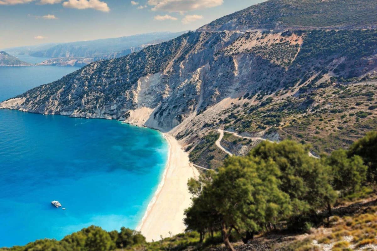
Myrtos stands out among the beaches of cephalonia island. It lies in the north-west, below two mountain peaks, and its round white cobblestones are marble. Skala, Lourdas, Petani and Xi add very different shores in the south and the west.
Wikipedia places Myrtos Beach in the Pylaros region, in the north-west of cephalonia island. Two peaks, Agia Dynati and Kalon Oros, frame the beach, and the second rises 901 metres. The sediment around it is marble, and the cobblestones are round and white.
The turquoise colour has a cause. Waves curve along the beach and lift the finest bits of marble. These make plumes that follow the curve of the shore and tint the water. The slope drops abruptly, so Wikivoyage does not recommend the beach for non-swimmers.
The road down from Divarata is about 2 km, twisting through hairpin bends. The way down shows the mountain side of cephalonia island. In the summer season the Municipality of Pylaros runs a public bus from Agia Efimia. Parking for cars is at the foot of the cliffs.
Skala lies in the south, 39 km from Argostoli. Wikivoyage calls it a relaxed resort focused on beach holidays. The present village replaces an older one that the earthquake levelled. Mosaic floors in three rooms of a Roman villa can be seen at its edge.
The ruins of an Apollo temple sit 3 kilometres from Skala, near the shore. Wikipedia places its origin in the sixth century BC. Today only foundation blocks and broken Doric columns are left. This ancient site stands near the sand on cephalonia island.
On the southern coast, Lourdas is a sleepy village beside a long sandy beach, as Wikivoyage states. Near Argostoli, in Lassi, lie Makrys Gialos and Platis Gialos, which the same page calls busy beaches. The south shows a sandy side of cephalonia island.
Petani lies on the Lixouri peninsula, and Wikivoyage says it resembles Myrtos. Xi, south of Lixouri, is a sandy beach that always seems to have space and peace. Wikivoyage notes that Myrtos can be busy, so these two offer another choice on cephalonia island.
Which caves and lakes lie under cephalonia island?
Melissani is the cave lake of cephalonia island, a sinkhole northwest of Sami with an opening in its roof. Wikipedia places it about five kilometres southeast of Agia Effimia. Boats carry visitors across the water below a forested slope.
Parking is available at the entrance, next to the main road joining Sami with Agia Efimia. Forests surround the cave. The Evmorfia and Agia Dynati mountains rise to the west of the lake. This makes the lake simple to find on a map.
The sinkhole formed after a limestone collapse in the nineteen-fifties. Rock gave way above the water table, and the cenote opened to the sky. Wikipedia compares it with the cenotes of the Yucatan peninsula in Mexico. The cave is one more result of the limestone under cephalonia island.
Greek myth named the place the Cave of the Nymphs. Archaeologists dug here under Spyridon Marinatos, and the finds now stand in the Archaeological Museum of Argostoli. So the lake joins the early story of cephalonia island to its geology, in one small place.
The water has a long path. Near Vlikha, west of Argostoli, sea water disappears into holes called Katovothres. About fourteen days later it comes out at Karavomylos in Sami, after crossing the Melissani lake. In the nineteenth century, a water mill used that flow on cephalonia island.
The bay of Sami holds a number of cenotes with deep shafts. Cave divers have followed wide karst channels under the bay. The groundwater of Melissani reaches the sea at Fridi beach. Water from the island’s own rock feeds the coast, so the lakes of cephalonia island link up below ground.
Drogarati Cave was discovered about 300 years ago, when an earthquake collapse revealed its entrance. Speleologists state that it is about 150 million years old. The cave is about 60 metres deep, with humidity near 90 percent. Stalactites hang from the ceiling in this dry cave of cephalonia island.
A long corridor leads to the Royal Balcony, a natural platform of stalactites. From there a traveller sees the Chamber of Exaltation, the biggest hall of the cave. Its acoustics are excellent, and the hall has room for 500 people. The chamber shows how cephalonia island hides large rooms underground.
What does Mount Ainos give cephalonia island?
At 1,628 metres, Mount Ainos is the tallest summit on cephalonia island. Its rock is dolomite and limestone, laid down in the Cretaceous period. National park status covers the bigger share of the range. A highway crosses the mountain and joins the south-west to the east.
The mountain carries more than one name. Ancient Greek wrote Ainos, and the Italian names are Monte Nero and Montagna Nera, which mean Black Mountain. The dark forest on its slopes explains those names. For sailors, the range stood as a landmark.
The Greek fir, with the Latin name Abies cephalonica, gives the island its tree. Black pine, Pinus nigra, grows beside it. The pine forests grow at heights from 700 up to 1,200 metres. Ponies that are semi-wild inhabit these woods, so horses are part of cephalonia island’s mountain scene.
Clear weather opens a wide horizon from the top. The view reaches Zakynthos, Lefkada and Ithaca, and the Peloponnese and Aetolia on the mainland. Towers for television and mobile phones stand on the summit. A climb up the mountain gives a map of cephalonia island and its neighbours.
The range has no ski resorts, and the page about it points to caves in the north. The highway over the mountains links the south-west of the island with the east. Only a small number of roads enter the range, so the slopes stay quiet.
Ancient writers knew this peak. Strabo wrote that a sanctuary of Zeus Ainesios stood on the mountain, and Hesiod also mentioned it. German, French and English explorers of the eighteenth and nineteenth centuries found its remains. The sanctuary adds a Greek faith story to cephalonia island.
The easy walk starts on the Mt Ainos road, which ends at the transmitter station. A dirt track takes about 10 minutes on foot, then steps lead up for another 10 minutes. A visitor book waits at the top of cephalonia island’s tallest peak.
A longer route starts at a quarry near Digaleto village. It runs 6.5 kilometres and follows yellow signs with a white square. Much of the path lies below the tree line, so the walk stays cool.
Which foods and wines belong to cephalonia island?
Robola is the wine grape of cephalonia island, and kreatopita, the meat pie, is its dish. Wikivoyage calls the pie a local speciality and a farmhouse dish. It also tells visitors to buy wild thyme honey and Robola wine.
Robola is a white variety grown mainly in the south-east of cephalonia island. Wikipedia notes ungrafted vines in the limestone soils there. Limestone is the same rock that forms the caves and the mountain. So the grape grows in the same stone that shapes the whole island.
The vine ripens early and gives a wine with high acid. The wine is dry, with a medium body and a clear lemon note. The wine expert Oz Clarke adds that Robola can have a flinty character. A glass of it is a quick taste of the island.
An older theory said Venetian merchants carried the vine to Friuli in the thirteenth century. Newer DNA profiling raised doubts about that link. The Vitis International Variety Catalogue treats Robola as its own grape. For wine students, the vine therefore stands as a plain local variety of cephalonia island.
Pies are called pites in Greek, and the meat pie leads the list. A food page of the Greek tourism board names kreatopita the pie king of the island. Wikivoyage calls it hearty farmhouse food rather than fine dining. It is simple cooking from the farms of cephalonia island.
Honey is the next product. Wikivoyage points to the wild thyme honey as a special buy. Near Skala, multi coloured beehives stand in the fields and on the hillsides. The bees there make honey with a thyme flavour, a taste that belongs to the hills of cephalonia island.
The tourism board page adds local cheeses, olive oil and almond-based sweets. It says the landscape and the Venetian heritage shaped these foods. Around Skala, orange, lemon, walnut, almond and fig trees have been planted. A traveller can build a whole table from the produce of cephalonia island.
How do travellers reach cephalonia island by air and sea?
Travellers reach cephalonia island by air through the airport near Argostoli and Lassi. By sea, ferries come from Patras and Kyllini on the mainland, and from Italy, as two travel pages state.
The airport of cephalonia island was opened to serve the former municipality of Leivatho with better transport links. A new runway followed in the nineteen-eighties. Later work added more airside space with more shops, plus a rebuilt car park and pick-up points.
Wikivoyage calls it a small island airport, where two planes on the ramp make it crowded. A cafe bar and a gift shop stand before and after security. Argostoli’s page adds that scheduled flights run to Athens and Zakynthos, with charter flights in summer.
Passengers who choose the bus find a public stop outside the terminal building. Wikipedia says this transit service to Argostoli runs during the summer season only. The road from the airport to Fiskardo is 61 km, about one and a half hours. Cephalonia island is long, so choose the first base with care.
At sea, the main ferry port of Argostoli joins the town with the mainland via Kyllini and with Zakynthos. It stands next to the new bus station. Wikivoyage also names Pessada as the place to connect with Zakynthos, and says car ferries come from the mainland.
The north has its own links. Fiskardo, the northernmost port, has ferries to Lefkada and to Frikes in Ithaca. Poros has a substantial ferry port, slightly separated from the rest of the town. Both ports give cephalonia island a second way in besides Argostoli.
Lixouri adds a summer service to Patras and Kyllini on the mainland, as its Wikipedia page states. Schedules change, so read the official page of each port before the trip. A plan for cephalonia island works well when the arrival port is chosen first.
The airport sits at 18 metres above sea level, as Wikipedia states. Wikivoyage names Tuesday and Sunday as the main travel days and calls both busy. Staff are described as cheerful and relaxed. A traveller to cephalonia island who lands on those days can plan extra time.
How do travellers move around cephalonia island?
Travellers move around cephalonia island by car or bike, because Wikivoyage states that you need one of them. Buses and the Argostoli to Lixouri ferry cover fixed routes between the main towns, the beaches and the villages.
Wikivoyage names Argostoli and Lassi as the places with the largest number of car and bike hire offices. It adds a plain tip for scooters: check the bike for earlier damage before you hire it. The tip fits any rented vehicle on cephalonia island.
Wikivoyage states that four peninsulas and serious mountains shape the island. A short distance on the map can therefore take time. Fiskardo lies 32 km north of Argostoli, and Asos lies 36 km north of it. Roads wind between the bays and the ridges.
A highway crosses Mount Ainos and joins the southwest with the east. Wikipedia calls it one of only a small number of roads into the range. From the village of Divarata, a road with hairpin turns drops about 2 km to Myrtos Beach. Cephalonia island rewards slow driving.
The new bus station of Argostoli stands near the lagoon and the bridge. It links the town with other towns, a number of villages, Athens and Patras. Service to Poros, Sami, Skala and Fiskardo is infrequent. Summer service to Lassi, the airport, Lourdas, Myrtos and Antisamos is frequent.
Wikivoyage warns that the bus routes are too infrequent to help a visitor much. In summer, the Myrtos bus leaves from the harbour of Agia Efimia and stops on the road above the beach. Lixouri has a bus service to the Paliki villages twice a day.
The ferry across the gulf saves a long drive round the bay. The Argostoli page gives hourly sailings in winter. In summer there are two sailings every hour. The Lixouri page says it carries vehicles under five tons.
Wikivoyage describes the Fanari Road as a coastal route for walking or driving. It lies north of Argostoli and Lassi. It passes a lighthouse, the old waterwheel and smaller beaches. Cephalonia island has taxis too, found at Plateia Valianos and along the seafront of Argostoli.
When do travellers visit cephalonia island, and what do they pack?
Travellers visit cephalonia island in summer, when buses and ferries run more frequently. They pack sun cover and shoes for the pebble beaches. Wikipedia gives Argostoli dry, hot summers and rainy, cool winters.
Summer opens the full set of services. The airport bus to Argostoli runs only in the summer season. Frequent summer buses reach the beaches, and the ferry across the gulf sails more frequently. For a first visit to cephalonia island, these links make the trip easier.
Winter is the quiet time. Wikivoyage names November to April as the out-of-season months, when work on the island is scarce. A visit to cephalonia island then means fewer open places and a slower pace.
Because winters are rainy and cool in Argostoli, a rain layer belongs in the bag for that season. Summer packing is simpler. Light clothes, a hat and strong sun cover suit hot, dry days. Cephalonia island has sandy beaches too, such as Xi south of Lixouri.
Wikipedia describes Myrtos Beach as round white cobblestones, with an abrupt drop at the shoreline. Wikivoyage adds that the stones can be blindingly hot in high summer, and tells visitors to take plenty of suncream. Shoes with a firm sole help on this part of cephalonia island.
The mountain has its own weather. Pine forests grow at 700 to 1,200 metres on Mount Ainos. A walk there runs mostly below the tree line and, as Wikipedia states, can be cool even in summer. Take a light jacket when you plan a climb on cephalonia island.
The caves stay cool all year. Wikivoyage states that Drogarati Cave holds a constant temperature of 18 degrees Celsius. It lies 3 km from Sami and 120 metres above sea level. Melissani Cave lies 2 km from Sami town. A thin top layer is enough for both caves.
Beach days differ by shore. Wikivoyage calls Myrtos popular and therefore busy, and says the same of the two beaches at Lassi. Xi south of Lixouri seems always to have space. Koroni in the south-east is a nesting site for loggerhead turtles. Cephalonia island gives each visitor a quieter choice.
What do the sea turtles add to cephalonia island?
Loggerhead sea turtles (Caretta caretta) feed and nest around cephalonia island. Wikipedia names the Koutavos Lagoon beside Argostoli as a feeding ground, and Wikivoyage names Koroni beach as a nesting site. No source read for this page promises a sighting to a traveller.
The Koutavos Lagoon lies east of Argostoli, at the end of the bay, beneath the Castle of Saint George. It is now a nature reserve. Long ago it was an almost impassable swamp where mosquitoes and malaria were rife. The change shows how the wild places of cephalonia island have been reshaped over time.
Wikivoyage lists Koroni as a stretch of sand and a nesting site for the loggerhead. Kaminia Beach is also listed. It is a shallow beach between Anno Katelios and Skala, and a turtle can be seen there. Skala is a village in the south, about 39 km from Argostoli, on cephalonia island.
The animal is easy to describe. Its skin ranges from yellow to brown, and the shell is reddish brown. The name loggerhead refers to the large head. Adult males have thicker tails than females. These are the visitors that reach the shores.
The turtle is an omnivore and feeds mainly on invertebrates that live on the sea bottom. Its large, powerful jaws help it break up its prey. This diet keeps it close to shallow coastal waters. It is a quiet part of the sea life around the island.
Wikipedia names the greatest threat to the species as the loss of nesting habitat. Coastal lighting and housing developments also confuse hatchlings as they leave the nest. For this reason a quiet, dark beach matters to a nesting turtle on cephalonia island. This page states no local beach rules, so a traveller follows the signs.
Untended fishing gear causes loggerhead deaths, and a turtle can suffocate if trapped in a trawl. Special devices give the turtle an escape route. Saving the species needs cooperation between countries, because turtles roam vast areas of ocean. The loggerhead is listed as vulnerable, and cephalonia island is one small part of its range.
Which monasteries and churches shape cephalonia island?
Wikivoyage lists four monasteries on cephalonia island. They are Agios Gerasimos at Omala, Agios Andreas at Livathos, Kipouria in Paliki, and Blessed Mary and Snake at Markopoulo. Each stands in a different village or district, so a traveller meets them in different parts of the island.
Kipouria Monastery is pictured on the west coast. Another Wikipedia photo shows the Ionian Sea view from the Kipoureon monastery. Paliki is the peninsula whose main town is Lixouri. A visit to this monastery therefore means a trip across the gulf, into the quieter west of cephalonia island.
The sources read give no more detail about the monastery at Omala than its place and name. They state no dates for church feasts either. This page therefore names no feast day. A traveller asks locally, because the sources do not say when the feasts of cephalonia island fall.
The earthquakes of the middle of the twentieth century razed virtually all of the island, apart from the Fiskardo area. Fiskardo kept its original architecture. Wikivoyage adds that the other towns were levelled. For this reason old churches are rare, and each church that survived marks the past of cephalonia island.
Two church photographs are named in the sources. One shows the Evangelistria Church beside the castle of Saint George. The other shows the inside of Saint Sofia’s Church in Mantzavinata. A third church gave its name to a lighthouse. The Agion Theodoron lighthouse near Argostoli takes its name from a small church next to it.
That lighthouse was built in the British period, on the coastal road the Venetians called the Piccolo Gyro. The first building fell in the earthquake, and a restored structure stands today. In Argostoli, the Lithostroto street runs beside the Catholic Church. These are the landmarks of cephalonia island that came back after the ruin.
Lixouri held a Catholic bishopric and was historically the cultural centre. Wikivoyage also lists a Byzantine Museum and the Tomb of Mazaraka at Livathos. It names Palaia Vlachata as a ghost village, left empty after the earthquake. Such places show how faith and loss shaped cephalonia island.
What does Ithaca add to a stay on cephalonia island?
Ithaca sits just north-east of cephalonia island in the Ionian Sea, and its capital is Vathy. Wikivoyage places the port of Sami facing it. The two islands share a long past, so a day across the water fits the trip well.
Ithaca is the smaller island. Its main island has an area of 96 square kilometres. Among the seven main Ionian Islands, only Paxi is smaller. The population is 2,862. Cephalonia covers 773 square kilometres. A traveller who stays on cephalonia island sees the larger island and its small neighbour side by side.
In the south, Vathy stands around a deep natural harbour, and 1,693 people live there. The town formed in the sixteenth century, during the late Venetian rule. Families moved down from Palaiochora, which means old town. Pirate raids had once forced them inland, as they did on cephalonia island.
The link with Odysseus is labelled with care. Wikipedia ties today’s Ithaca to the Ithaca of Homer, where Odysseus lived. The Odyssey tells of his delayed return. It adds that other places have been proposed. One is Paliki, now a peninsula of cephalonia island.
The author Robert Bittlestone argued that Paliki stood apart as an island in the late Bronze Age. A three-year project, begun in the summer, tested that idea. Wikipedia only reports the idea and the project. It does not call the matter settled for cephalonia island.
Wikivoyage describes Sami as the port town in the east, facing Ithaka. From Fiskardo, ferries run to Frikes, a port of Ithaca, and to Lefkada, as Wikipedia states. Wikivoyage also calls a boat excursion to Ithaca particularly recommended. Timetables differ, so a traveller checks them for cephalonia island.
The two islands also share a story. Both stayed in the Stato da Mar of the Venetian Republic. Under the French they belonged to the department of Ithaque, with its prefecture at Argostoli. In Vathy, the dockyard worked through the nineteenth century and over 200 ships were built. That trade tied Ithaca to cephalonia island.
The earthquake of the middle of the twentieth century hit Vathy as well. Rebuilding went step by step, copying the old Venetian look. A later law protects the architecture by fixing the style and colour of repairs. On the islet of Lazareto, a chapel stands where ships spent a forty-day quarantine, near cephalonia island.
What else do travellers ask about cephalonia island?
Is the island linked to Ithaca by sea?
Yes. The port of Fiskardo, at the northern tip of cephalonia island, connects by sea with Lefkada and Frikes on Ithaca. A traveller reads the current timetable before planning the crossing.
Fiskardo also gives its name to a bay about two kilometres long. The village is 32 kilometres north of Argostoli. The airport lies 61 kilometres south of the village by road. The dense forest around the village is protected under Greek law.
Ithaca can also be seen from above. On clear days the view from Mount Ainos on cephalonia island takes in Zakynthos, Lefkada and Ithaca. The north-west Peloponnese and Aetolia are in the view too. The mountain is the tallest on the island.
Was cephalonia island the Ithaca of Homer?
Nobody can say for certain whether cephalonia island was the Ithaca of Homer. Writers have suggested that the larger island, not the small one called Ithaca today, was the home of Odysseus. Wikipedia presents this as a suggestion, not a settled fact.
Robert Bittlestone put forward one idea in his book Odysseus Unbound. He suggested that Paliki, today a peninsula of cephalonia island, was cut off by water in the late Bronze Age. The idea links Homer’s description of Ithaca to that former island.
A research project that lasted three years examined this idea. The question is still a debate, so this page treats it as a theory and names no winner. Homer’s poem stays a story, and the peninsula stays a place a traveller can visit. Paliki is the peninsula where the town of Lixouri stands.
What does Captain Corelli’s Mandolin have to do with cephalonia island?
The novel is set on cephalonia island. Its story follows the Second World War, when Italian and German soldiers were posted there, as Wikipedia states. Louis de Bernieres, a British writer, wrote it. A BBC survey called The Big Read later listed the novel at number 19.
A film version was released later, directed by John Madden. Nicolas Cage played the Italian Captain Corelli, Penelope Cruz played Pelagia, and John Hurt played her father, Dr Iannis. The cast also included Christian Bale and Irene Papas.
The mine explosion scene in the film was set at Myrtos Beach on cephalonia island. From the village of Divarata, a steep road about two kilometres long drops to the shore, with hairpin turns. Both the film and the novel are invented stories. A traveller treats them as fiction placed in a real setting.
Where do sea turtles feed on cephalonia island?
Loggerhead turtles feed in the Koutavos Lagoon, which sits next to Argostoli below the Castle of Saint George. Today the lagoon is a nature reserve on cephalonia island.
The lagoon was once an almost impassable swamp where mosquitoes and malaria were rife. Today the De Bosset Bridge separates it from the bay. After a renovation the bridge reopened as a pedestrian bridge, so walkers can look over the lagoon. The bridge is 689.9 metres long, so the walk gives plenty of time to look.
Nesting beaches on cephalonia island are not named in the texts checked here, so none appears on this page. Local tourist information offices are the place to ask about turtle watching and the rules that protect the animals.
What ancient finds have turned up on the island?
Builders near the centre of Fiskardo found a Roman-era grave complex on cephalonia island. Wikipedia says it measures 6.1 metres by 7.9 metres and holds five burial sites. The Greek Culture Ministry said nothing like it had been found on any other Ionian island.
Gold earrings and rings, glass, clay pots and bronze objects lay inside. Archaeologists also found a well-preserved theatre nearby. Other digs there showed houses, a baths complex and a cemetery from Roman times.
Near Skala in the south stand the remains of a third-century Roman villa with mosaic floors in three rooms. Three kilometres along the beach road towards Poros lie the foundation stones of a sixth-century BC temple of Apollo. Parts of three Doric columns stand there too, so cephalonia island holds ruins from more than one age.