
Hiking in Greece runs from limestone gorges on Crete to the high Pindus range and the old stone paths between island villages. The tours in Greece on the home page start from the same regions.
This page covers the landscapes, the Cretan gorges and mountains, Zagori and the Vikos Gorge, the Pindus peaks, Mount Olympus, central Greece and Pelion, the Peloponnese trails, the island paths, the waymarks, the park rules, the months and the gear; the Mount Olympus day trip from Thessaloniki page holds one mountain in a single day.
What does hiking in Greece offer?
Hiking in Greece offers a choice of walks, and four fifths of the land is mountainous, as Wikipedia states. Gorge walks, peak climbs, old mule paths, island paths and long-distance trails each fill a different day. Each starts in a different part of the country and shows a different landscape.
Hiking in Greece covers five kinds of walk. A gorge walk follows a river canyon between steep rock walls. A peak climb rises to a summit. An old mule path joins two villages. An island path runs along a slope or a shore. A long-distance trail links days of walking into one route.
Wikivoyage names four hiking areas in its article on Greece. They are Mount Olympus, the gorges of Crete, the national parks of Epirus and the Rhodope Mountains. This page covers the first three and adds central Greece, Pelion, the Peloponnese and the islands. The Rhodope Mountains lie outside its plan.
Hiking in Greece on this page runs region by region:
- Crete
- the Pindus and Zagori
- Mount Olympus
- central Greece and Pelion
- the Peloponnese
- the islands
Greece is both mountainous and coastal, Wikivoyage notes, and its countless islands lie in the Ionian and Aegean seas. The islands account for about a fifth of the territory, according to the Geography of Greece article. The coastline measures 13,676 kilometres. The walks of this page start in the mountains and along the shore alike.
Hiking in Greece crosses more than one kind of country. The Wildlife of Greece article names habitats that include mountains, hills, forests, rivers, lakes, coasts and cultivated land. The same article counts 1,278 endemic plant species.
Wikivoyage describes the terrain in a list. It names towering mountain ranges, wine-producing valleys, stretches of olive orchards in the south and lush forests in the north. So a walk in the south and a walk in the north cross different land.
After the regions come the marked long-distance paths, the rules of the national parks, the months and the gear. Each region gives its start, its end, its height and its length as a source states them. A fact that no source states stays out of the text.
Which landscapes shape hiking in Greece?
Hiking in Greece follows the Pindus range, which forms the spine of the Greek mainland, as Wikipedia states. The range is the southern extension of the Dinaric Alps and separates Epirus from Thessaly and Macedonia. Limestone gorges, old stone roads and island slopes add three more landscapes.
The Pindus lies across the centre of the country from northwest to southeast. Its extensions cross the Peloponnese. Underwater, they run on across the Aegean and form islands, Crete among them. Hiking in Greece on the mainland and on Crete therefore meets one mountain system.
Crete shows the island side of the same mountains. Mountains run the length of Crete, west to east. They form three subranges: the White Mountains, the Idi Range and the Dikti Mountains. Hiking in Greece on Crete therefore means choosing among three subranges.
Limestone shapes the gorges. The Geography article describes central and western Greece as high, steep peaks cut by canyons and karst landscapes. It names the Vikos Gorge among them. Ancient Greeks built with limestone, it adds, in buildings such as the Parthenon.
Hiking in Greece through a gorge also means the Samaria Gorge in Crete. A small river cut it, with the White Mountains on one side and Mount Volakias on the other. In the Peloponnese, Wikivoyage names the Lousios Gorge. Each of the three gorges has its own section below.
Old stone roads link the villages. A kalderimi is a cobblestone road built for hoofed traffic, Wikipedia explains. Flat stones pave it, upright stones form its steps, and retaining walls hold it on slopes. At about 2 metres wide, it let two loaded mules pass each other.
Hiking in Greece on a kalderimi follows a network that formerly linked almost every village, hamlet, chapel and sheepfold. Crete alone held thousands of kilometres of these roads. In parts of rural Greece they were the principal means of travel until the nineteen sixties or seventies.
The word comes from Turkish kaldirim, which means pavement. After years of neglect, initiatives now map and restore these roads for walking tourism, the article states.
Island landscapes start under the sea. The Cyclades rise as peaks from mountainous terrain that lies under the sea, Wikipedia explains. The exceptions are two volcanic islands, Milos and Santorini. Hiking in Greece along the coast includes the walk from Sfakia to Agia Roumeli. Wikivoyage says the village has no road, so access is on foot or by boat.
The Wikivoyage article on Crete ties one food to the spring flowers. Anthotiros is a soft, mild spring cheese. Shepherds make it while the sheep pastures are still full of flowers.
Which Cretan gorges anchor hiking in Greece?
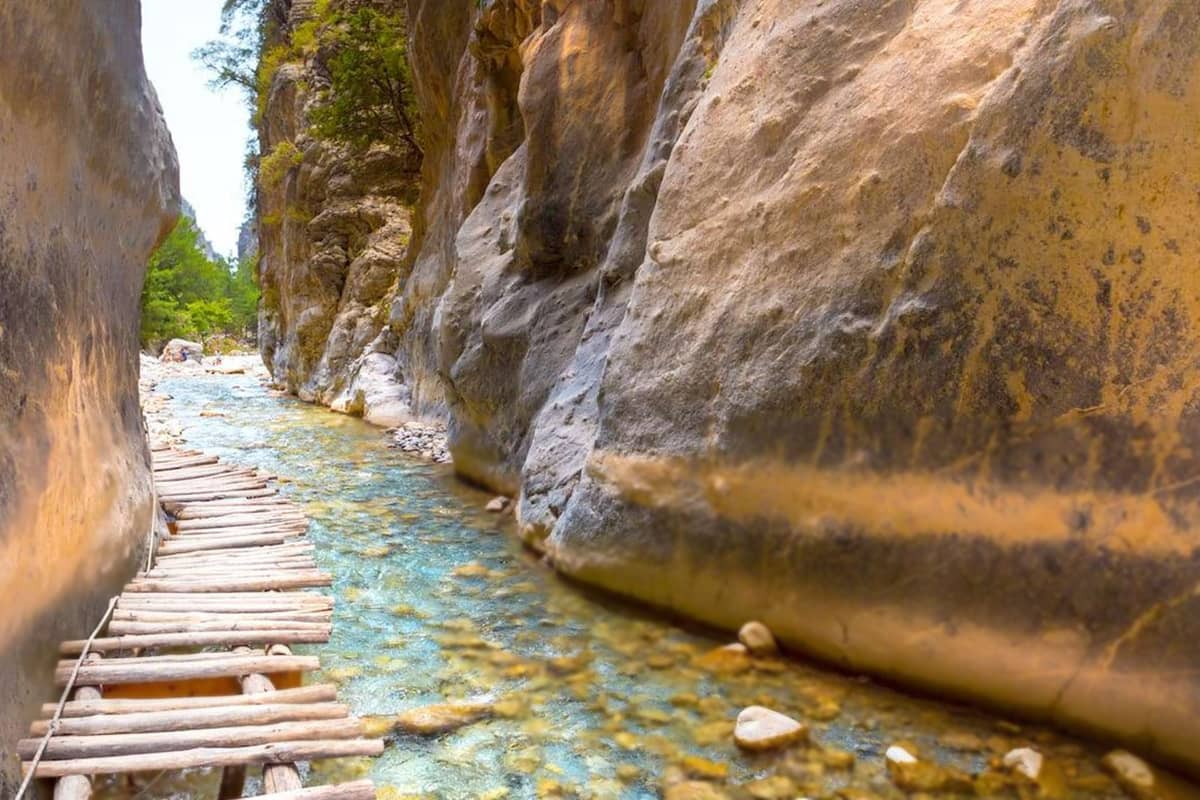
The Samaria Gorge anchors hiking in Greece on Crete. Its 16 kilometres lead down from the high Omalos plateau to the coast of the Libyan Sea. The walk ends at Agia Roumeli, a village that people reach only on foot or by boat.
Hiking in Greece on Crete begins on the Omalos plateau. The plateau covers 15 square kilometres and lies 38 kilometres south of Chania. Three districts meet on its floor. The Greek word omalos means even or smooth, and it names this flat ground. Xyloskalo, the gorge entrance at 1,250 metres, stands about 5 kilometres from the village of Omalos.
Gingilos, 2,080 metres high, and Volakias, 2,116 metres high, rise above Xyloskalo. Legend ties them to the throne of Zeus. A small river carved the gorge between Volakias and the White Mountains. Xyloskalo means wooden staircase, as Wikivoyage translates it.
The Gates form the narrowest part of the gorge. There the walls stand four metres apart and climb nearly 300 metres overhead. Walkers also call the stretch the Iron Gates, a name Wikipedia marks as incorrect. From the park exit, two more kilometres lead on to Agia Roumeli.
The kri-kri, a Cretan goat living wild, wears a light brown coat with a darker band round the neck. Its horns curve back. It is shy of people and rests by day. The Untrodden cliffs, 900 metres high, stand at the head of the gorge. Hiking in Greece here runs beside the home ground of the goat.
Agia Roumeli was once Tarra, an ancient city-state that Homer names in the Iliad. Today the village has two parallel streets along the water, with restaurants and souvenir shops. Castle ruins stand on a hill to the west. A boat carries walkers on to Hora Sfakion in the east or to Sougia in the west.
Hiking in Greece on Crete also includes the Imbros Gorge, near Hora Sfakion. It is 11 kilometres long. The walk to the village of Kommitades covers 8 kilometres and falls 650 metres. The narrowest point is only 1.60 metres wide. The gorge carried a mule trail, the sole route from Chania to Hora Sfakion until the road was built.
The Aradena Gorge adds a high bridge to hiking in Greece on Crete. Aradaina lies on the south slope of the Lefka Ori, at 520 metres. The gorge is about 100 metres deep and divides the village from the Anopolis plateau. A 70 metre iron bridge spans it. No road reached the village before that bridge.
Which Cretan mountains reward hiking in Greece?
Mount Ida, the summit of the Psiloritis massif, rises 2,456 metres and tops every other mountain on Crete. Pachnes in the Lefka Ori follows at 2,453 metres. Together the two ranges give hiking in Greece on Crete high plateaus, stone shepherds’ huts and an ancient cave.
The highest summit of the Lefka Ori is Pachnes, the second tallest peak on Crete after Mount Ida. In Greece as a whole it takes tenth place by height. The name means morning dew, or fog in Cretan. Hiking in Greece in this range runs among peaks of pale limestone.
The Lefka Ori hold about 50 gorges, Samaria among them. Plateaus lie at heights between 500 and 1,100 metres, among them Askifou, Impros, Kallikratis, Anopolis and Omalos. Mountains ring each one. Snow stays on the summits into late spring.
The central and southern Lefka Ori lie at 1,800 metres and above. There the land resembles a moon landscape, a high desert. Four mountain refuges serve hiking in Greece here. Kallergi stands at 1,650 metres, 5 kilometres from Omalos, and Svourichti at 1,980 metres, seven hours from Anopolis.
Volikas stands at 1,450 metres, above Kampi Keramion, and dates from nineteen fifty-eight. Tavris stands at 1,200 metres near Ammoudari. The range also carries the name Madares, from a Cretan word for high ground bare of plants. Both caves in Greece deeper than one kilometre, the Cave of the Lion and Gourgouthakas, lie in the Lefka Ori.
Two plateaus give hiking in Greece on Mount Ida a human story. East of the summit spreads the Nida plateau, where shepherds’ huts called mitata stand, built only of local stone. Shepherds use them for shelter and cheesemaking. Zominthos, in the northern foothills, holds the Minoan villa at the greatest altitude yet found.
Mount Ida also adds myth to hiking in Greece. The Idaean Cave, Idaion Antron, lies on its slopes, and the mountain was sacred to the Titaness Rhea. Minoans and Hellenes both honoured the cave, and by Greek times it was rededicated to Zeus. Legend places the birth of Zeus here, but other legends name Psychro Cave.
Psiloritis sits on the water divide of Crete. Water on its southern side drains to the Libyan Sea, and water on the northern side drains to the Aegean. A saddle at 2,321 metres joins the summit to Mount Agathias in the east. The ridge runs west to Mount Stolistra at 2,336 metres. The E4 European long-distance path also visits Crete.
How does hiking in Greece work in Zagori and the Vikos Gorge?
Hiking in Greece in Zagori works as a crossing from village to village through the Vikos Gorge. The gorge cuts into the south side of Mount Tymfi. Its main part starts between Vitsa and Koukouli and finishes close to Vikos village, as Wikipedia states.
Hiking in Greece in Zagori happens inside the Vikos-Aoos National Park, founded in nineteen seventy-three. The park sits on the Greek mainland, among ten national parks there, Wikipedia notes. It covers 12,600 hectares, 30 kilometres north of Ioannina. The park takes its name from two gorges, the Vikos and the Aoos.
The name Vikos has more than one origin story. One view in the Wikipedia article links it to a Greek word for a jar with ears. That word fits the shape of the gorge and the echoes inside it. Another view takes the name from a Slavic word for chasm.
Hiking in Greece through this canyon means walking in a gorge with a world-records entry. In the Guinness Book of Records, the gorge is the deepest canyon in the world for its width. Gorge lobbyists contest that claim. At one point, the park article gives 900 metres of depth and 1,100 metres of width, rim to rim.
The gorge cuts a deep section through the mountain, so its walls show rock of different ages. The top 200 metres of wall are Eocene limestone, a relatively young rock. Below 700 metres lie Jurassic and Cretaceous limestone, with grey Jurassic dolomite at the bottom. Wikipedia ties the scarce water to the dissolving limestone.
Hiking in Greece in Zagori includes a walk south from Monodendri through the gorge. It ends at the eighteenth-century stone bridges near Kipi, as Wikipedia describes the route. Vikos village, at 770 metres, lies 30 minutes by trail from the Voidomatis springs, Wikivoyage says. The Vradeto Steps are a walk of 3 kilometres from Kapesovo to Vradeto.
Hiking in Greece in Zagori also passes villages with a healing past. Local healers called Vikos doctors once harvested the herbs of the gorge, among them the mountain tea. The natural history museum in Koukouli shows a collection of 2,500 dried plant species.
The Aoos Gorge, near Konitsa, is 10 kilometres long and runs from east to west. Wikipedia dates the single-arch stone bridges there to the seventeenth, eighteenth and nineteenth centuries. Monasteries in the local style stand beside them.
Which Pindus peaks crown hiking in Greece?
Hiking in Greece in the Pindus climbs to Mount Tymfi, where the peak Gamila reaches 2,497 metres. Mount Smolikas lies to the northeast of it. Smolikas is the highest of the Pindus Mountains, and only Mount Olympus rises higher in Greece, as Wikipedia states.
Hiking in Greece on Mount Tymfi crosses a massif in the northern Pindus. The massif runs east to west for 20 to 25 kilometres, and its width is about 15 kilometres. Wikipedia places it just south of the fortieth parallel. On the north side, cliffs rise as high as 400 metres.
The peak names tell their own story. Wikipedia says Gamila means camel in Greek, and Karteros means mighty. Megala Litharia means big rocks, and Lapato is the Greek word for sorrel. Astraka is a Greek word for roof eaves.
Hiking in Greece on this massif reaches Astraka at 2,436 metres. Karteros stands at 2,478 metres and Gamila II at 2,480 metres. The peaks form a plateau, and Astraka dominates its northern face. Wikipedia dates the first recorded climb to nineteen fifty-six and lists the easiest route as a walk.
Snow covers Mount Tymfi from autumn until late spring, as Wikipedia states. Lakes on the mountain dry out in summer, but Drakolimni, the Dragon lake, keeps its water all year. It formed after the glaciers retreated. It is 4.95 metres deep at its deepest point and covers one hectare.
Hiking in Greece to the Dragon lake starts at Papingo, where a footpath crosses the sub-alpine plateaus of Tymfi. Wikipedia gives about five hours for the trek. Wikivoyage calls the route to the lake a bit easier than the route to the refuge.
On the way, at 1,950 metres, stands the Mountain Hut of Tymfi, also called the Astraka hut. It normally opens from late spring to October.
Hiking in Greece on Mount Smolikas meets rock of another kind, because the mountain consists of ophiolite rocks. Its northern and eastern cirques were glaciated in the Pleistocene, and the last glaciers retreated about 11,500 years ago. A small alpine lake, also named Drakolimni, lies near the summit at about 2,200 metres.
Above 2,000 metres, the slopes of Smolikas are grassland and rock. Deciduous and conifer forests grow lower down. A water-powered sawmill stands at Armata.
Konitsa lies 15 kilometres southwest of Smolikas. The villages around the mountain are Agia Paraskevi to the north and Palaioselli, Pades and Armata to the south. The Aoos river flows north of Mount Tymfi, and its tributary, the Voidomatis, rises on the mountain.
How does hiking in Greece reach the top of Mount Olympus?
Hiking in Greece reaches the top of Mount Olympus along a path that begins at Prionia. It passes the Spilios Agapitos refuge, then goes on by Skala to Mytikas. This summit rises to 2,918 metres, the highest point of Greece. Beech forest lines the path between Prionia and the refuge.
Hiking in Greece on Olympus starts from Litochoro. The town took the name City of Gods from its position at the mountain’s foot, as Wikipedia states. From the town a road leads to Prionia, where the walk begins. The Enipeas rises at Prionia and runs out into the Aegean Sea.
The Spilios Agapitos refuge is the first refuge of the region. It stands at 2,100 metres, at a site called Balkoni, which is also named Exostis. Wikivoyage lists Skala as the next stage after the refuge and Mytikas as the last. Hiking in Greece on this route climbs from Prionia at 1,100 metres.
The article on the peak names two trails to Mytikas. One is the Skala and Kakoskala route. The other is the Zonaria and Loukia route. Hiking in Greece here ends on a rounded summit. Mytikas forms two sides of a triangle with Stefani. The heights of the two peaks are hard to compare by eye.
Hiking in Greece on the second path passes the Petrostrouga refuge, which stands among Bosnian pines. Above 1,400 metres that tree forms an almost unmixed forest. The path leads to the Muses’ Plateau, which extends at 2,550 metres between Stefani and Profitis Ilias. The Christos Kakkalos refuge stands at the southwest edge of the plateau, at 2,648 metres.
The first recorded ascent of Mytikas came on the second day of August in nineteen thirteen. The Swiss climbers Frederic Boissonnas and Daniel Baud-Bovy made it with Christos Kakkalos, a goat hunter from Litochoro. Kakkalos was the first of the three to climb Mytikas. Marcel Kurz later edited a book containing the earliest detailed map of the summits.
The mountain became a national park in nineteen thirty-eight, the first region of Greece to receive specific protective rules. In antiquity a sanctuary of Zeus stood on Agios Antonios, the third-highest summit, as archaeological finds show. Each year the mountain draws an estimated 10,000 visitors or more. The majority reach only the Skala and Skolio summits.
Which paths of central Greece and Pelion suit hiking in Greece?
Hiking in Greece in the centre of the mainland follows the old trails of Mount Parnassus north of Delphi. Pausanias, an ancient Greek author, wrote about the climb to the Corycian Cave. An active walker finds it easier, he said, than mules or horses do. Meteora and Pelion add paths of their own.
Inside the national park north of Delphi, the Corycian Cave belongs to the south side of Mount Parnassus. It has been a sacred space since the Neolithic era. Hiking in Greece here follows ancient trails that pass the cave on the way up the mountain. The climb gives a much broader view of the Livadi Valley below.
Pierre Amandry, a French scholar, dug the cave with his team in nineteen sixty-nine. They found 22,000 astragals, ankle bones of sheep and goats that served for games of chance, like dice. People had smoothed down 2,500 of them and pierced each one for a leather thread. The finds point to shepherds, goatherds and hunters as the visitors.
Parnassus became a national park in nineteen thirty-eight, the same year as Olympus. The first plan left out the highest peaks. Today the park covers about 150 square kilometres. Hiking in Greece on Parnassus crosses limestone, and the melting snow supplies water to the surrounding communities.
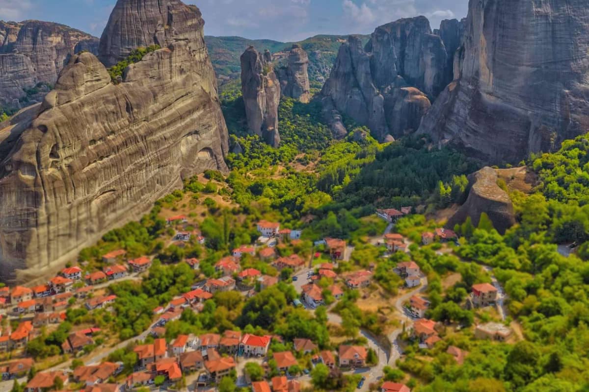
The Meteora rocks ring the village of Kastraki and also line the northern edge of Kalabaka. The article on Meteora lists Megali Agia at 630 metres and Adrachti at 474 metres. A narrow path carved into the rock links Agiou Pneuma, a rock monastery in ruins. Hiking in Greece here draws hikers, trail runners and climbers, particularly in summer.
Zagora is a village on Pelion, north of Volos and west of Chorefto. Its four districts match its four main churches: Agios Georgios, Agia Kyriaki, Agia Paraskevi and Metamorphosis. The main square, Agios Giorgios, is one of seven squares. One account of the name links it with a Slavic word meaning behind the mountain.
Milies is a mountain village at 400 metres on Pelion, 28 kilometres from Volos. Stone houses and cobbled roads line it. The narrow-gauge Pelion Railway ends there. Hiking in Greece on Pelion reaches its high point at Pourianos Stavros, 1,624 metres. The Aegean Sea and the Pagasetic Gulf wash the two sides of the peninsula.
Which Peloponnese trails carry hiking in Greece?
Hiking in Greece on the Peloponnese starts with the Menalon Trail, a route of 75 kilometres in eight sections. As the national tourism page states, it links nine stone villages and begins at the Lousios Gorge. The municipality of Dimitsana places the first stop at Stemnitsa and the last at Lagkadia.
Section one of the Menalon Trail links Stemnitsa and Dimitsana. It measures 12.5 kilometres and takes about five hours, as the municipality page lists it. Hiking in Greece here follows the Lousios Gorge on stone mule paths and bridges. The same page names two monasteries and an open-air water power museum on the way.
According to tradition, Zeus washed at its springs after his birth, giving the river its name. Pausanias held it to be colder than any other river in the known world. The Philosophou monastery stands 2.5 kilometres from Dimitsana and dates to the tenth century. One source dates the Prodromos monastery, built into a rock face, to the twelfth century.
Hiking in Greece on the middle sections begins with a steady climb of 4.2 kilometres from Dimitsana to Zygovisti. Next come 14.9 kilometres to Elati over the Bilali Pass and the Koskitsa plateau, past Mount Pliovouni. The stretch from Elati to Vytina covers 8.5 kilometres and passes the Pirgaki Springs and the Makrinou Fountain.
The last four sections lead on to Lagkadia. A stone bridge at Tzavarenas comes on the 5.6 kilometres to Nymphasia. The Kernitsa Bridge and Monastery lie on the way to Magouliana. The final 13.9 kilometres start at Valtesiniko, where a Byzantine fortress stands. For hiking in Greece, the route met 41 quality and technical criteria and earned a European certification.
Hiking in Greece also climbs Mount Taygetus. Its Profitis Ilias summit, at 2,405 metres, is the tallest point of the Peloponnese. The summit looks across to the Parnon range and down on the Evrotas Valley. A small chapel there holds a festival each twentieth of July. Snowmelt runs down the Vyros Gorge to the Messenian Gulf at Kardamyli.
Hiking in Greece near Kalavryta leads to Mount Chelmos and the Styx waterfall. This stream, the Mavroneri, drops through a gorge on the mountain’s north side and joins the Krathis river. Herodotus places it near Nonacris. Local names are the Black Water and the Dragon Water. In myth, the gods swore their oaths by the water of Styx.
Which island paths suit hiking in Greece?
Island paths suit hiking in Greece where marked networks exist, and Andros has one. Wikipedia lists marked paths there, among them the 100 kilometre Andros Route. The island is nearly 40 kilometres long and lies about three kilometres north of Tinos. It is the northernmost of the Cyclades.
On Andros, the Sariza spring at Apoikia sends its water out of a lion’s head carved in stone. Palaeopolis, the ancient capital, climbed a steep hillside, and its harbour breakwater still lies under the sea. Hiking in Greece on this island can pass both places on the way between villages.
Friends of the island created the Corfu Trail, which crosses Corfu from south to north. The official Corfu tourism page gives its length as 180 kilometres. It names 13 daily stops, among them Old Perithia, from Kavos to Agios Spyridon. Hiking in Greece on this route avoids steep passages, as the page puts it.
Hiking in Greece on Naxos centres on Mount Zas, the highest point of the Cyclades at 1,001 metres. Wikivoyage starts the climb at the Aria Spring near Filoti and calls the footpaths up Zas easy and clearly marked. An ancient carving found near the cave says Zeus Melosios, naming Zeus as protector of sheep.
Hiking in Greece on Santorini includes the Fira to Oia path, which follows the crater ridge, as Wikivoyage states. The Pyrgos to Kamari trail passes the Profitis Ilias monastery, the island’s top, then the Zoodochos Pigis cave. A gentler route in the south follows the beach for three kilometres from Perissa to Agios Georgios.
Wikivoyage describes Sifnos as having a well-marked network of more than 100 kilometres of trails, with red and white waymarks. The trails join the towns to the beaches. One path of about three kilometres links Kastro and Apollonia. Another leads from Artemonas down to the Panaghia Poulati monastery and then along the sea to Kastro.
On Tinos, the granite hill of Exomvourgo carries the ruined walls of a Venetian fortress. Wikivoyage lists it as a short hike. The village of Volax lies among rounded granite boulders, with old paths through the Kakovolo landscape. Wikivoyage suggests exploring Volax slowly on foot. On the island, Wikipedia counts roughly 1,000 dovecotes and 80 windmills.
How do waymarks and long-distance paths work for hiking in Greece?
Hiking in Greece follows the E4 long-distance path, which enters from Bulgaria at Promachonas. It runs down the mainland to Gythio and reaches Crete by ferry. Aluminium plates and painted marks show the way. A mountaineering federation and its clubs established the route and maintain it.
The E4 belongs to a set of 12 European long-distance paths. Together they cover more than 65,000 kilometres, as the article on the network states. The European Ramblers’ Association designates the paths. In general, the routes join existing national and local trails. Hiking in Greece meets two of the 12, the E4 and the E6.
The E4 reaches Greece from Kulata in Bulgaria and crosses the border at Promachonas. Planners first drew it from North Macedonia to Florina instead. The northern list runs from Promachonas to Florina and measures 300 kilometres. Doirani, Pella and Loutraki stand along that stretch.
The list gives 900 kilometres from Florina to Itea, with stops at Olympus, Meteora, Agrafa, Karpenissi and Delphi. Hiking in Greece along the Peloponnese stage runs from Diakofto to Gythio. It measures 300 kilometres and takes fourteen days, with board and lodging for every night. A ferry then links Gythio to Kastelli Kissamou on Crete.
Hiking in Greece on the E4 relies on two kinds of waymark. An aluminium plate shows a yellow rhombus with a black outline on white, with the letters E4/6 in black. Paint on rocks and trees shows a white ground. A yellow parallelogram sits on the left and a black one on the right.
Spelling changes from sign to sign. The E4 article blames the move from the Greek alphabet. It adds that a place can hold an official name and a local or old name. Its own list writes Gythio as Yithio and Delphi as Delfi.
Printed map sheets cover much of the route. One sheet shows the Taygetos range at one to twenty-five thousand.
Hiking in Greece on the E4 also passes refuges. The Olympus article places the Kalyva tou Christaki refuge at 2,430 metres on the E4, between Kokkinopilos and Skala. The official refuge list for Olympus belongs to the management agency of its national park.
The E6 is the second path. Its first section ends on the Adriatic coast in Slovenia. A second section starts again in Greece and finishes in Turkey.
The E4 has a named keeper: Hellenic Federation of Mountaineering and Climbing, which works through associated clubs. It published a leaflet on the E4 in English, French and German. It also published descriptions of the E4 and E6 with maps, in English and German.
Which national park rules apply to hiking in Greece?
National park rules for hiking in Greece depend on the zone. The core of a park allows only scientific research, mild recreation and environmental information. The article on the national parks of Greece states this rule. The surrounding area allows camping and hiking infrastructure, as well as roads and outposts.
Hiking in Greece leads into parks that share one layout, a core and a surrounding area. Greek law keeps the core at no less than 15,000,000 square metres, except in marine parks. The surrounding area must be as large as the core or larger.
Greece holds 15 national parks, 10 woodland parks and 2 marine parks, according to the world database on protected areas.
The Vikos-Aoos park shows the split. Its core covers 3,400 hectares and holds 12 kilometres of the Vikos Gorge. The law bans forestry, grazing, hunting and fishing in the core. The peripheral zone has no such bans, but the Forest Service can take any necessary measure.
Hiking in Greece through the Samaria Gorge needs an entry ticket, and the official ticket page calls it mandatory. NECCA, short for Natural Environment and Climate Change Agency, now manages the park. The ticket counts as a resource of NECCA and of the neighbouring municipalities.
The ticket page says the ticket supports basic works. They include cleaning and upkeep of the main path, upkeep of infrastructure and supervision along the path.
Wikipedia relays a notice from the Chania Forest Protection Service about the season and the hours. Visits start in late spring and stop when October ends. Visiting hours run from seven to three each day. After three, walkers are allowed only two kilometres into the park, counted from Xyloskalo or from Agia Roumeli, until sunset.
Lighting fires is on the Samaria list of bans. Hiking in Greece also meets a country-wide ban on campfires, bonfires and barbecues, as Wikivoyage lists it. The ban lasts six months and finishes with October.
The European Union links its nature areas into one network called Natura. Two kinds of site make it up. Special Protection Areas are set up for birds. Special Areas of Conservation are set up for habitats and other species.
The Vikos-Aoos park, a place for hiking in Greece, belongs to the network. The network article says its sites vary in character and are not strictly protected in how people use them. The park article counts 121 bird species and calls 26 of them conservation priority species.
Which months suit hiking in Greece?
Hiking in Greece fits late spring, June, September and October, the months Wikivoyage names for pleasant weather. Seven months of near-constant sunshine run from April until November, as that page counts them. The cold, rainy spell begins sometime in November and stretches into late March or early April.
On the coast, hiking in Greece runs under a Mediterranean climate, as Wikivoyage states for all coastal areas. Summers are hot and dry. In the dry months, rain falls as a rare, quick shower. Wikivoyage names two more climates. A cool Alpine one covers the mountainous interior. A continental one brings very cold winters to the north-central and northeastern interior.
Wikivoyage puts the warmest weeks from mid-July until the middle of August and calls the midday sun very strong. The wildlife article says snow can still lie near the peaks in June, while the lowlands feel high temperatures. It sets an alpine climate in the higher western and central regions and in the Peloponnese mountains.
Hiking in Greece on Olympus meets cooler numbers. The Olympus article gives the alpine region a summer average of ten degrees Celsius. The higher places range from zero to twenty degrees. Rain and snow are not unusual there even in summer. A weather station was set up on the Agios Antonios summit, at 2,815 metres, as the highest in Greece.
Refuge calendars show the same year. On the Plateau of the Muses, the Kakalos refuge is open from late spring through October. It opens again from December to the middle of April. The Petrostrouga refuge, at 1,900 metres, is open all year, according to the article.
Wikivoyage walks through the Zagori year. By the end of February the snow on the nearby peaks begins to melt. Short river walks then follow the returning water. Summer brings more stable weather. The page calls all four seasons suitable for a visit. In autumn, hiking in Greece passes foliage in red, copper and vermilion, over a carpet of leaves.
Hiking in Greece on Crete has fixed dates. The Chania forest service notice, quoted in the Samaria article, ends the park season on the thirty-first of October. At Agia Roumeli, the sea end of the gorge, Wikivoyage lists restaurants and shops as closed from November to March.
What gear and water does hiking in Greece need?
Hiking in Greece needs stiff-soled shoes, water for the whole day, sun cover and a layer for changing weather. The Olympus article calls springs scarce above 2,000 metres. It tells visitors to bring water and the clothing that any weather needs. The paragraphs below take each item in turn.
Hiking in Greece starts with the shoes. The article on hiking says terrain, climate and time of year decide the kit. Hikers traditionally wore sturdy boots for stability, it adds, and trail running shoes have grown popular in recent decades. Boots are still common in mountain terrain.
Mountain boots have stiff soles that support the ankles on rocky trails, the article on hiking boots states. A fit that is neither too loose nor too tight helps prevent blisters. Socks that wick sweat, give warmth and cushion the feet are recommended. A thin inner sock also helps.
Water thins out with height on Olympus, where hiking in Greece climbs to nearly 2,918 metres. The rock layout lets springs rise, the article says, and the greater part of them lie below 2,000 metres. Above that line springs are scarce. The Bosnian pine zone has no springs or streams at all.
One named spring appears in the Wikivoyage entry for Zagori. The Despotis Spring lies near Kaloutas, a village known for its old churches and a triple-arched stone bridge. The Hiking equipment article lists containers for carrying water among the basics. A container that holds the day’s water is therefore part of the kit.
Hiking in Greece also needs cover from the sun. The Hiking equipment article lists sunglasses, sunscreen and lip balm. It says clothing shades the body and protects it from thorns and UV rays. Wool and polyester still insulate to a degree when wet. Cotton and linen wick moisture, which suits hot or humid weather.
A single day on Olympus can bring more than one kind of weather, the article states. Summer rain there is frequent, commonly as evening thunderstorms. Hiking in Greece on a high mountain therefore starts early. Wikivoyage advises waking early and using the cool morning hours, then resting in the shade in the afternoon.
Before the walk, charge your phone and save 112 in it. Wikivoyage gives 112 as the emergency number of Greece. Tell your host or a friend which path you take, where you start and when you plan to be back.
What do walkers still ask about hiking in Greece?
Does hiking in Greece need a licensed guide?
Hiking in Greece works with a licensed guide or without one, and the sources show both ways. Wikivoyage’s page for Zagori mentions signposted hiking trails that lead from the villages to the attractions. A walker on such a path carries a map and follows the signs.
As the Wikipedia article defines the job, an expert guide of the mountains is a trained professional mountaineer. Local authorities or associations of these professionals certify each one. Such an expert guide leads individuals or small groups who need expert help. The article lists precise local knowledge of mountain routes and weather among the services.
On the Samaria walk, Wikivoyage’s page for Agia Roumeli says a walker can join an organised tour. The other way is the public bus from Chania to Omalos, where the walk begins. Local operators run a coach that collects walkers at their hotel and drives them up to the gorge entrance. A second coach waits after the ferry.
So hiking in Greece gives three choices. One is a signposted path alone. Another is a tour that handles the buses. The third is an expert guide who leads a small group. A walker picks the choice that fits the route and the group.
Can you camp in the wild while hiking in Greece?
The sources give a split answer for hiking in Greece, because each place sets its own rule. Wikivoyage’s page for Agia Roumeli lists a small wild camping area with no facilities. It lies by the riverside on the coast at the village.
The Samaria park itself is different. The park article states that camping and overnight stays are prohibited inside it. Swimming in the gorge streams is prohibited too. Wikivoyage adds that tickets are checked at the exit, so that nobody stays in the park overnight.
On Mount Olympus, the Wikivoyage page for Olympos National Park counts nine refuges where a walker can stay overnight. It adds that you can also camp, and that camp sites stand on the coastal zone of Pieria. Hiking in Greece on a big mountain pairs a refuge on the slope with a camp site at the coast.
A park sets its own rules, so read its page before you pitch a tent.
Which mountains near Athens suit hiking in Greece?
Hiking in Greece can begin inside the Athens area, on Hymettus. The Wikipedia article places the range about 15 kilometres east of central Athens. Its highest point, Evzonas, stands at 1,026 metres, and the range runs 16 kilometres towards the Saronic Gulf.
A colloquial name for it is Trellovouno, the crazy mountain, in awe of its winding length. The Kaisariani Monastery is built into the flank, and the Koutouki cave opens on the east side near Paiania. Only authorised vehicles reach the top, where towers stand.
Parnitha is the second choice for hiking in Greece near the capital. The article calls it the highest range on the Attica peninsula, with a summit named Karavola. A national park covers the larger part of the slopes. The park began in nineteen sixty-one. Two shelters, Mpafi and Flampouri, stand on the mountain.
The cave of Panas lies on the west slopes at 750 metres. It served as a place of worship in antiquity. The Gouras gorge is near it. Beletsi Lake, on the east slopes, is an important place for migratory birds.
How do buses reach a trail start for hiking in Greece?
Hiking in Greece without a car means working with the KTEL coaches. Wikivoyage’s page for Chania says regular KTEL bus lines link the town with the rest of Crete. The centrally located bus station offers luggage storage lockers, so a walker can leave a bag there.
For the Samaria walk, the Agia Roumeli page states that buses run from Chania to Omalos and to Sfakia. The Samaria article notes that the morning buses from Sougia and Paleochora do not run on Sunday.
Pelion needs a different plan for hiking in Greece. Wikivoyage names Volos as the gateway, and a coach leaves the Volos Interurban Bus Terminal for the region. The page calls the coaches infrequent and names the car as the easiest option.
In Zagori, buses from Ioannina to the villages keep no regular schedule, Wikivoyage states. Coaches pass the viewpoints between villages without a halt, and the page calls public transport time consuming. Check the timetable of each line before you plan a walk.