
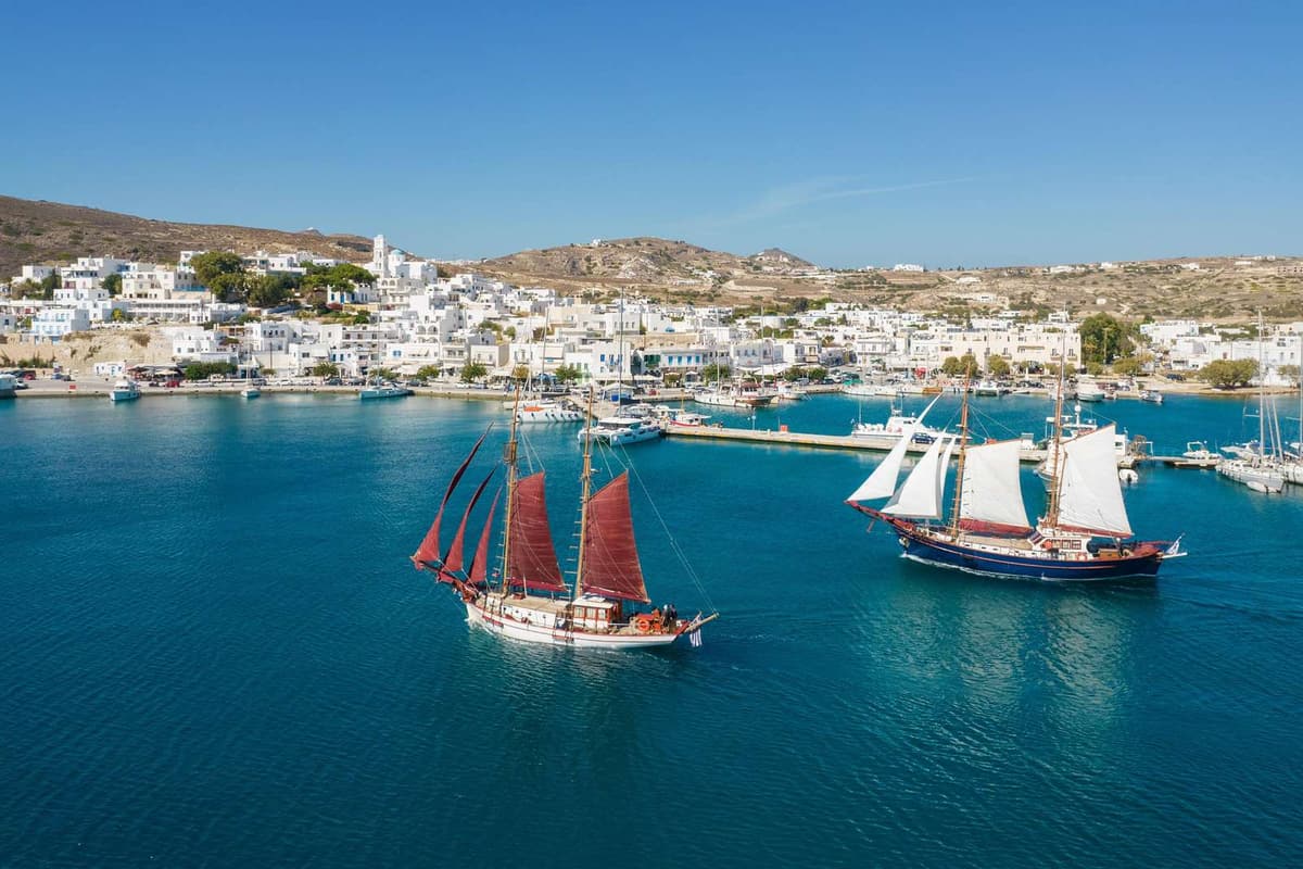
Sailing in Greece runs from a half-day sail out of an island harbour to a week on a chartered yacht between the islands. The Ionian Sea and the Saronic Gulf give short hops between green islands, while the Cyclades and the Dodecanese open onto the wind of the Aegean. The tours in Greece on the home page add the land side of a trip.
This page covers the ways to sail, the sea areas, the winds and the months, then the marinas, harbours and day cruises. The Greece island hopping tours page holds the ferry routes, and the Santorini catamaran cruise page holds a day under sail in the caldera.
What does sailing in Greece involve?
Sailing in Greece means travelling from island to island on a boat under sail. The sea gives you room for it. The count of Greek islands depends on the definition. Wikipedia gives a span from 1,200 to 6,000, and 227 islands have residents. The way you book the boat decides how much of the work is yours.
Wikipedia gives Greece the longest shoreline of the whole Mediterranean basin. That long shore gives sailing in Greece plenty of starting points. They run from the harbours beside Athens to the island chains of the Ionian Sea and the Aegean. A trip can stay inside one island group or cross to the next.
The shortest way into sailing in Greece is a day sail. The boat leaves an island harbour, stops off a beach for a swim and ends in the same port. The crew runs the boat, so a day sail asks for no sailing skills from you.
Wikipedia names three kinds of yacht charter: bareboat, skippered and crewed. On a skippered charter, a professional skipper handles the boat, and this form exists on every type of yacht. Wikivoyage adds that the skipper can teach basic boat handling while you take the lighter deck duties.
On a crewed charter, a captain and a professional crew run the boat. That crew can include a chef and a deckhand. A crewed boat is the hands-off form of sailing in Greece. Wikivoyage notes that a manned charter lets you try cruising without earlier boat-handling skills.
A flotilla is the group option. Wikipedia describes a flotilla holiday as a group of chartered yachts that set sail together on the same route. The boats follow one route and set sail as a group.
A bareboat charter hands you the boat without a crew, so the charterer navigates and manages it. Greece has a significant charter market, and Wikipedia counts more than 2,000 boats on offer. Bareboat sailing in Greece asks the client to skipper the boat.
The article adds that the majority of bareboat charter companies want proof of competence in the form of a licence. The International Certificate of Competence is one such licence.
Wikivoyage calls the pleasure-craft operator certificate, the ICC, the main European document of this kind. It allows you to skipper sailboats or powerboats at sea, up to a certain size.
Countries set rules on who is allowed to charter or skipper a boat of a given size, Wikivoyage points out. The charter base is the place to ask about the local rules before you book. Papers belong to every trip: the boat has its documents, and the crew list names everyone on board.
Three kinds of boat appear in sailing in Greece. A monohull has one hull, and a catamaran has two. Wikipedia ties the growing popularity of catamarans on crewed charters to their capacity and fuel efficiency. A gulet is a wooden motor-sailing yacht. Wikipedia calls it a common choice for crewed charters on the Greek and Turkish coasts.
Which sea areas suit sailing in Greece?
Sailing in Greece covers six sea areas. The Ionian Sea lies in the west. The Saronic and Argolic gulfs lie by Athens and the Peloponnese. The Cyclades, Dodecanese and Sporades lie in the Aegean. The Corinth Canal links the Ionian side with the Aegean.
- The Ionian Sea
- The Saronic Gulf
- The Argolic Gulf
- The Cyclades
- The Dodecanese
- The Sporades
Wikivoyage describes the Ionian Islands as a chain that stretches along the western side of Greece. The main islands run from Corfu in the north down to Zakynthos, and smaller islands sit among them. This is the western home of sailing in Greece.
Attica and the Argolis peninsula frame the Saronic Gulf, an inlet of the Aegean. Aegina, Salamis and Poros lie inside the gulf. Piraeus, the port of Athens, sits at the north-eastern side of the gulf.
The Argolic Gulf cuts into the Peloponnese from the Aegean, on the east flank of the peninsula. Seen on a map, it is roughly fifty kilometres long and thirty wide. Nafplio serves as its main port, and Spetses stands at its entrance. The two gulfs and their islands are sometimes grouped together as the Argo-Saronic Gulf.
The Cyclades lie in the central Aegean Sea, south-east of the mainland. Wikipedia puts the number of islands in the group at about 220. The name refers to islands in a circle around Delos. The Sea of Crete closes the group off on its south side.
Two more groups finish the map of sailing in Greece. The Dodecanese fill the south-east Aegean. Crete sits south-west of them, and the Cyclades lie west of them. The name means the Twelve Islands, yet the group has 15 major islands and 93 smaller islets.
The Sporades lie north-east of the island of Euboea. They have 24 islands, and four are inhabited: Alonissos, Skiathos, Skopelos and Skyros.
The areas differ in how far the islands lie from the coast. The Saronic islands sit just off the mainland, with regular ferries from Piraeus, so a hop there stays short. The Cyclades lie further out in the central Aegean. That split shapes any plan for sailing in Greece.
Wikivoyage lists these island regions: the Saronic Gulf Islands, Cyclades, Dodecanese, Sporades, Ionian Islands, East Aegean and North Aegean. It puts the Saronic Gulf Islands first among those closest to Athens. That puts the Saronic Gulf nearest to the capital for sailing in Greece.
The Corinth Canal joins two gulfs. At one end lies the Gulf of Corinth, which Wikipedia places in the Ionian Sea. At the other end lies the Saronic Gulf in the Aegean. The cut measures 6.4 kilometres in length. Measured at sea level, the channel spans 24.6 metres, and no locks interrupt it. Builders finished it in eighteen ninety-three.
With the canal in place, the Peloponnese stands apart from the mainland. For sailing in Greece, that makes the cut the link between the western and the eastern waters.
How do the Ionian Islands and the Saronic Gulf answer sailing in Greece?
Sailing in Greece on the Ionian side links islands that sit close together. Corfu’s southern end and Paxos lie about 15 kilometres apart, and Meganisi lies immediately east-southeast of Lefkada. In the Saronic Gulf, Aegina is 27 kilometres from Athens, so the distances in both areas are short.
The Ionian Islands make up a chain along the western side of Greece, in the Ionian Sea. Sailing in Greece follows six of the seven principal islands, from Corfu in the north to Zakynthos in the south. Kythira, the seventh, sits off the south of the Peloponnese. Of them all, Kefalonia covers the greatest area.
Paxos has the smallest area of the seven principal islands. For sailing in Greece, it sits between two coasts. It lies about as far from Parga on the mainland as from Corfu. Antipaxos lies 5 kilometres further southeast. The harbour of Gaios, the capital of Paxos, lies behind two islets, Agios Nikolaos and Panagia.
A causeway and a floating bridge connect Lefkada with the mainland, and the causeway is long. Nidri, the island’s largest resort, has a sheltered setting. From there the eye reaches Skorpios, Meganisi and the mainland. Seen from Nidri, sailing in Greece means looking across the water, because the next islands already lie in view.
Meganisi has a central village, Katomeri, and two ports, Vathy and Spartochori. Fishing boats mainly use the harbour at Atheni Bay. Car ferries cross from Vathy and from Spartochori to Lefkada. Vasiliki is 20 kilometres south of Nidri. It is a centre for windsurfing, with ferries to Kefalonia and Ithaca.
Sailing in Greece around the Saronic Islands starts close to Athens. The islands sit in a gulf of the same name, near the Greek coast. Four main islands have residents: Salamis, Aegina, Agistri and Poros. Other lists add Hydra and Dokos. Regular ferries link the group with the port of Piraeus and with the Peloponnese.
By hydrofoil, the run from Piraeus to Aegina takes forty minutes. Agistri lies a ten-minute boat ride from Aegina, or an hour from Piraeus. Poros is 58 kilometres south of Piraeus. Piraeus to Hydra measures 37 nautical miles, which is 69 kilometres.
Between Poros and the Peloponnese runs a channel only 200 metres across. Galatas stands on the facing mainland shore. For sailing in Greece, note that a bridge joins the two islands of Poros. Kalaureia lies in the north and Sphairia in the south. The houses of Poros town rise in tiers up a hill, as in an amphitheatre.
Only a narrow strip of water lies between Hydra and the Peloponnese. Hydra port wraps around a crescent harbour, and steep stone streets lead away from it. No wheeled vehicles are allowed on the island. Instead, mules, donkeys, horses and water taxis give it public transport. Sailing in Greece into Hydra port means arriving in a town without cars.
How do the Cyclades, the Dodecanese and the Sporades answer sailing in Greece?
Sailing in Greece in the Aegean means three different island groups. The Cyclades ring the island of Delos, sacred to the religion of ancient Greece. The Dodecanese lie in the southeast Aegean beside Turkey. The Sporades lie northeast of Euboea as wooded, fertile islands.
- The Cyclades number about 220 islands. By area, Naxos leads the group; by population, Syros does.
- The Dodecanese consist of 15 major islands plus 93 smaller islets.
- The Northern Sporades have 24 islands, with permanent residents on four: Skiathos, Skopelos, Alonnisos and Skyros.
Sailing in Greece among the Cyclades means crossing an archipelago of the Aegean, lying southeast of the Greek mainland. The islands are summits of a sunken mountain terrain. Volcanic origin marks just two of them, Milos and Santorini. The Aegean’s north wind, the meltemi, is strong and dry; the next section returns to it.
To the east of the Dodecanese lies Turkey, to the southwest Crete, and to the west the Cyclades. Rhodes is the largest of the islands. Kos is the third largest and stretches 42.1 kilometres by 11.5. It lies south of Kalymnos and north of Nisyros. Patmos lies north of Leros, and Kalymnos stands near Turkey’s western coast.
For sailing in Greece, Symi is a small Dodecanese stop between Rhodes and Kos. It sits 24 kilometres north of Rhodes. Its nearest land neighbours are two peninsulas of Turkey. The main town, named Symi like the island, is on the northeast coast. The lower town of Yialos surrounds the harbour, and Ano Symi stands above it.
Wikipedia names the port of Yialos as a popular marina for sailors. Symi was an important trade waypoint in the middle of the Dodecanese. That role lasted until steam shipping appeared in the nineteenth century. Rocky cliffs, beaches and isolated coves follow one another along the coast, and small valleys fill the interior.
Sailing in Greece in the Sporades means wooded islands. Wikivoyage calls them fertile and heavily wooded, with pine-clad mountains sloping to the beaches. Houses there follow northern Greek style, with stone roofs and less whitewash. Skiathos is the westernmost of the group, with Skopelos to its east.
Skiathos is around 12 kilometres long and 6 across on average. Its coastline of 44 kilometres holds over 60 beaches. Alonnisos lies east of Skopelos at a distance of 3 kilometres. Its main port is Patitiri in the southeast. The old village, Chora, is on the island’s southern side.
Greece opened the Alonnisos Marine Park by presidential decree in nineteen ninety-two, its first marine park. For sailing in Greece, it is a large stretch of sea, around 2,260 square kilometres. Europe has no larger marine protected area. Its land includes Alonnisos itself, six small neighbours and 22 uninhabited islets.
The Mediterranean monk seal is common around Alonnisos. Its caves form an important part of the monk seal’s habitat. In all three groups, sailing in Greece links harbours such as Yialos on Symi, Patitiri on Alonnisos and Skiathos town.
How do the winds and the months shape sailing in Greece?
Sailing in Greece follows the meltemi, whose other name is the Etesian wind. This dry wind sweeps down from the north across the Aegean with real strength. It sets in during late spring and ends by mid-September. Wikipedia names it a dominant influence on Aegean weather, so the month you pick shapes the route.
Its direction changes with the sea. The north Aegean gets it from between north-east and north, and the central Aegean gets it straight from the north. In the south it comes from the north-west. So one Etesian day gives sailing in Greece three wind directions.
Sailing in Greece meets a daily rhythm. Afternoon brings the peak, and the wind eases after dark. One spell sometimes runs for days with no pause. Beneath it the weather stays fine and clear, while the northerly softens the hot months.
The forecast brings sailing in Greece to the Beaufort scale. It links wind speed to what you see at sea, from zero to twelve. Its terms still appear in shipping forecasts. At its peak the Etesian reaches force 7 to 8. The article adds that not every yacht and not every inter-island ferry can sail at that strength.
Two gulfs of the Aegean gain shelter from the land. The Saronic Gulf gets partial shelter from the summer meltemi, and mountains protect the Argolic Gulf from its strong winds. Even a place name speaks of the air: Kalaureia, the northern part of Poros, means “gentle breeze”. Sailing in Greece gains from that shelter.
The Etesian article records comparable winds over the Ionian and Adriatic regions. The climate article for Greece draws a line at the Pindus mountains. West of them the climate is wetter, with maritime features. East of them the summer is drier and windier. Near the shore, a breeze off the cooler sea softens heatwaves.
The sirocco adds a second wind to sailing in Greece. It is a Mediterranean wind from the Sahara, drawn north by low-pressure cells that move east across the sea. A sirocco runs for as little as half a day, or for days. The peaks fall in March and November. Greek has its own name for it, sorokos.
The sea sets the other half of the calendar for sailing in Greece. Summer brings 19 to 24 degrees Celsius to the top layer of the Aegean. Winter water ranges from 8 degrees in the north of the sea to 13 in its very south. Late spring and mid-September bound the Etesian period, with July and August in the middle.
Weather forecasts and observations for Greece come from a government agency, the Hellenic National Meteorological Service. Its main building stands at Elliniko in Athens, and it works under the Hellenic Air Force. Wikivoyage gives plain advice for short boat trips: check weather forecasts. Sailing in Greece begins with that check.
How do marinas, harbours and day cruises work for sailing in Greece?
Sailing in Greece starts at a marina or a harbour. Alimos and Flisvos serve the Athens coast, Zea is a harbour of Piraeus, and Lavrio lies further south. On Corfu, Gouvia holds the largest marina of the island. A boat then ties up to a quay or anchors in a bay.
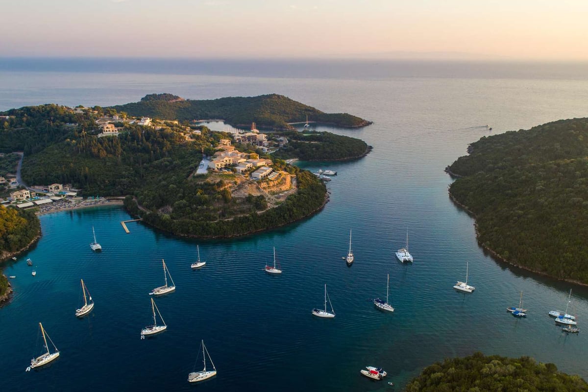
- Alimos: a coastal town beside the Saronic Gulf, 8 kilometres from central Athens, with a large marina and beaches.
- Palaio Faliro: the Flisvos marina sits beside Flisvos Public Park, on a shore redeveloped for the Olympic Games.
- Zea: also called Pasalimani, one of the two small eastern harbours of Piraeus that serve recreational and fishing craft. The other is Munichia, known as Mikrolimano.
- Lavrio: a port whose bay looks across to Makronisos, roughly 60 kilometres out of Athens.
- Gouvia: a natural harbour on Corfu, 8 kilometres from Corfu Town, with the remains of a Venetian shipyard.
The Mediterranean mooring is the method to know. Boats set an anchor off the pier, head in square to it and pass two lines ashore. Wikipedia names the gain: more boats fit along a fixed length of pier, because each takes only its width. A caption on that page shows the stern tied to the pier.
An anchor mooring works differently. It fixes the boat to a point on the bottom without a link to the shore. A boat on a swing mooring swings in a circle when the wind or tide changes. A quay puts the boat beside the town, and a bay puts it in open water.
A day sail or a catamaran cruise needs only a harbour to leave from and a harbour to return to. Wikivoyage describes the coastal rhythm of a sailboat: leave in the morning, reach the destination in the evening. Sailing in Greece by day therefore fits any harbour in the list above.
Four islands give the day cruise its setting. The ring of islands around the Santorini caldera has Santorini itself as its biggest member. The nickname Island of the Winds belongs to Mykonos, where the wind is very strong. On Naxos the wind suits windsurfing and kitesurfing, as on other Cycladic islands. Milos has its harbour town at Adamantas.
Lavrio and Sounio mark the far end of the Athens Riviera, which starts at Piraeus. A day boat has a long coast to start from. Sailing in Greece through the Corinth Canal meets a wind of its own. The canal’s steep walls channel the wind along the water, and the two gulfs have their tides at different times.
Which questions do readers raise on sailing in Greece?
Does a first-time crew need a skipper for sailing in Greece?
A crew with no boating record does well to start with a skipper aboard. Wikivoyage gives newcomers the same advice: begin with somebody else as skipper and help on that person’s instructions. The skipper is a friend, the master of a crewed charter boat, or someone met at a marina.
Sailing in Greece also brings the radio into the plan. Wikivoyage calls marine VHF the main channel for talking at sea. For Europe it names two certificates. One carries a call sign for the boat’s station, and one covers whoever works the set. The Short Range Certificate is the operator paper it names.
Range matters on an open crossing. A yacht with a masthead aerial reaches a coast station up to 50 nautical miles away, as Wikivoyage states. Ship-to-ship calls reach 20 nautical miles. A first-time crew learns the call routine at the helm, next to the skipper.
The same page asks for at least a hand-held VHF marine radio on board. It adds that portable sets also link a yacht with its dinghy. A first week of sailing in Greece with a skipper lets the crew learn this routine before taking the wheel.
Skippers differ in how well they let a newcomer learn aboard, as Wikivoyage notes. It urges a newcomer to sailing in Greece to join boats with different skippers. That way the newcomer also meets different kinds of boats.
Which length of trip suits sailing in Greece, and which loop fits a week?
A week of sailing in Greece suits one sea area and a loop of three or four harbours. Staying inside one island group keeps the week for the water, not for the move between areas. Two loops fit this plan: the Ionian loop from Lefkada and the Saronic loop from Athens.
The Ionian loop starts at Lefkada and calls first at Meganisi. Atheni Bay on Meganisi serves mainly fishing boats, as Wikipedia states. Ithaca comes next. It sits east of Kefalonia, with the Strait of Ithaca running between the two islands.
At Ithaca, Vathy harbour sits on the south arm of Molos bay. Lazaretto Islet guards the harbour, and a church of the Saviour stands on it. Kefalonia closes the loop. Wikivoyage shows Fiscardo, in the north of Kefalonia, with Venetian architecture.
A spare day on the Ionian loop fits Kalamos. Wikivoyage describes Kalamos as sitting at the heart of a protected marine zone in the inner Ionian. It calls that zone the largest in Greece. Sailing in Greece from Lefkada reaches it without a change of sea area.
The Saronic loop starts from Athens and runs through Aegina, Poros, Hydra and Spetses. In the Wikivoyage list, the Saronic Gulf islands come closest to Athens. Spetses has three natural harbours, Saint Marina, Saint Paraskevi and Zogeria. Wikipedia says they sheltered cargo ships as far back as twenty-three hundred BC.
Does sailing in Greece suit a family?
Yes, a family fits the boat when the plan stays small and everyone has a task. Wikivoyage tells a skipper to plan a pleasant cruise and share the planning. It adds that everyone shares the chores fairly, the captain included. Sailing in Greece offers islands small enough for that plan.
Wikivoyage also suggests trying the smallest boat that suits the crew. It notes that it is easy to want a boat that is too big to handle. A smaller deck is easier for a family to learn on than a large one.
Paxos shows what small means here. Among the seven principal Ionian islands, Paxos holds the least land, as Wikipedia states. Its length is 10 kilometres, and its widest point reaches 3 kilometres. Gaios, Lakka and Longos line its east coast and form the main settlements.
Wikivoyage adds one more rule for the crew: teach everyone how to manage all the parts of the boat. A family that shares each job, from the lines to the anchor, feels part of one crew. On a small island like Paxos, sailing in Greece gives each person a task between harbours.
What do crews pack, and how does life on board work for sailing in Greece?
Pack soft bags that fold into a bunk, because a yacht has little floor space. Wikivoyage describes the common yacht as a boat with bunks, a galley with a campstove and basic toilet facilities. Sailing in Greece asks for a pack that suits that small cabin.
Water comes first. Wikivoyage says a large quantity of drinking water has to be carried in any case. It asks for at least two sources of water, plastic bottles included. Seawater washes dishes and decks, which cuts the use of fresh water on board.
For shade and air, Wikivoyage names canvas sunshades and a fabric windscoop over the forward hatch. For the galley it asks for a stove with at least two burners that is easy to light. A sun hat and a long-sleeved shirt cover the crew on deck.
At anchor, Wikivoyage advises a line of five times the depth, though three times is enough in theory. It adds that a crew tests the hold before trusting an anchorage. A marina berth brings fresh water, shore power and showers, so sailing in Greece mixes both kinds of night.