
Greek cities and islands make up two halves of one trip: the mainland towns where flights, trains and buses arrive, and the island groups that ferries and short flights reach from them. Read this page as a map before you pick any of the tours in Greece.
The page sorts the cities by area from north to south, then the island groups, the ports, the airports and the seasons, and it points to deeper pages on athens history, santorini island, mykonos greece, corfu greece and ios greece.
What are the greek cities and islands, and how does this page sort them?
The greek cities and islands are the urban centres and the sea islands in two Wikipedia lists. One list names cities and towns, and one names islands. This page follows both. It starts with the cities, then covers the island groups, and ends with the ports, the airports and the seasons.
The greek cities and islands start with a Wikipedia table of urban settlements. Each one holds more than 10,000 permanent residents. The table has 153 rows. Not every row is a city. Bold type marks the places that form a city or town. The majority of the other rows are suburbs or central districts of Athens and Thessaloniki.
The census calls its lowest level of place oikismoi, which means settlements. The table defines each one as the smallest continuous built-up area with a place name set for the census. This is why a suburb of Athens can sit in the same table as Patras or Heraklion.
Two thirds of the Greek people live in urban areas, the same page states. The greek cities and islands therefore begin on the mainland. Athens and Thessaloniki are the largest metropolitan centres, and Patras is the third-largest city.
Islands follow a looser rule than cities. A counter must decide how small a rock can be and still count. The Greek islands page cites around 1,200 islands at the low end and 6,000 at the high end. For inhabited islands it cites 166 to 227. The greek cities and islands here are therefore groups, not totals.
Each place on this page gets one role. A gateway is a city where a trip starts. A port is a city where a boat leaves. A base is a town or an island where you stay while you visit the area around it. The next parts use these three roles for every city and island group.
How does Greece divide its greek cities and islands into regions?
Greece divides its greek cities and islands among thirteen regions, which form the second level of the administrative map. Four of them hold the main island groups: South Aegean, North Aegean, Ionian Islands and Crete. Other islands sit inside mainland regions, so a group name and a region name do not always match.
The thirteen regions divide into 74 regional units, as the Administrative divisions page counts them. The old prefectures were either abolished and divided or turned into regional units. Municipalities sit one level below the units. A place among the greek cities and islands therefore sits in a region, a regional unit and a municipality.
The South Aegean region holds two island groups. The former prefectures of the Cyclades and the Dodecanese both list it as their region. For the greek cities and islands, the city table places Rhodes, Kos, Kalymnos and Ermoupoli there. Santorini, Mykonos, Paros, Milos, Syros and Tinos give the same region on their own pages.
For the other regions of the greek cities and islands, the city table gives the match. It lists Mytilene and Chios under North Aegean, Corfu and Argostoli under Ionian Islands. Heraklion, Chania and Rethymno fall under Crete. The North Aegean islands lie, for the greater part, in the North Aegean region.
Not every island sits in an island region. The Sporades regional unit belongs to Thessaly and splits into three municipalities. Wikivoyage also files the Northern Sporades under its Thessaly travel region. So on the map of the greek cities and islands, that group has a mainland region.
The city table names a region for each city. Athens and Piraeus belong to Attica, and Thessaloniki to Central Macedonia. Patras sits in Western Greece, Larissa and Volos in Thessaly, and Kalamata in the Peloponnese. Ioannina belongs to Epirus and Kavala to Eastern Macedonia and Thrace. That is the mainland half of the greek cities and islands.
Travel sites draw their own map. Wikivoyage lists the Greek Islands as one travel region of eight groups, and Crete stands in a separate region. In that map, Athens belongs to Central Greece, a travel region that also holds Attica and Boeotia. This page sorts the islands by group and names the region next to each city.
Which greek cities and islands do first-time travellers meet?
First-time travellers meet five names first among the greek cities and islands: Athens, Santorini, Mykonos, Ios and Corfu. Athens is the national capital and the gateway city. Santorini, Mykonos and Ios belong to the Cyclades, while Corfu belongs to the Ionian Islands. Each name below gets one fresh fact.
Attica names Athens as its regional capital, and the city holds the national capital title as well. The Athens article lists the National Archaeological Museum and ranks its holding of ancient Greek antiquities highest in the world. The capital is therefore the first name among the greek cities and islands.
Santorini adds a buried town to the greek cities and islands. The Santorini article describes Akrotiri, a town sealed under volcanic ash. Its streets, squares and houses up to three storeys high survived, and the wall paintings held their original colour. A loom workshop found there suggests that cloth was woven in an organised way for export.
Mykonos adds a tourism story to the greek cities and islands. The Mykonos article ties its reputation to beaches, nightlife and traditional Cycladic architecture. It dates the rise of international tourism to the nineteen-sixties, when the jet set arrived. Tourism then came to dominate the local economy, the article adds.
Ios adds a hillside village to the greek cities and islands. The Ios article calls Chora the principal village of the island. It stands up the hillside from the port, and a footpath links the two. The article also names Palaiokastro, a ruined Venetian castle in the north.
Corfu is an Ionian island set in Greece’s north-western corner. Its relief runs from a low-lying south, through an undulating centre, to a mountainous north, as the Corfu article describes. The article calls Pantokrator the more important of the island’s two ranges. Among the greek cities and islands, Corfu is one island with three kinds of ground.
These five names return later on this page. Athens appears with Piraeus among the cities. Santorini, Mykonos and Ios return with the Cyclades, and Corfu returns with the Ionian Islands. The greek cities and islands that first-time travellers meet are therefore only the first layer of the map.
What do Athens and Piraeus add to the greek cities and islands?
Athens is Greece’s capital and also its largest city, and Piraeus is the port of that capital. Together they give the greek cities and islands one hub where flights, trains and ferries meet. The trip plan starts here. Wikipedia places Piraeus inside the Athens urban area.
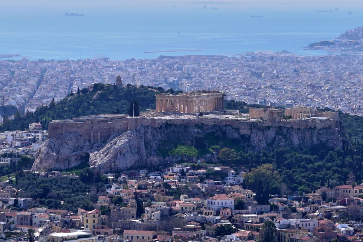
Athens sits in a basin. Three mountains frame it, Ymettos, Parnitha and Pendeli, as Wikivoyage describes. The Saronic Gulf closes the south side, and the Aegean Sea lies beyond it. Twelve hills rise inside the city. The Acropolis hill and Lykavittos are the two prominent ones.
UNESCO recognises two places in Athens: the Acropolis rock and, from the Middle Ages, the Daphni Monastery. This page does not retell either story. In a first plan, a day in the capital fits before the ferries.
Athens International Airport lies 27 kilometres east of the city centre, near the suburb of Spata, as Wikivoyage places it. Metro Line 3 connects Piraeus with the airport. For the greek cities and islands, that single line joins the arrival by air to the departure by sea.
Piraeus serves as the harbour of the capital in the greek cities and islands. Eight kilometres separate it from the Athens city centre. Sea lies to its south and west, and the urban area of Athens joins it on the east and north-east.
Wikivoyage notes that the streets of Athens melt into it. Three natural harbours shape the rocky peninsula of the old city.
The central harbour sends ferry lines to the Dodecanese, the Cyclades and Crete. They also reach much of the northern and eastern Aegean Sea. Cargo ships use the western side of the port instead.
Wikipedia adds that the harbour has a ferry route to nearly every island in the east of the country. That makes it the sea door for the greek cities and islands in the east.
Two railway stations stand next to the seaport, one for the Metro and one for the suburban railway. Metro Line 1 starts at Piraeus, crosses the centre and ends at Kifissia in the north. A ferry traveller in the greek cities and islands can therefore reach the capital by rail.
What does Thessaloniki add to the greek cities and islands?
Thessaloniki leads the north as its biggest city and as the seat of the Central Macedonia region. Mount Chortiatis rises to its east, and its waterfront faces the Thermaic Gulf. Within the greek cities and islands, Thessaloniki is the northern gateway and a major transport hub, Wikipedia states.
Wikivoyage describes Thessaloniki as the once biggest port of the Balkans. Empires took the city in turn, and each left a mark. Roman, Byzantine and Ottoman buildings stand beside Ancient Greek ones.
Among the greek cities and islands, Thessaloniki holds a UNESCO listing for early Christian and Byzantine monuments. The churches were built over a long period, between the fourth century and the fifteenth.
Hosios David, Saint Demetrius and the Rotunda hold mosaics that UNESCO counts among masterpieces of early Christian art. For the greek cities and islands, that series is the northern stop for early Christian art.
The listing also covers the city walls, which are four kilometres long. The White Tower once guarded the sea walls at their eastern end, Wikipedia says.
The tower is now a monument and a museum on the waterfront. It is round, with six floors, 34 metres high and 23 metres wide. Inside, an exhibition follows the city and its past, period by period. The city adopted the tower as its symbol. A traveller can use it as the landmark for a first walk.
A great fire burned down much of the city centre, and it was rebuilt on a grid. Streets run parallel and at right angles to the coast. Wikivoyage sums up the rule for walkers: take any downhill street and it ends at the waterfront. For a walker in the greek cities and islands, downhill is the sea.
Aristotelous Square sits at the centre of city life, and Wikivoyage calls it the focal point. The Aristotelous Promenade starts at the square and leads on to the Roman Forum. Cafes and restaurants line the route.
Ano Poli, the Upper City, survived the fire and has a more medieval look. The quarter adds to the greek cities and islands a hillside of small stone-paved streets and old squares.
Two yearly events fill the calendar in Thessaloniki, an international fair and an international film festival, as Wikipedia lists them. A bus from Volos takes roughly two and a half hours. A bus from Athens takes roughly six and a half, Wikivoyage states. The northern city ties the greek cities and islands together by road and sea.
What do Kavala and Ioannina add to the greek cities and islands?
In the north-east, the port of Kavala serves eastern Macedonia and faces the island of Thasos. In the north-west, Ioannina is the capital of Epirus, beside Lake Pamvotis. Together they add a port and a lake city to the greek cities and islands.
Kavala looks out over its bay toward Thasos, and the A2 motorway serves it. A drive to Thessaloniki, 160 kilometres away, takes one and a half hours, according to Wikipedia. Kavala also gives its name to a regional unit and serves as its capital. Within the greek cities and islands, Kavala is the mainland door to Thasos.
Two ferry lines join Thasos to the mainland. The shortest crossing leaves from Keramoti, a port close to Kavala International Airport. The other line runs from Kavala to Skala Prinos, 20 kilometres south of Thasos town. The harbour of Kavala also serves ferry boats to Limnos and Mytilene, Wikivoyage adds.
The old town keeps a Roman-origin aqueduct with 60 arches. It is 25 metres high and 280 metres long, and the present structure dates to the sixteenth century. The hill above the old town carries the castle, and its largest section dates to the fifteenth century, Wikivoyage states.
From the harbour, the climb to the castle needs 15 to 20 minutes on foot. Wikipedia records a thriving tobacco trade in Kavala in the past. The house of Muhammad Ali, who founded a dynasty that ruled Egypt, is preserved as a museum. It adds a museum stop in the north-east to the greek cities and islands.
In Roman times Kavala served as the port of Philippi, Wikivoyage notes. UNESCO describes Philippi as a walled city founded in 356 BC by King Philip II of Macedon. Visitors can still see its walls and gates, its theatre and a funerary temple, UNESCO states. So Kavala ties the greek cities and islands to an ancient Macedonian city.
Wikivoyage places the old town of Ioannina on a cliff, 100 metres above Lake Pamvotis. The same entry adds that a visitor covers the centre on foot. In the greek cities and islands, Ioannina is a lake town for walkers.
Athens is 410 kilometres away to the south-east, and Thessaloniki is 260 kilometres away to the north-east. Igoumenitsa, a port on the Ionian Sea, is 80 kilometres away to the west. So the lake city is an inland base for the greek cities and islands in the north-west.
The castle is the fortified old town of Ioannina. It stands on a rocky promontory that juts into the lake. Two citadels dominate it, and the larger one is called Its Kale. Ali Pasha rebuilt the walls in the early nineteenth century.
A boat ride of 20 minutes reaches the islet of Ioannina in the lake. It is the only inhabited islet there, with around 200 inhabitants, according to Wikivoyage. Byzantine monasteries dot the green islet. So the greek cities and islands include one island that sits in a lake, not in the sea.
The mountain district of Zagori touches Ioannina at its southern tip. Forty-six villages lie among the Pindus mountains there, and UNESCO recognises the district as a World Heritage Site.
Mountain paths and arched stone bridges tied the villages together until newer roads arrived in the nineteen-fifties. Expatriate merchants funded those bridges in the eighteenth century. Here the greek cities and islands leave the sea behind.
What do Patras and Nafplio add to the greek cities and islands?
Patras is the busy port city of the north-western Peloponnese. Nafplio is a harbour town whose strong fortifications made it home to the provisional Greek government. Together they add a ferry gateway and a fortified seaside town to the greek cities and islands.
Western Greece is an administrative region, and Patras is its largest city and seat. Patras is a large stop for the greek cities and islands, with 215,922 inhabitants in the municipality. The old upper town climbs the last slope of Mount Panachaikon. The lower town and the port sit beside the Gulf of Patras.
The port ties the Peloponnese to Italy and the Ionian Islands. Daily routes link it to Corfu, Cephalonia and Igoumenitsa, and to Italian cities such as Bari and Brindisi. The Italian ferries now use a newer harbour at the south end of Patras, as Wikipedia states.
The Rio-Antirrio Bridge runs between the suburb of Rio and the town of Antirrio. It links the Peloponnese with mainland Greece. The carnival runs from the seventeenth of January until Clean Monday. The restored Roman Odeon in the upper town hosts summer concerts. In winter, Patras is the carnival stop among the greek cities and islands.
Farming ranks beside tourism as a key sector. Around the town, an irrigated and fertile plain yields peaches, apricots and almonds. The port is used only for bulk cargo, because its depth is limited. In the tourist season, it also hosts leisure boats. That working harbour sets Nafplio apart among the greek cities and islands.
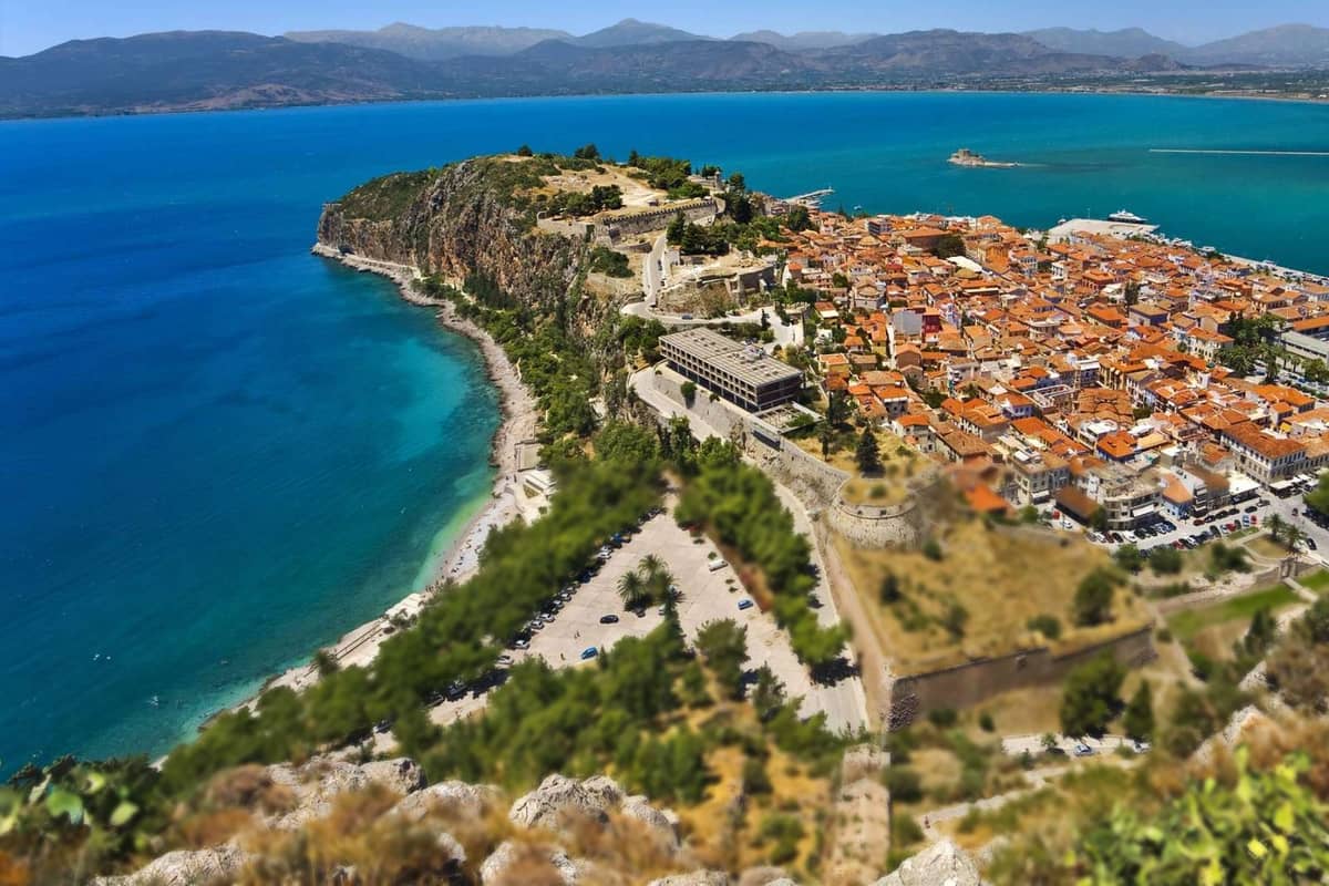
Marshes once left Nafplio almost isolated from the land around it. Landfill projects over recent decades have almost doubled the land area. The old town lies on a headland that forms a sheltered bay, and human-made moles extend the shelter. Colourful buildings with a Venetian influence fill its streets. Neoclassical buildings stand among them.
The oldest part of Nafplio is the Acronauplia. The Palamidi is the hill fortress north of the old town. The harbour holds a third fortification, the Bourtzi. A public bus to Athens takes about two hours, going via Corinth and Argos. A short stop here suits the greek cities and islands well.
What do Kalamata and Sparta add to the greek cities and islands?
Kalamata ranks second after Patras for population on the Peloponnese and is the chief port of Messenia. Sparta is the regional capital of Laconia and stands on the site of ancient Sparta. Both add a southern base to the greek cities and islands of the mainland.
Kalamata lies on the Messenian Gulf, along the Nedon River. Its port is the largest in Messenia and in the southern Peloponnese. In the summer months, ferries serve places such as the islands of Kythira and Crete. That sea link gives the city an island route within the greek cities and islands.
The Kalamatianos dance, the olives and the olive oil all carry the name of the city. The Holy Apostles church in the old town has a Byzantine core from the twelfth century. The castle dates from the thirteenth century and sits on a pine-covered hill above the sea. Two museums add more stops.
Wikivoyage calls Kalamata the ideal base for Messenia, since the sights are easy to reach by car. Mani lies to the southeast. In the summer months, direct charter and scheduled flights reach Kalamata International Airport. That makes Kalamata an air gateway to the south of the greek cities and islands.
Sparta, a provincial town of the south-eastern Peloponnese, occupies the site of ancient Sparta in the Evrotas Valley. Mount Taygetos stands to the southwest, and the Parnonas range, forested mainly with fir trees, stands to the east. Among the greek cities and islands, Sparta is an inland town.
The town was re-founded by a decree of King Otto in eighteen thirty-four. The ruins of the ancient acropolis lie north of the city. They include the theatre and, to the west, the Temple of Athena Chalkioikos. The Sanctuary of Artemis Orthia lies to the east. Wikivoyage notes two main streets, which make the town easy to cross.
In the town centre, the Archaeological Museum is Greece’s first museum in a provincial city. Mystras became the centre of Laconia from the thirteenth century. It lies about four kilometres west of Sparta, a 15-minute ride. The town, the ruins and Mystras make one combined stop for the greek cities and islands.
What do Volos and Larissa add to the greek cities and islands?
Volos is a port city at the foot of Mount Pelion, with ferry links to the Sporades. Larissa is Thessaly’s capital and largest city and lies inland on the plain. Together they add a sea gate and an inland hub to the greek cities and islands.
Agria lies on the eastern edge of Volos, and Nea Anchialos on the south-west. It sits midway on the mainland, 170 kilometres from Athens and 140 from Thessaloniki. Thessaly, the largest agricultural region of the country, reaches the sea only through Volos. On a route through the greek cities and islands, Volos is the sea gate of the region.
Ferries and hydrofoils link Volos with the Sporades, which include Skiathos, Skopelos and Alonissos. Links also run to Lemnos, Lesbos, Chios and Skyros. Only Piraeus and Thessaloniki rank above Volos among the commercial ports of the mainland in the Aegean. The interurban bus terminal lies near the City Hall, the harbour and the train station.
Myth places the hero Jason’s home in Iolcos, one of three ancient cities on the site of Volos. Jason sailed on the ship Argo with the Argonauts to win the Golden Fleece. Sesklo, west of Volos, is a Neolithic settlement with the oldest acropolis in Greece. Volos is the Argo city among the greek cities and islands.
Larissa ranks fifth among Greek cities by population. The city stands at the centre of the Thessaly plain and straddles the Pineios river. It is about 120 kilometres from Thessaloniki and about 210 kilometres from Athens. Larissa is the inland counterpart to Volos among the greek cities and islands.
Larissa is a major farming centre, thanks to the plain of Thessaly. It is also a national transport hub. Road and rail link it with the port of Volos, Thessaloniki and Athens. The main railway line between Athens and Thessaloniki crosses Thessaly. A train from Athens to Volos changes at Larissa, as Wikivoyage states.
The Pineios river crosses the centre, with the Alkazar Park on its banks. The First Ancient Theatre dates to the closing years of the third century BC. It remained in service for six centuries. Mount Olympus, Mount Kissavos and Meteora lie close to the city. Larissa is a mainland stop among the greek cities and islands.
What do the Cyclades add to the greek cities and islands?
The Cyclades add the island circle to the greek cities and islands. The Greek word kyklos means circle, and Delos stands at the centre of that ring. Wikipedia says Delos kept its name as a sanctuary throughout antiquity. On this page the group opens the island sections, after the mainland cities.
Counting islands, islets and rocks, Wikivoyage reaches about 2,200 for the group, and only 33 islands are inhabited. Wikipedia lists the major islands by name, among them Amorgos, Andros, Sifnos and Tinos. For the greek cities and islands, those 33 inhabited islands are the ones to place on a plan.
Two islands anchor the Cyclades within the greek cities and islands. In size, Naxos leads the group, and Wikipedia gives its summit height as 1,001 metres. Syros ranks first for population, with 21,124 inhabitants at the census that Wikipedia quotes.
Ermoupoli, on Syros, is the city side of the Cyclades among the greek cities and islands. Wikipedia gives it three roles: it serves as capital of the island, of the group and of the South Aegean.
Wikipedia says builders raised Ermoupoli in the eighteen-twenties, while the Greek War of Independence was under way. In the nineteenth century this port was even more significant than Piraeus. The Venetians built Ano Syros above it, on the hill of San Giorgio.
Tinos brings villages, windmills and dovecotes to the greek cities and islands. Wikipedia counts about 80 windmills, about 1,000 artistic dovecotes, which are houses for pigeons, and 50 active villages. Venetian defences stand on Mount Exomvourgo. Wikipedia says the island holds both Greek Orthodox and Catholic populations.
Wikivoyage Greece says whitewashed houses and blue-domed churches mark only one region of the country, the Cyclades. Wikivoyage links this group first with Santorini and Mykonos, two names of the greek cities and islands. It calls Ios a party island for young people. It names Milos as the least touristed among the larger islands, with volcanic rock formations.
Paros is round like a plump pear, says Wikipedia. One mountain of 724 metres slopes evenly down to the sea. Windsurfers favour the strait between Paros and Naxos, where a strong wind blows constantly. Among the greek cities and islands, Wikivoyage calls Paros the largest ferry hub inside the Cyclades.
Wikivoyage says island hopping is very popular across the Cyclades and links it to trips longer than one week. It adds that ferry schedules in the group are excellent. A plan of the greek cities and islands can give this group that time.
What do the Ionian Islands add to the greek cities and islands?
The Ionian Islands add a green west coast to the greek cities and islands. Wikivoyage places the chain off the Greek west coast, in the Ionian Sea. It says the islands are covered in green, unlike the Cyclades. Each island has its own character.
Wikipedia names seven main islands. Kythira, the southern one, is administered with Attica, not with its six neighbours. Greeks settled the islands early, certainly by the ninth century BC, Wikipedia says. Within the greek cities and islands, Wikivoyage lists this chain from north to south, with Corfu first. It adds Antikythera to the group.
Wikivoyage lists three major communities in this part of the greek cities and islands: Corfu Town, Zante and Argostoli. Corfu Town is the capital of its island and of the region. Zante is the capital of Zakynthos, and Argostoli is the capital of Cefalonia.
Wikivoyage adds one-line notes on the islands of the greek cities and islands in this chain. Corfu leads the chain in population, and Kefalonia leads it in size. Lefkada is tied to the myth of Sappho, and Ithaki to Odysseus. Antikythera gave up the Antikythera mechanism from a sunken Roman cargo ship.
Lefkada has a land link to the mainland, and Wikipedia names Vasiliki in the south as a windsurfing centre. Wikipedia gives Zakynthos a coastline of 123 kilometres. Wikivoyage puts Kalamos in the middle of a marine protected area in the inner Ionian Sea. It adds that this is the largest such area in Greece.
The chain became a distinct region under centuries of Venetian rule, which Wikipedia says kept the islands outside Ottoman control. Venetian was the official language. Wikivoyage Greece names baroque homes and churches in pastel colours on Corfu. It sets this look beside the whitewashed Cycladic homes of Paros, two styles among the greek cities and islands.
Wikipedia ranks winter rainfall on Corfu above that of other Greek islands. It describes the summers there as hot and dry. Its Mykonos article explains low rainfall on that island by the Pindus mountains, which dry out the westerly winds. Together, the two articles describe two climates among the greek cities and islands.
What do the Saronic Islands and the Sporades add to the greek cities and islands?
The Saronic Islands and the Sporades add two groups beside the mainland to the greek cities and islands. The Saronic group is named after the gulf that holds it, close to the coast. The Sporades run along the east coast, northeast of Euboea.
The inhabited core of the Saronic group has four islands: Salamis, Aegina, Agistri and Poros. Wikipedia says Hydra and Dokos are sometimes included as well. The group belongs to the administration of Attica. Wikivoyage calls it a short ferry ride from Piraeus, popular for day trips among the greek cities and islands.
Salamis is the biggest island in the group, and Wikivoyage places it only 2 kilometres offshore. Aegina is barely an hour away by ferry. Wikipedia adds that ancient Aegina ran a powerful city-state of its own and once rivalled Athens.
Hydra is one crescent-shaped harbour town, with steep stone streets climbing away from the water, says Wikipedia. The island bans cars, motorcycles, scooters and bicycles. Spetses is a popular resort island, says Wikivoyage. Poros is made of two islands linked by a bridge. These three add island days to the greek cities and islands.
Wikipedia notes vacation homes owned by mainland Greeks on the Saronic Islands. The boats to them leave Piraeus and the Peloponnese coast. Wikivoyage adds that the tourism there is almost all Greek. It places the group southwest of Athens, a note for any plan of the greek cities and islands.
The Sporades differ from the Cyclades within the greek cities and islands, says Wikivoyage. They have fertile land and thick woods, with pine forests on the mountains, more stone roofs and less whitewash.
Only four of the 24 Sporades islands have permanent residents: Alonnisos, Skiathos, Skopelos and Skyros, as Wikipedia lists them. Skyros is administered with Euboea, while the other three belong to Thessaly.
Skiathos lies west of Skopelos and east of the Pelion peninsula, and Wikipedia gives it a coastline of 44 kilometres. Wikivoyage calls Skiathos the easiest of the group to reach. It calls Skopelos less touristed outside July and August, and Alonnisos much quieter.
Wikipedia ties the shipbuilding of Skiathos in the nineteenth century to its pine woods. Today a small yard just north of the main town still turns out traditional caiques. The boatyard links the shipbuilding past of the island to the present day.
From Athens, Wikivoyage describes a combined bus and ferry ticket to Agios Konstantinos. From this port, boats leave for all three Sporades islands. Boats also run from Volos and from Kymi on Evvia. A commercial airport serves Skiathos alone.
What do the Dodecanese add to the greek cities and islands?
The Dodecanese add the south-eastern corner of the Aegean Sea to the greek cities and islands. Wikipedia counts fifteen major islands there, plus smaller islets, off the coast of Anatolia. The seat of the group is Rhodes, and 26 of its islands have residents.
Dodecanese means the twelve islands. Under Ottoman rule, twelve main islands held privileges of self-government, as Wikipedia explains. The Greek press later used the name for those twelve. Among the greek cities and islands, this is the group whose name no longer matches its count.
As Wikipedia describes it, the Dodecanese fill the corner where the Aegean Sea meets the eastern Mediterranean. The Sea of Crete ends at this group on its eastern side. Three neighbours frame the greek cities and islands of this group. The Cyclades lie on the west, Crete on the south-western side and Turkey on the east.
Rhodes anchors the Dodecanese in the greek cities and islands. Rhodes has led its neighbours since antiquity, Wikipedia notes. The principal town of Rhodes keeps a medieval core with World Heritage status, Wikipedia adds. Wikivoyage ranks Kos third for size and second to Rhodes for visitors.
Patmos lies north of Leros, and Wikivoyage ties it to the revelation of Saint John the Divine. UNESCO notes a monastery for the saint, founded in the late tenth century. Below Kos lies the small island of Nisyros, and Wikivoyage lists its volcano as active. The greek cities and islands thus hold a holy island and a volcano.
Smaller islands fill the gaps between the larger ones. Symi lies between Rhodes and Kos, and so does Tilos. Wikivoyage puts Kalymnos in the stretch from Kos to Leros, near the western Turkish coast. It calls Leros less crowded than the other islands.
The group covers 2,714 square kilometres, as Wikipedia gives it, and its islands joined Greece in nineteen forty-seven. Astypalaia lies between Kos and Amorgos, and Karpathos between Rhodes and Crete. Halki lies very close to Rhodes. So the greek cities and islands of this group meet the Cyclades and Crete at its edges.
What do Crete and its three cities add to the greek cities and islands?
Crete adds the largest Greek island and three island cities to the greek cities and islands. Heraklion, Chania and Rethymno are the capitals of three of its four regional units. Heraklion is the largest, Chania lies in the west, and Rethymno stands between the two.
Among the greek cities and islands, Crete counts as a whole region of its own. Greece has thirteen regions, and this one sits at the far south. It holds 624,408 people, the fifth rank by population. Four regional units share the island. Three carry the names of the cities below, and Lasithi, in the east, holds the fourth.
The capital of Crete, Heraklion, is also its largest city. Wikipedia ranks it fourth among Greek cities by population. For the greek cities and islands, it is the city that holds Knossos. The palace lies in the south of the municipality, and Knossos ranks second to the Parthenon for visitor numbers. Wikivoyage adds an important archaeological museum.
Chania, on the north-west coast, comes second to Heraklion in size, says Wikivoyage. Its Old Town is largely intact. The capital of Crete moved from Heraklion to Chania in eighteen forty-nine. The English word quince goes back to Cydonia, the ancient Greek settlement there. Chania marks the west of Crete among the greek cities and islands.
Rethymno gives the greek cities and islands a pedestrian old town. Venice built a commercial station there between Heraklion and Chania. The old town, palia poli, is almost entirely Venetian work. Wikivoyage describes a maze of lanes below a massive Venetian fortress. The Venetian Loggia hosts an information office of the national culture and sports ministry.
The three cities work as bases for the whole island. Visitors to Crete, Wikivoyage notes, overwhelmingly settle in a single northern city and go out from it. A campus of the University of Crete stands in Rethymno, and Wikipedia lists five museums there.
Inland, thirty summits of the White Mountains rise higher than 2,000 metres. The Lasithi plateau lies in the east, at 840 metres, and up to 10,000 white-sailed windmills once worked there. Agios Nikolaos, a port town with a lake, is the seat of Lasithi. That fourth unit closes the list of Cretan regional units.
What do the North Aegean islands add to the greek cities and islands?
The North Aegean islands add a scattered northern group to the greek cities and islands. Wikipedia explains that they form no physical chain and are grouped for tourist or administrative reasons. Lesbos, Chios, Samos, Ikaria and Lemnos share one region, and Mytilene is its capital.
Wikipedia sets the Dodecanese south of this group, with the Cyclades and Sporades on its western side. Five larger islands run along the Turkish coast: Samos, Ikaria, Chios, Lesbos and Lemnos. Thasos and Samothrace lie in the Thracian Sea, in the far north. Together they form the northern edge of the greek cities and islands.
The greek cities and islands of the north have one regional capital, and it stands on Lesbos. Mytilene lies on the south-eastern coast, and a third of the islanders live there. Lesbos covers 1,633 square kilometres, with about 400 kilometres of coast. In classical times, five cities formed a pentapolis: Mytilene, Methymna, Antissa, Eresos and Pyrrha.
Chios adds a harbour town with a medieval castle to the greek cities and islands. The main town has 32,400 inhabitants, as Wikipedia gives it. Seven villages in the south, the Mastichochoria, have controlled mastic gum production since the Roman period.
Ikaria lies 19 kilometres south-west of Samos, and tradition ties its name to Icarus. The Aitheras range, rising to 1,037 metres, splits the island between north and south. The north is greener, and the south is rockier and drier.
Samos adds four towns near its corners to the greek cities and islands. From the capital Vathy, in the north-east, the list runs to Karlovasi (north-west), Pythagoreio (south-east) and Marathokampos (south-west). Samos sits between two neighbours, Chios above it and Patmos below it.
Lemnos lies halfway between Mount Athos and the western coast of Turkey. It is primarily flat. Myrina, also called Kastro, meaning castle, stands on the west coast and has a good harbour. A seven-hectare desert, the Pachies Ammoudies, lies on the island. Lemnos adds a flat island to the greek cities and islands.
No major Greek island lies further north than Thasos, which covers 380 square kilometres. Its capital, Limenas, stands on the north side. Administratively, Thasos is a regional unit of Eastern Macedonia and Thrace. Thasos adds the far north to the greek cities and islands.
Samothrace is 17 kilometres long and belongs to the Evros regional unit. Fengari, its highest peak, rises to 1,611 metres. The Sanctuary of the Great Gods stood there. The Winged Victory statue, now in the Louvre, was found on the island.
Which ports link the greek cities and islands?
Piraeus is the main port of the greek cities and islands. Wikivoyage counts it as one of five areas of Athens and calls it the main port of the capital. Other towns and cities act as ports too, from Rafina in the east to Igoumenitsa in the west.
For passengers, the Athens article names only one busier port in Europe than Piraeus. For containers it gives the port thirteenth place worldwide. The port article notes the nickname gateway to Europe. Wikivoyage lists Piraeus first among the departure points for daily Cyclades ferries. A plan for the greek cities and islands can start at this quay.
Rafina and Lavrio add two more ports to the greek cities and islands. The Rafina entry calls the town a suburban port with 14,620 inhabitants. Wikivoyage names Rafina for Andros, and Lavrio for Kea and Kythnos. Lavrio was known for its silver mines, and its bay faces the island of Makronisos.
Igoumenitsa is a coastal city in north-western Greece and the capital of Thesprotia. The city climbs a forested mountain and spreads round the gulf. Its passenger port connects the mainland with Italy and the Ionian Islands. Patras, described above, also faces Italy, as its article states. Both ports open the west side of the greek cities and islands.
Three northern cities work as ports. Thessaloniki stayed an important seaport during almost five centuries of Ottoman rule, says its article. Kavala was the first European port of call for merchants and travellers from the Middle East. Wikivoyage Greece calls Kavala the ferry port for the North Aegean Islands, and Volos serves the Sporades.
Wikivoyage lists a cruise or ferry port for five Cretan towns. They are Heraklion, Chania, Rethymnon, Sitia and Agios Nikolaos. Heraklion also holds the main international airport of the island. One island therefore gives a traveller five harbours for the greek cities and islands.
Not every city harbour takes ferries. The Nafplio article says its port handles bulk cargo only, because the water is not deep enough. In the tourist season the same port hosts leisure ships. Nafplio, described above, is a port city of the greek cities and islands that serves cargo and leisure boats.
Wikivoyage Cyclades names two types of ferry, the ordinary ferry and the speedboat. Tinos shows the split. Its article counts three ports. Passenger speed boats use one. Ferries and high-speed boats, which carry cars as well as people, share the other two. Know the boat type before you plan the greek cities and islands.
Which airports link the greek cities and islands?
Athens International Airport is the main air gate of the greek cities and islands. Its article calls it the largest international airport in Greece. The same article names Attica as its region and says it handles connecting traffic too. City and island airports then spread the traffic across the mainland, Crete and the islands.
The main terminal of the Athens airport has three levels. Its two parallel runways are 4 and 3.8 kilometres long. The airport station lies next to the terminal, with an elevated walkway between them. The suburban railway and Metro line 3 call there. A flight into the greek cities and islands can end on a rail platform.
Northern Greece has its main airport at Thessaloniki, named Makedonia. Its article adds that it also serves the tourist area of Chalkidiki. Wikivoyage notes a seaside setting. Bus line 01X runs between the airport, the new railway station and the Macedonia intercity terminal, day and night. The north of the greek cities and islands lands here.
Two Cretan airports serve international travellers, the Crete article states. Heraklion, named for the writer Nikos Kazantzakis, is the primary airport of Crete. Chania ranks sixth among Greek airports, and the air force uses it too. The airport takes its name from Daskalogiannis, a Cretan rebel against Ottoman rule. It opens western Crete to the greek cities and islands.
Rhodes Airport, named Diagoras, began civil flights after the Second World War. Its only runway is 3,305 metres long. Corfu’s first commercial flight came from Athens in the late nineteen-forties, says its airport article. Wikivoyage names Corfu, Kephalonia and Zakynthos as major Ionian airports. They link the south-east and the west to the greek cities and islands.
The village of Kamari lies south of the Santorini airport. Its article says the field takes civil and military traffic alike. Mykonos has an international airport too. The article ties its domestic and European routes to the island’s popularity as a leisure destination. These two airports bring the Cyclades into the greek cities and islands by air.
In the greek cities and islands, six of these airports sit close to the town they serve. Corfu airport lies about 2 kilometres south of Corfu Town. Mykonos lies 4 kilometres from its town and Heraklion 5 kilometres east of the centre. Santorini lies 6 kilometres south-east of Thira. Chania and Rhodes stand 14 kilometres from their cities.
How do the seasons change the greek cities and islands?
Summer is the busy season of the greek cities and islands, and the island links thin out in winter. The bulk of visits fall between April and October, says Wikivoyage Greece. Out of season, ferry schedules shrink and flights grow fewer, as the pages below show.
Wikivoyage Cyclades marks late spring and June as the early season, when it is not that hot. It marks September to mid-October as the post season. July and August are the crowded months. These shoulder months give the greek cities and islands more room than midsummer does.
Summer heat differs inside the greek cities and islands. The Lavrio article gives its summer highs as 2 degrees Celsius below Piraeus and 4 below downtown Athens. So the thermometer reads lower on that coast than in the middle of Athens. The same article names July and August as its driest months and December and January as its rainiest.
The islands keep their own calendar. The Mykonos article gives a rainy season from October until March. Average daily highs are about 15 degrees Celsius in winter and about 27 in summer. The article gives two reasons for relatively cool summer days: the meltemi wind and the sea’s moderating effect.
Air links follow the same calendar. Off-peak, the Mykonos airport keeps limited flights and hours, its article says. The Santorini article ties its extra charter and scheduled flights to the higher seasons. It names three: spring, summer and autumn. Check the flight list first when you plan the greek cities and islands in winter.
Corfu and Thessaloniki show the same swing. The Corfu airport article says air traffic peaks in summer, between April and October. Wikivoyage says Thessaloniki airport sees highly seasonal traffic, peaking in the summer months. For the Ionian Islands, it warns of seasonal routes. In the low season you connect via Athens.
The Saronic page of Wikivoyage splits the boats in two. Fast hydrofoils take only people on foot. Their sailings are frequent in summer, and in winter they rarely run at all. Bad weather can cancel them. Slower conventional ships take cars and sail year round. A winter plan for the greek cities and islands picks the ship.
What else do travellers ask about the greek cities and islands?
Five questions follow about the greek cities and islands. Two concern the car and the signs. Two concern a mixed plan of city and island, and the airports. One concerns the gap between a city day and an island day.
Do travellers need a car for the city stops of the greek cities and islands?
No. The city stops of the greek cities and islands run on rails and buses. Wikipedia says Greece has two rapid transit systems, one in Athens and one in Thessaloniki. The Athens Metro links with buses, trolleys, the tram and the suburban railway, the article adds.
The Athens tram is the only tramway still running in Greece, Wikipedia states. Commuter trains link a city’s central station with its port or airport and its suburbs. They sometimes reach nearby towns too. Three such systems serve Athens, Thessaloniki and Patras.
Thessaloniki adds a metro to the greek cities and islands. Wikipedia traces the first proposal to a plan to redesign the city after the Great Fire. Venizelou station holds an active archaeological site dubbed the Byzantine Pompeii, Wikivoyage notes. The Macedonia bus terminal is the biggest of four major terminals and serves all of Greece.
Which script do the signs use in the greek cities and islands?
The signs of the greek cities and islands use the Greek alphabet. Wikipedia notes that it was derived from the earlier Phoenician alphabet. It remains the script used for Greek writing today. Wikivoyage adds that road signs repeat the place name in Latin letters, as a rule.
Three details in Greek words mislead English readers. Wikipedia lists Yannis, Jani, Ioannis, Yiannis and Giannis as spellings of one Greek name. The sound B is written with the pair mu and pi, while beta stands for V. The lowercase sigma has two forms, and one form is kept for the end of a word.
Text messages add a second writing style. Wikipedia describes Greeklish, Greek typed in Latin letters, with thelw and 8elo as two ways to write one word. Greek also has its own question mark, shaped like a semicolon and called the erotimatiko.
Can one trip mix a city plan and an island plan from the greek cities and islands?
Yes, once the nights are counted first. A nine-day trip holds eight nights, so the nights set the limit, not the days. Share them between one city and one island group of the greek cities and islands, not four places. Each stop then gets a clear share.
Wikivoyage’s Thessaloniki page lists Thasos for a day trip, yet it says the island is worth more days. That fits this split. The city stop and the island stop each need whole days. A day trip leaves less time on the island.
A city can also hold sea time. Wikivoyage lists frequent ferry services from the White Tower in Thessaloniki to the beaches of Peraia and Neoi Epivates. The trip takes about 40 minutes each way. In Athens, it sends beach-goers by tram from Syntagma or by buses from Sygrou metro station.
Why does not every island of the greek cities and islands have an airport?
Tinos shows how an airport plan can stall. Flat ground is rare on the island, Wikipedia notes. That made the plain of Falatados a strong candidate for a proposed airport. The meltemi winds and concerns of local villagers have all but halted the project.
Wikipedia’s article on transport in Greece counts 16 international airports, 11 military ones and 26 of mixed use. The separate list of airports names small island airports on Astypalaia, Ikaria, Kithira, Skyros, Kassos, Kastellorizo and Leros. It also marks the old Paros airport as closed. Check these lists first when a plan depends on a flight.
Skiathos shows the other case among the greek cities and islands. Wikipedia reports work on a runway extension and more hard standing for parked aircraft at its airport. Plane spotters come to watch aircraft take off from very close, it notes.
What changes between a city day and an island day in the greek cities and islands?
A city day starts at a desk or a station. Wikivoyage lists a tourist information centre at Aristotelous Square in Thessaloniki, plus tourist booths at the central bus stations. A bus line numbered 50 leaves the White Tower on a figure-of-8 route past the major sights. In the greek cities and islands, the day runs on rails and buses.
An island day starts at a quay. Wikivoyage advises against bringing a car to the Saronic islands, since not every route allows cars. Travellers on foot get far more choice of sailings. Every one of these islands has walking trails, and even a small hill gives panoramas of the Gulf.
Poros shows the exception among the greek cities and islands. Wikivoyage names it as an island near enough to the mainland to drive to the nearest port. The car then waits in long-stay parking while the short ferry crosses.